Western Wildlands Route + Detours: Utah

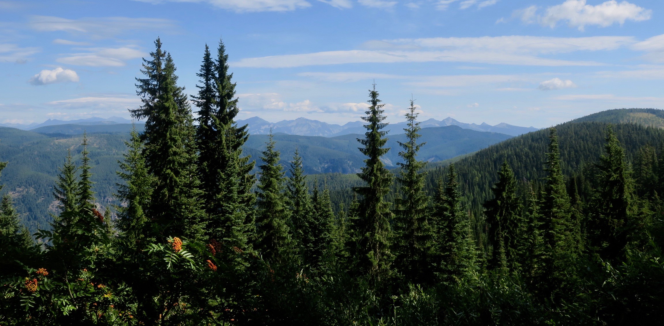
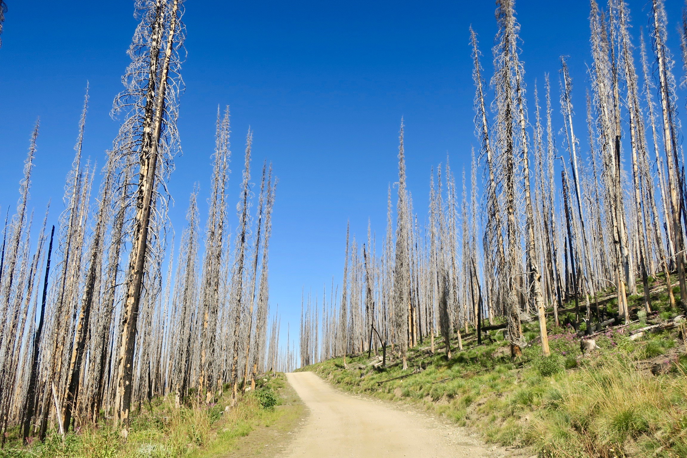
I have to admit –  riding through most of Montana and Idaho, I rarely felt 100%. The random stomach bug I had really took its toll on me, draining a lot my energy for over two weeks. Rolling into Utah, my most anticipated US state, I was finally feeling strong. 

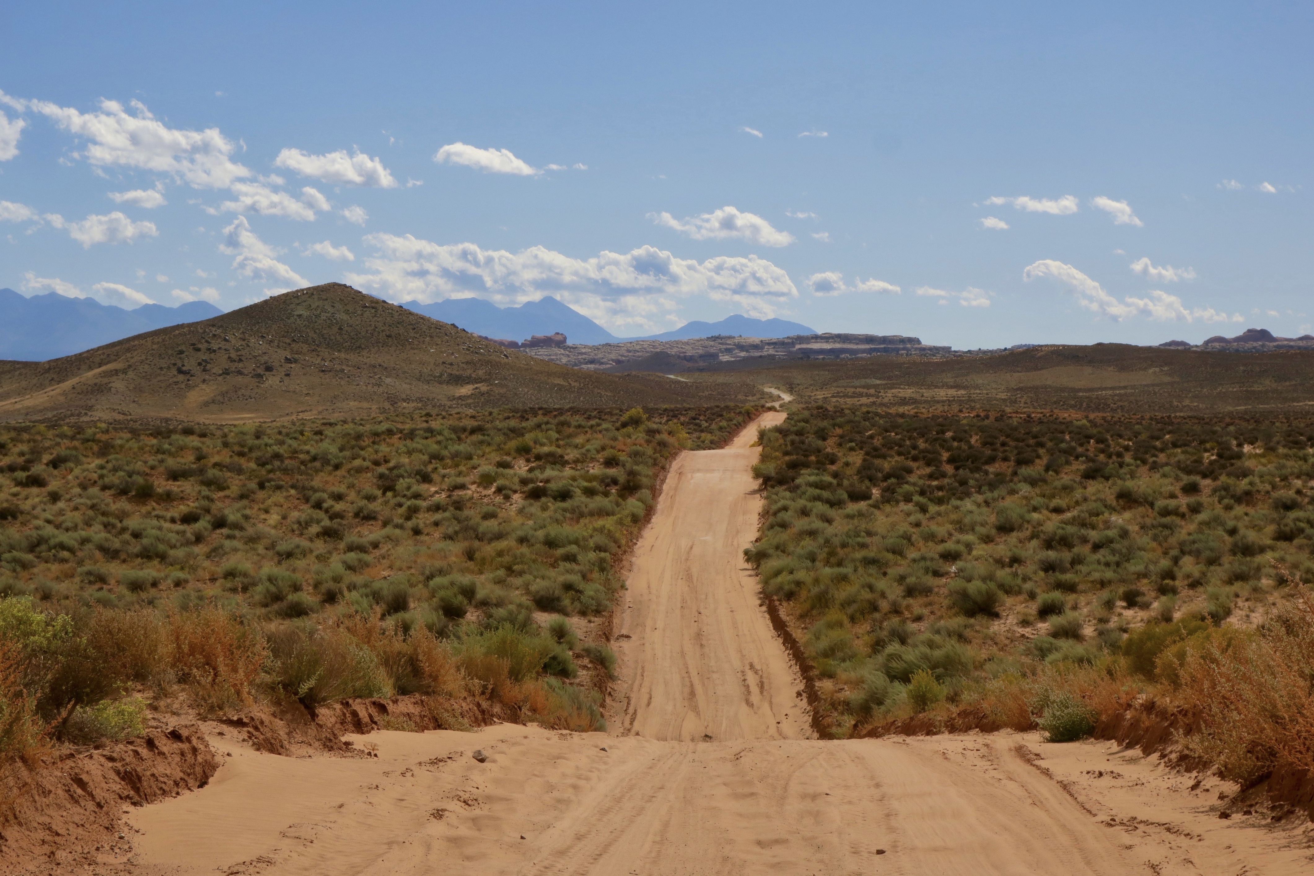
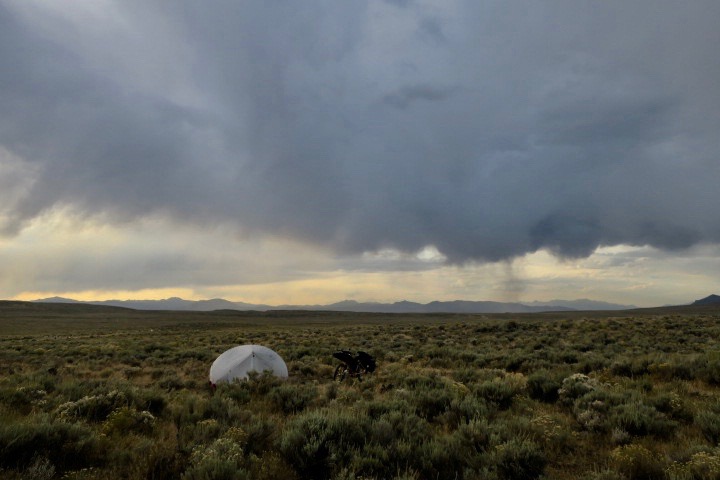
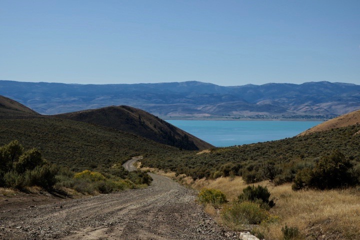
Sagebrush lands in Northern Utah

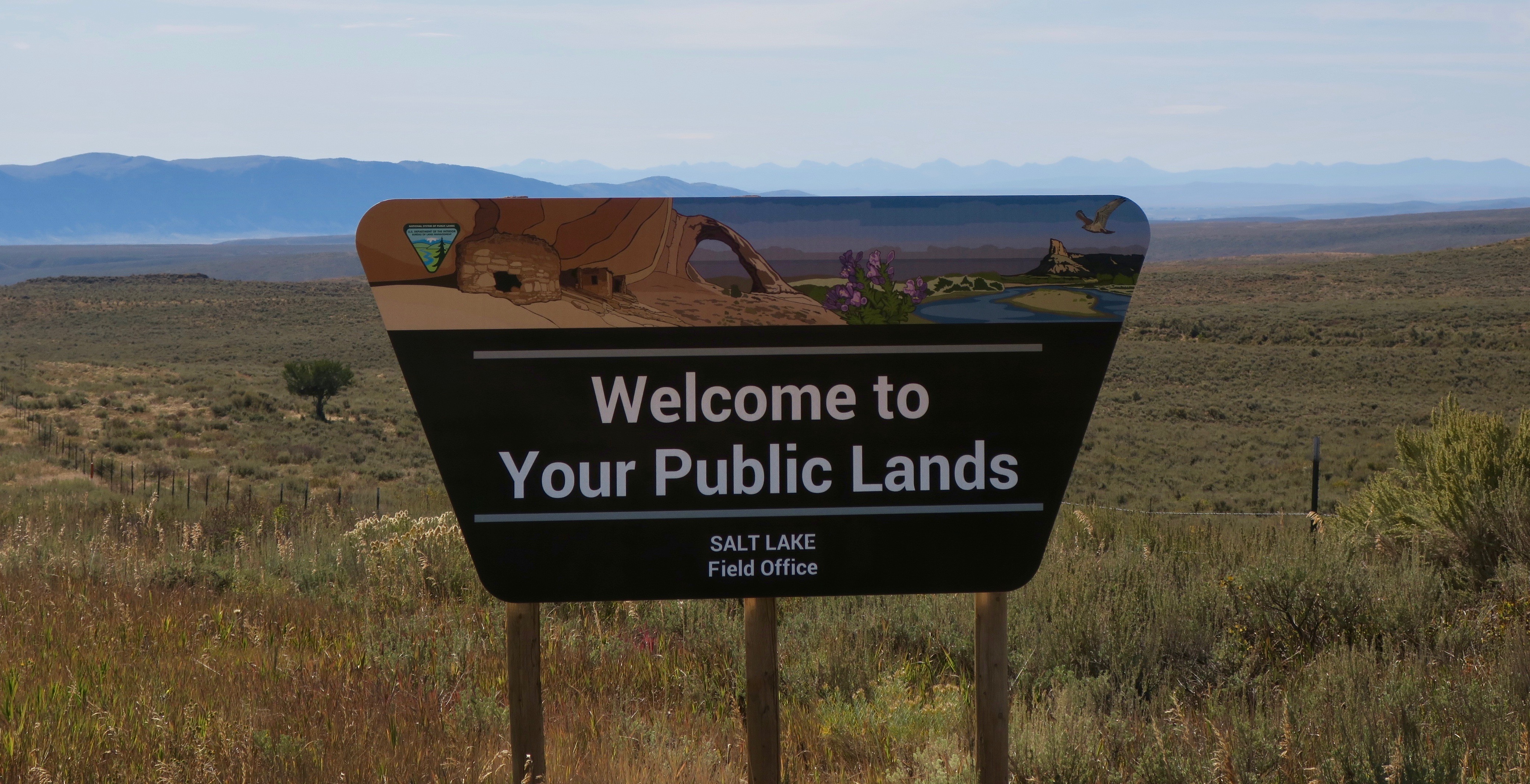
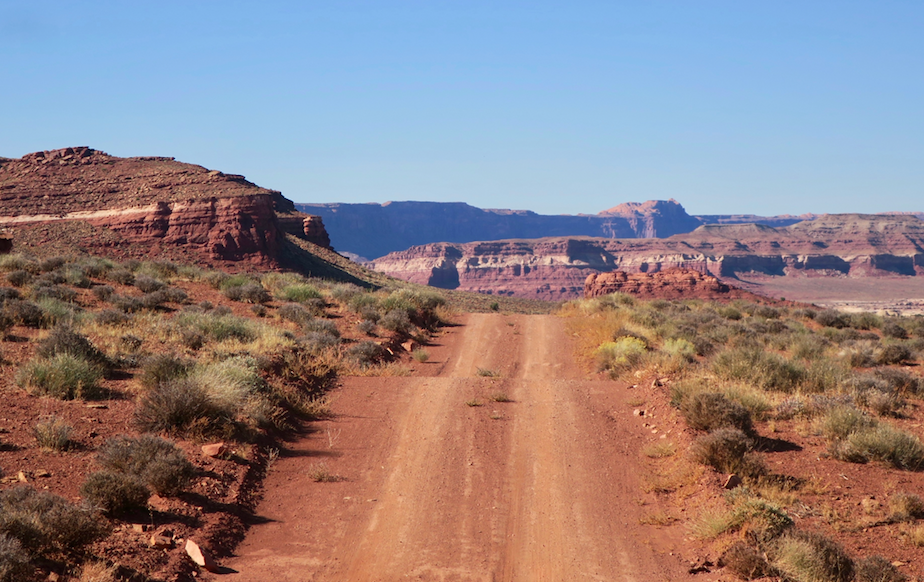
It was late September and I was in a bit of a race against the colder weather at the higher elevations that could possibly bring snow. Northern Utah was largely flanked by private land, making wild camping very difficult. I was still in the realm of the sagebrush – landscapes wide open and expansive.

The Western Wildlands Route briefly ducked into a section of Wyoming in Evanston, full of strip malls and fast food chains. The majority of the towns I passed through in Montana and Idaho were for the most part absent of these features.  I won’t say I was too good for these familiar creature comforts, though, as I headed directly for McDonalds and devoured a large fries and chicken nuggets!

Of course, I was approached by more friendly locals. One man spoke to me outside of McDonalds about bikepacking. He was planning his first trip and looking for advice. Outside of the Wal-Mart (yes, for shame) I met another lady who expressed her support for me and eagerly handed over her daughter’s contact when I mentioned i was headed to Moab. And on the way out of town, a man pulled up in a pickup, where I was briefly stopped on the side of the road. He had coolers full of ice cold water in the back of his truck and said I could take what I wanted. We chatted for a little while about the places I had been and I eventually learned that he was a widower. He seemed eager to continue the conversation with me and I sensed that this man was perhaps a bit lonely and enjoyed the company. I knew that I had miles to cover and I carried his slight look of disappointment with me when I eventually said goodbye and pedalled away.

By the time I had reached Park City, I felt like I was in a bit of a slump. The riding just wasn’t nearly as interesting as I was travelling through a much more densely populated area. I knew the best was yet to come, though, and I needed to be patient. 

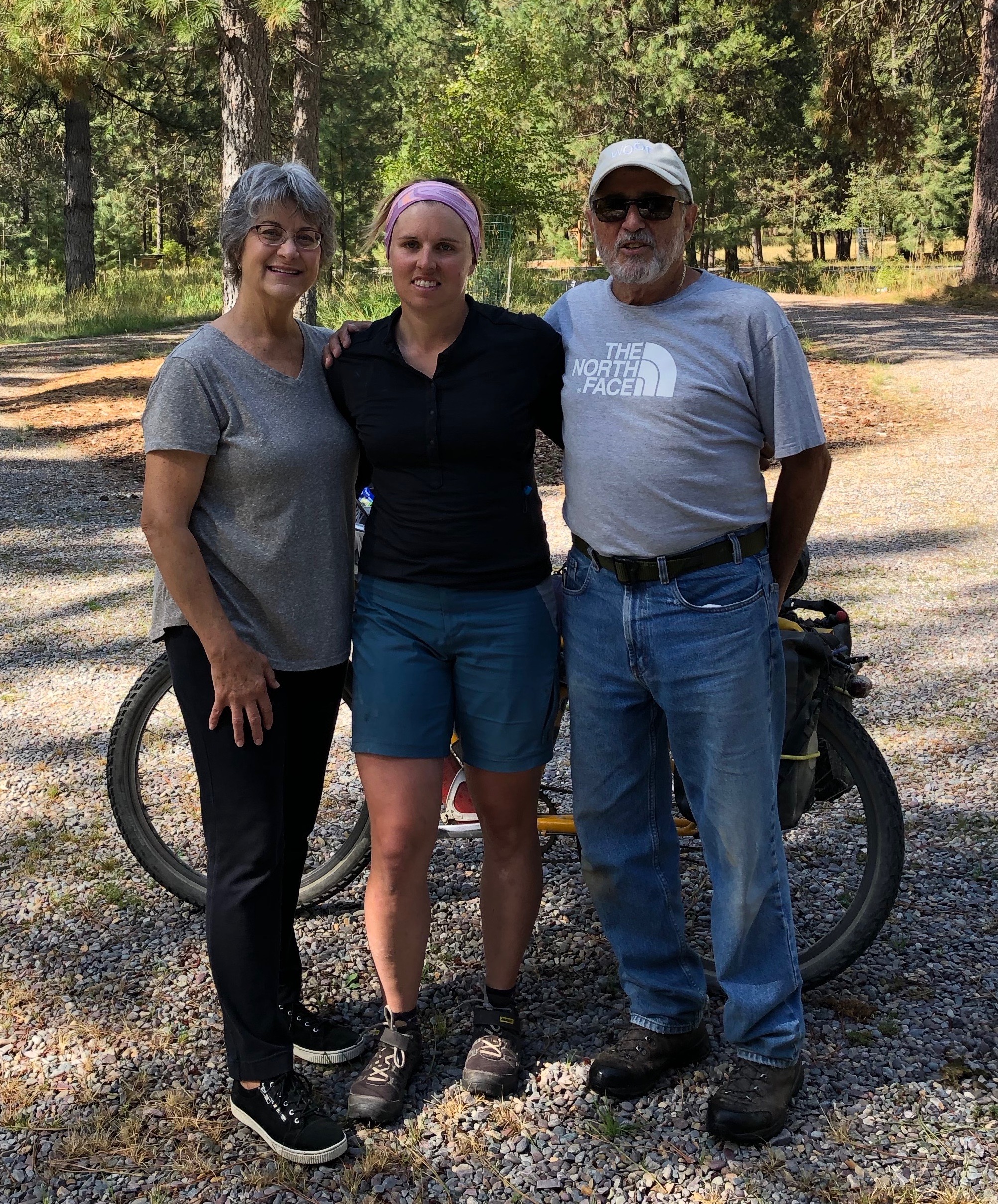
I spent a few days with an inspiring French cycling family in Park City, who were my Warm Showers hosts. This couple had taken their kids, both under eight years old on various bicycle touring and backpacking trips around the world. The kids were very proud of the fact, asking me if I was a biker like them.

 “We don’t want to travel in a fucking RV,” my host said, which was clearly the preferred mode of travel for many in this part of the world. 

I left Park City with a new plan. I would deviate from the Wild West Route as there was rain in the forecast for the next few days. Not wanting to be stuck in impassible mud, I made the decision to detour onto pavement towards Strawberry Reservoir. 

I decided to head to Midway, Utah, because there was a Warm Showers host there. That turned out to be an excellent decision. I had an amazing few days hanging out with the hilarious, creative, wacky and kind Steve and Noelle and their daughter Quinn. Steve is a pretty successful Youtuber with a very interesting documentary type channel called “The Talking Fly.” Another interesting fact – these guys were a family of ex-Mormons. I was in Utah, the motherland of Mormonism. This definitely gave me some interesting insight into the religion and its stronghold on the state. 

On my planned departure date, the weather was still a bit nasty with strong wind and intermittent rain. But in the interest of time, I needed to keep moving. Again, I was a bit sad to leave this fantastic group of people behind. 

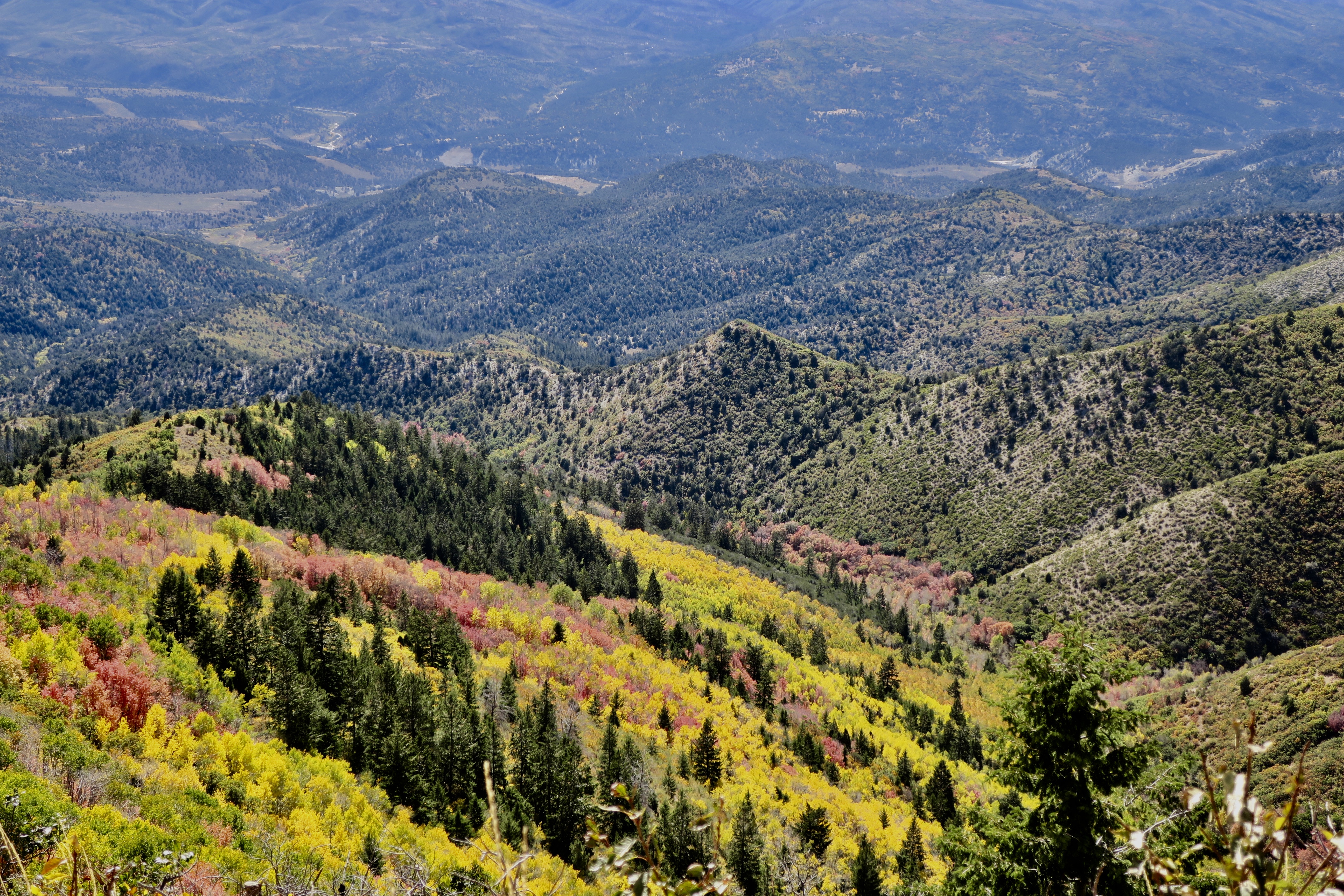
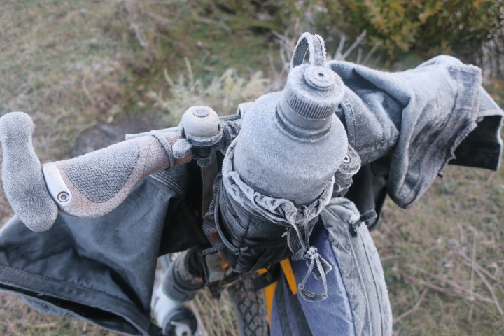
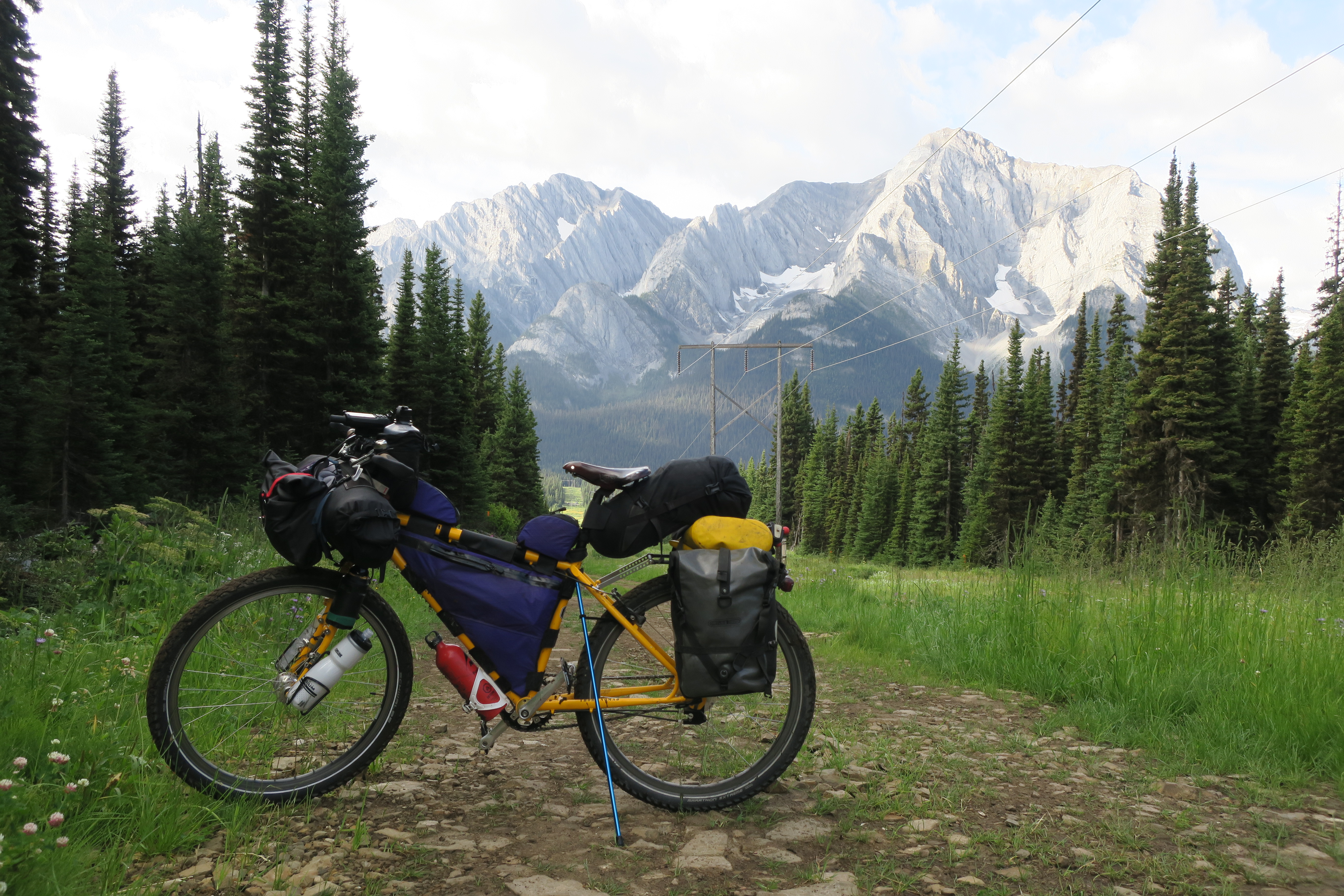
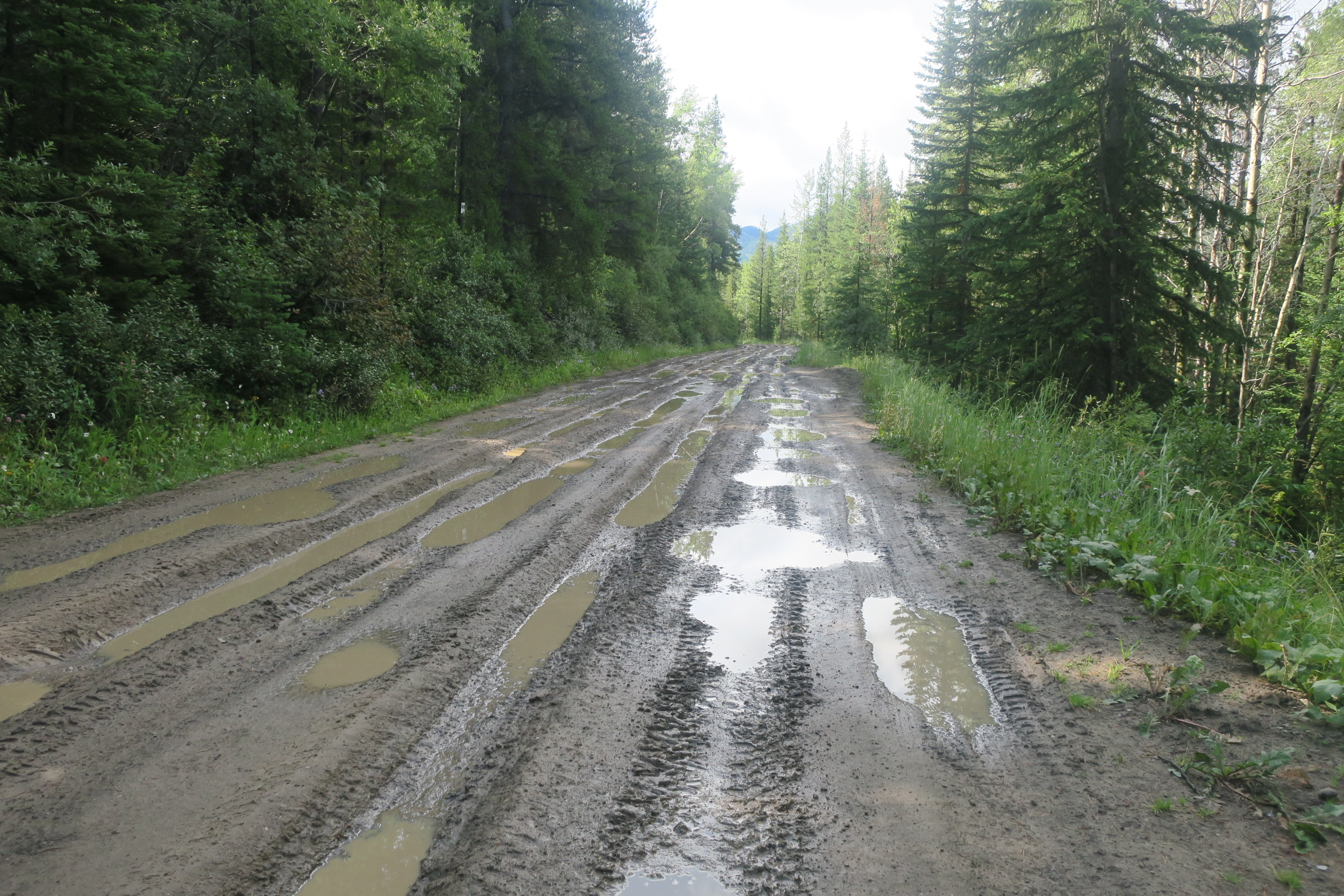
I climbed most of the day towards Strawberry Reservoir along an unpleasant and busy highway. I was relieved when I finally turned off onto a quiet gravel road, bitter and soaked in a mess of water and asphalt grime.  I found a place to camp near some RVs. The next morning, I woke up again to a very frosty tent and bike. I waited for the sun to come up and thaw me out before leaving. In the biting fall wind, I continued climbing, surrounded by barren brown hills flecked with golden aspen. I had a fantastic view of the rich blue reservoir.

Strawberry Reservoir, northern Utah

On the descent to Soldier Summit, I rode high along a ridge with an ocean of colour below.

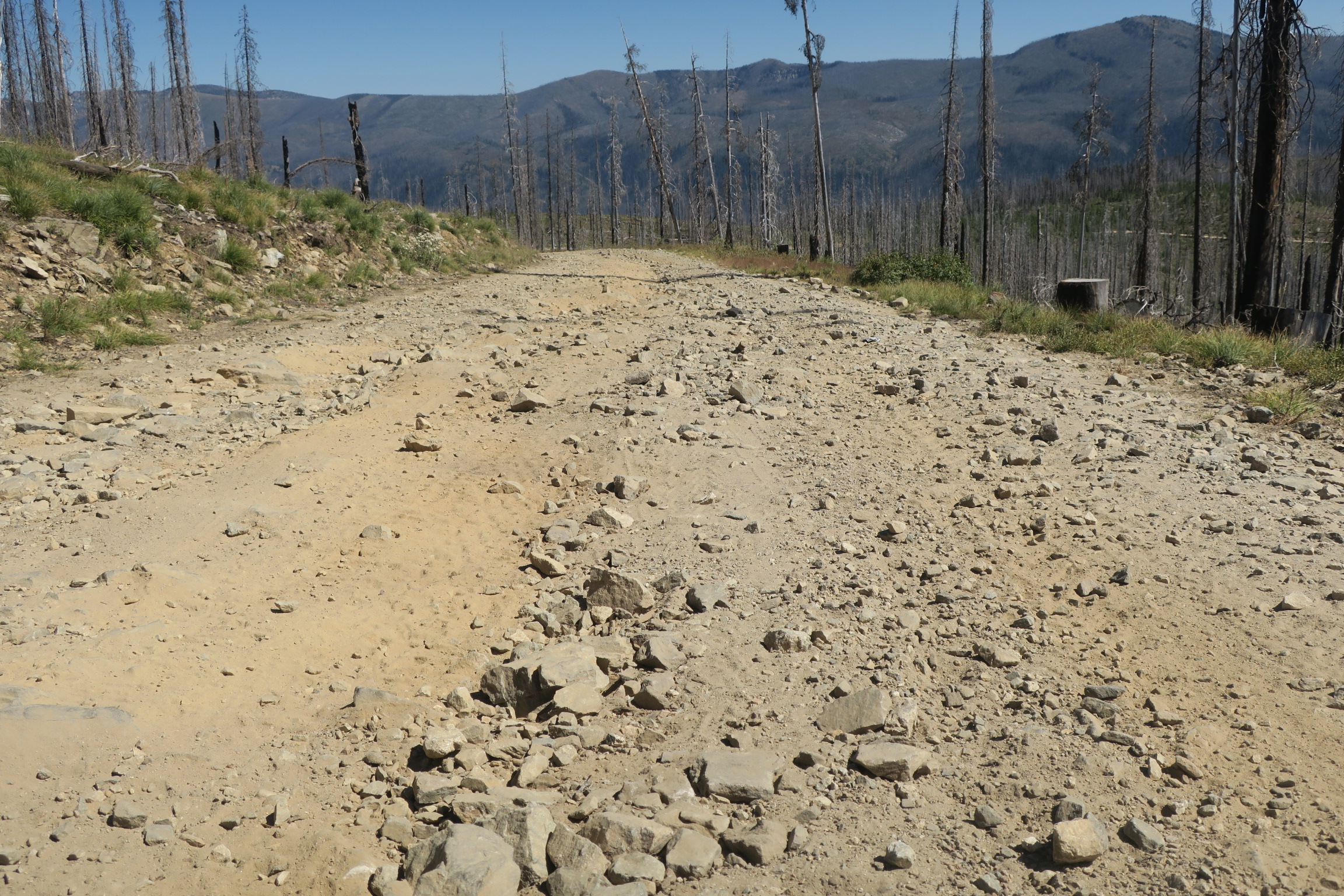
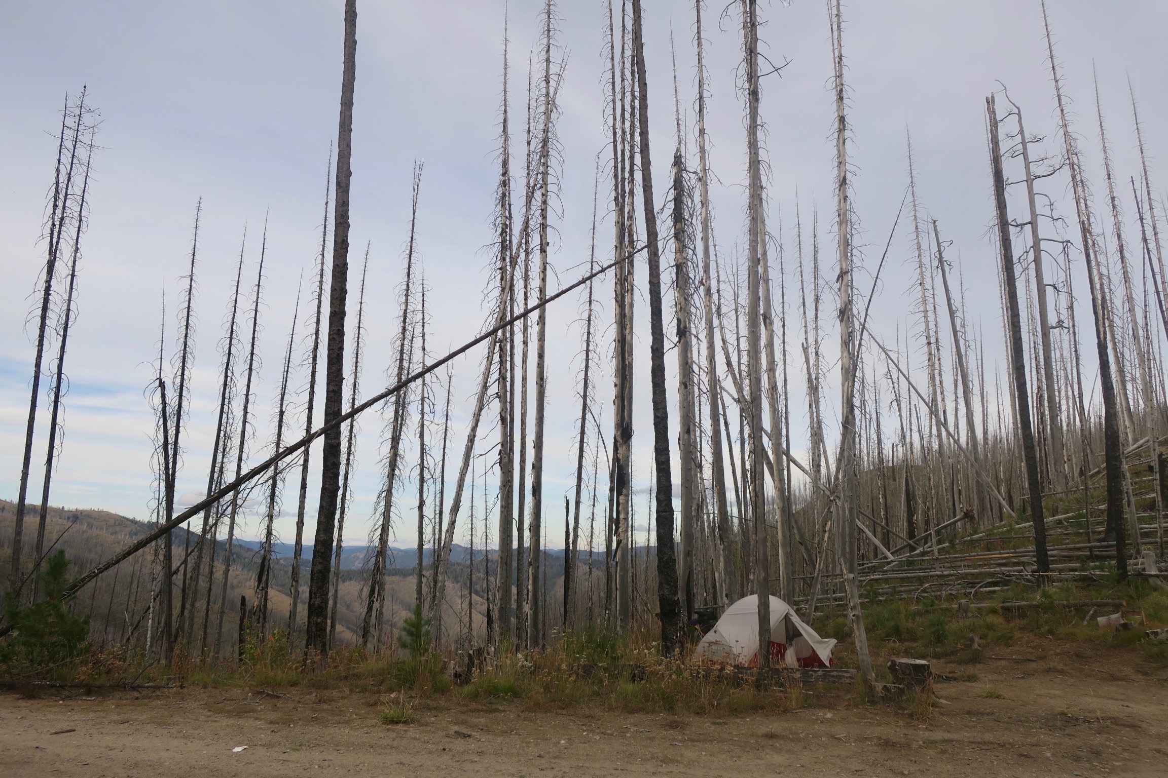
From Soldier Summit, the Western Wildlands route traversed the Wasatch Plateau along the high Skyline Drive. But due to expected cold temperatures, questionable weather and a general feeling of fatigue, I opted to beeline it for the desert.  At this point, the quickest way was along more highway towards the community of Castle Dale, where I would hit dirt again. 

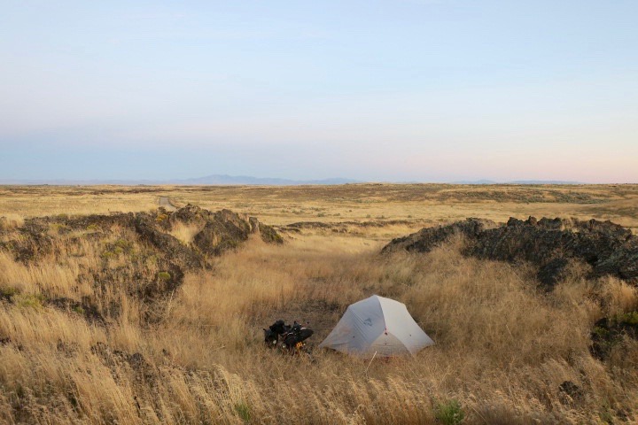
Arriving in Soldier Summit, I was exhausted and didn’t like the prospect of looking for somewhere to camp near the highway. I thought that I would risk slight embarrassment by enquiring at the gas station (that’s all there was in Soldier Summit) to see if I could camp somewhere. To my delight, the very friendly lady said yes, I could camp behind the gas station. After, she warned me the temperature was going to dip into the ‘teens overnight (about -10C). 

Camping behind Soldier Summit gas station (grey tent in the back)

I ate breakfast in the gas station on a frigid morning and reluctantly turned left onto the highway in the opposite direction of Skyline Drive. I definitely wouldn’t recommend that cyclists take this route – I just wanted to get to a lower elevation quickly. 

sunrise at camp ground in Huntington, UT

I had originally planned to ride on pavement all the way to Castle Dale, but a lady in a local bakery in Huntington told me about a dirt road shortcut. 

I was thrilled to leave the busier roads behind as I entered the silence and vastness of the desert.

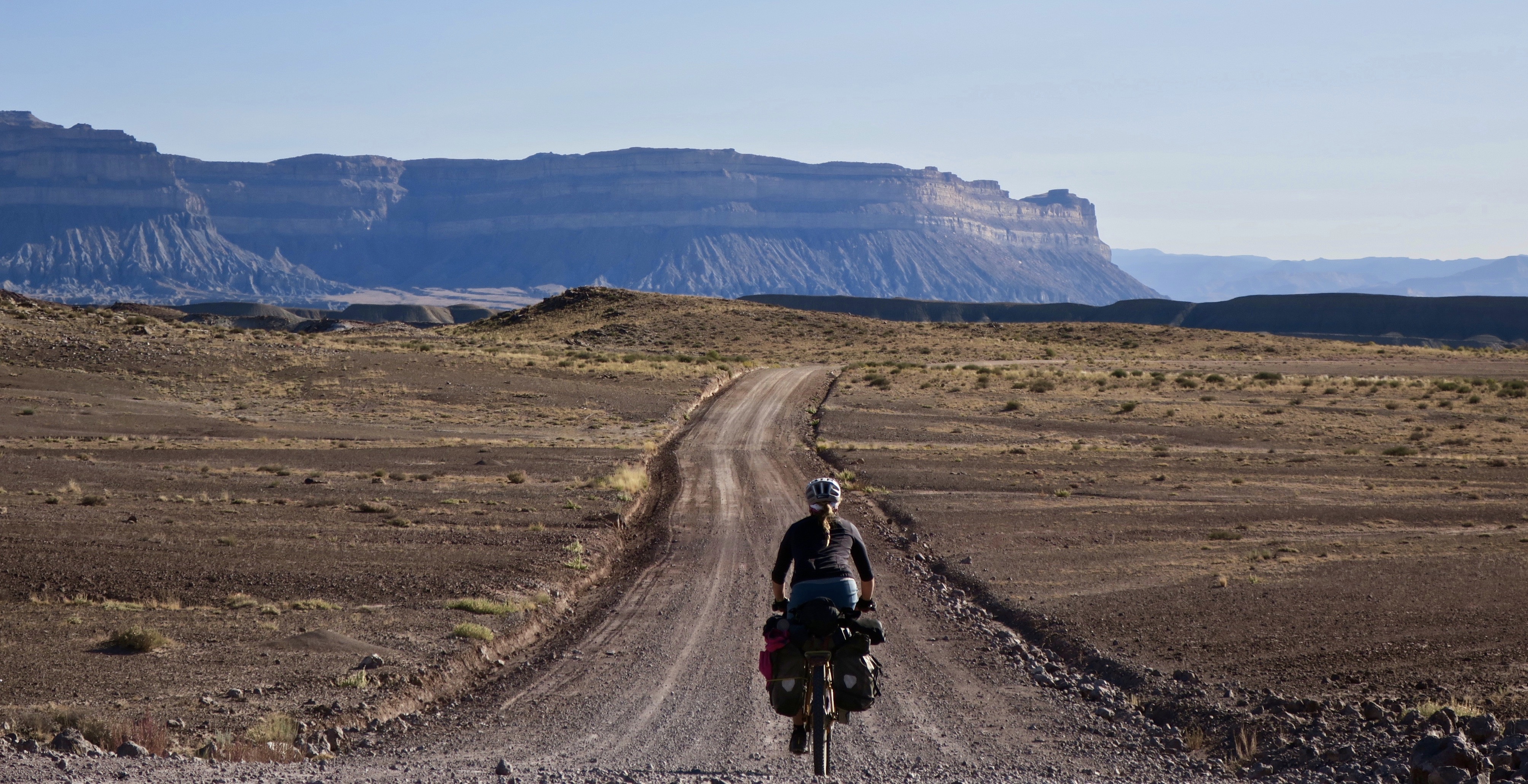
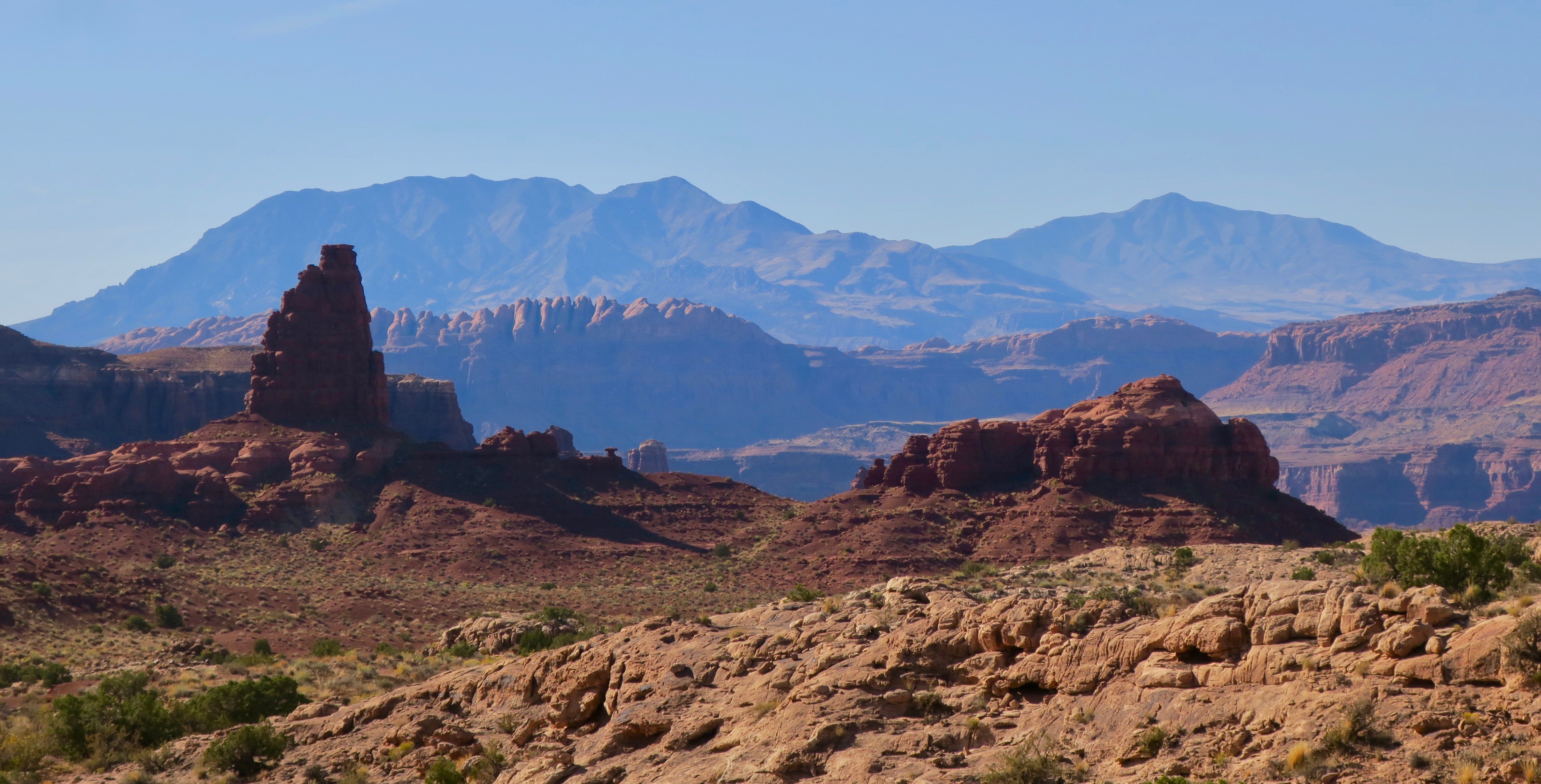
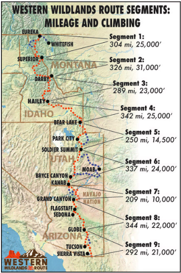
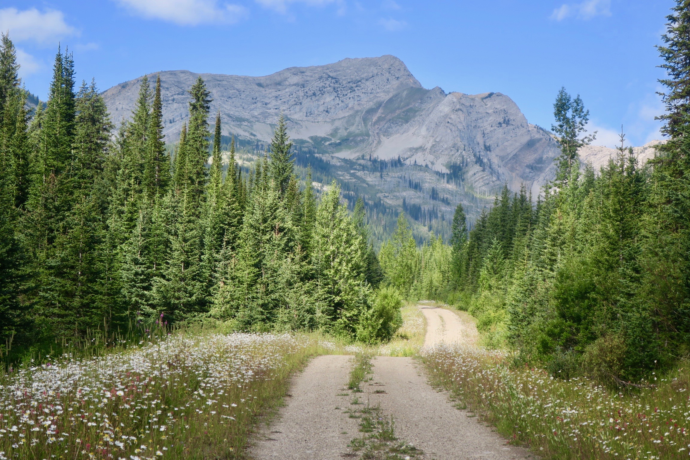
From there, I headed east towards Moab, using a combination of dirt roads that would lead to the Plateau Passage Bikepacking Route. I would rejoin the main Western Wildlands Route near Bryce Canyon. In Utah, the Western Wildlands Route mainly follows Utah’s high plateaus and I was keen to get into the low desert and famous red rock scenery. 

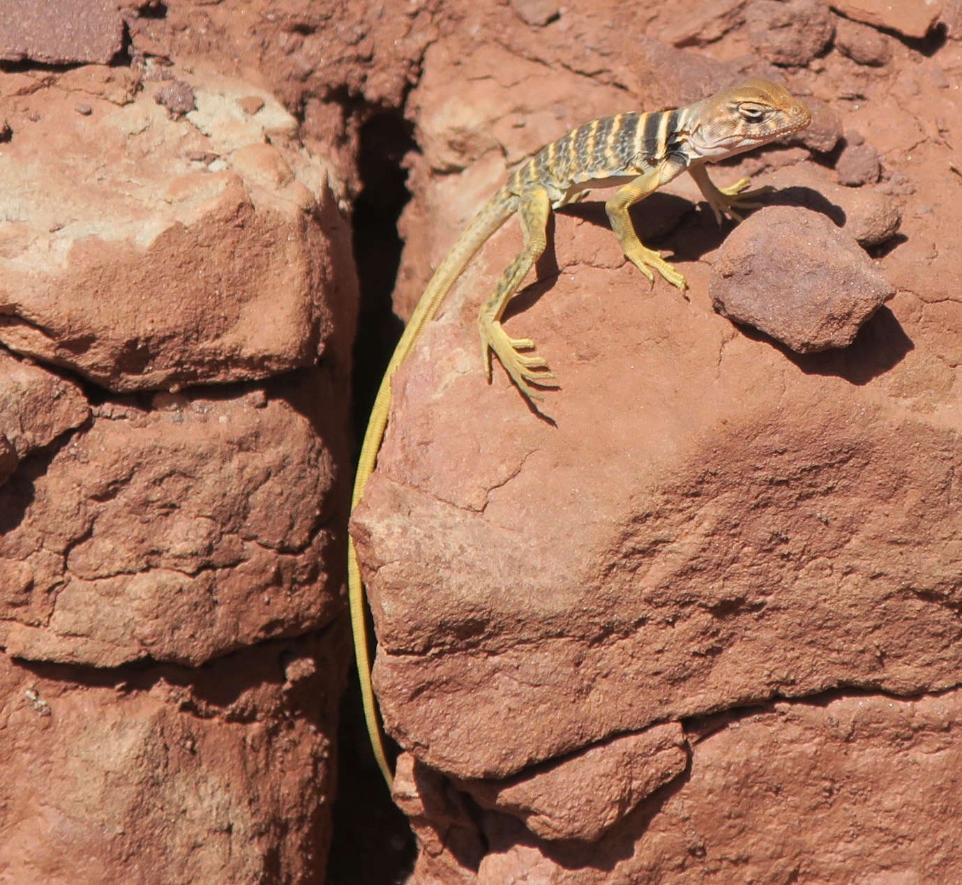
When the colourful waves of rock began to rise out of the scrublands, I felt like I was moving through a dream. I was buzzing all over, suddenly finding it surreal to really be where I was. I had wanted to ride through the Utah desert forever and I had finally made it here. I stopped many times to take photos and attempt to absorb it all. 

I turned off onto the Cottonwood Wash road – a rough and sandy jeep track, where I only saw one vehicle all day. There was a mix of riding and pushing to get my bike across old riverbeds clogged with deep sand. I camped near the San Rafael Swell that night, completely alone under a star-filled sky. 

I woke up to very cracked and swollen lips – the sun was wrecking havoc on me throughout the trip and now it was at its worst. In discomfort, I continued along a sandy trail following a power line track towards Green River. Hitting the pavement and passing through the town was a bit of shock. I went from the silence of the desert to a busy touristy circus. I didn’t linger, bought my necessary food supplies and continued on. 

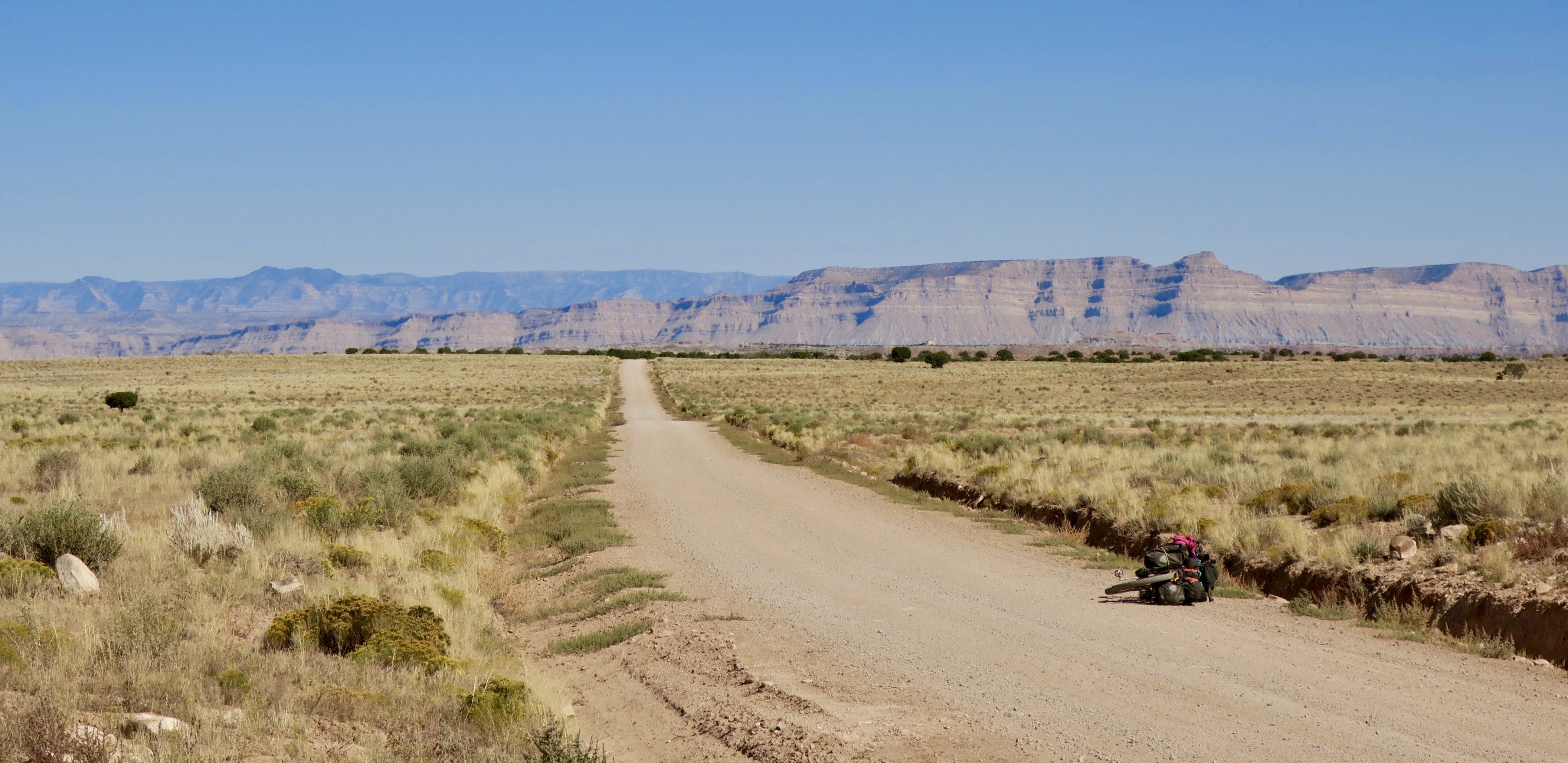
Sandy roads approaching Moab

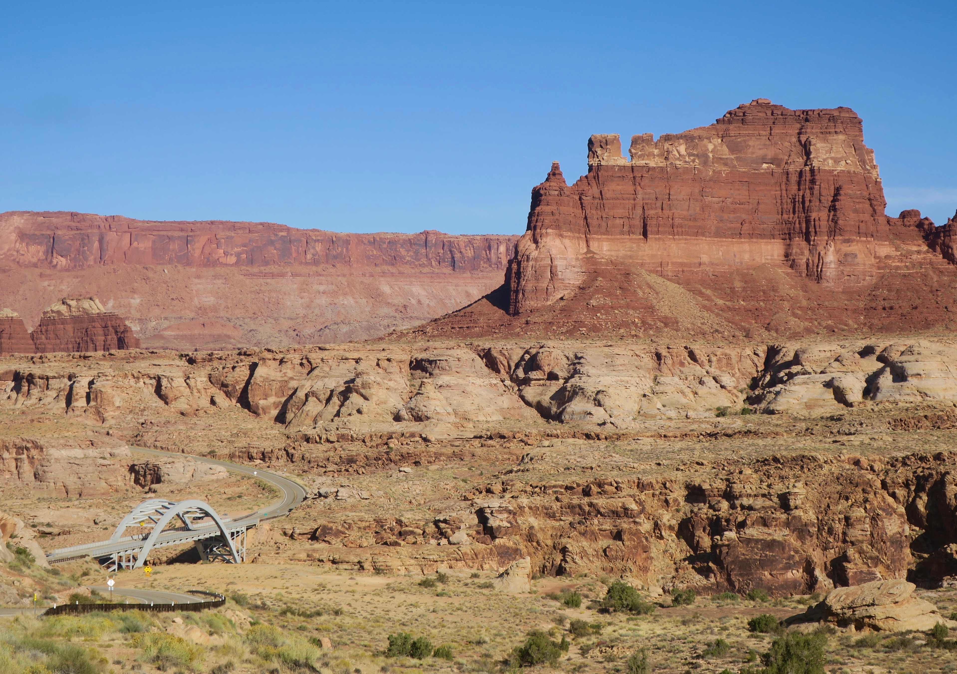
As I got closer to Moab, the colour of the surrounding rock formations deepened to that famous burning red. I headed towards a wide open area where various RVs were parked. It was funny, but I selfishly admit that I maybe became inclined to camp near RVs because it often led to interesting conversations  and almost always food. That night’s encounter was no different. 

I was walking my bike near a group of about three RVs camped together in a clearing, with a collection of motorbikes and e-bikes. A large Grateful Dead flag was strapped to one of the awnings, flapping in the wind. One of the guys invited me over for beer and food. I was soon introduced to the “FOG” crew – the “Fucking Old Guys” as they called themselves. This group of three friends gathered every year to hang out and play in the desert around Moab. They were great to hang out with. There was a couple there – “Bubba” and his wife, whose name I forget. They had lived in Alaska for 15 years. She now worked for the State Park in Moab and “Bubba” floated around in the RV in between jobs. When they spoke, the word “fuck” and its variations often took the place of a comma in a sentence (“I was like ‘fuck’…and the fucking guy…” etc.). Old folk tunes and modern alt country greats like Chris Stapleton and Jason Isbell played from a speaker. They spoiled me with huge amounts of food and we had some great conversation over a roaring fire late into the night. 

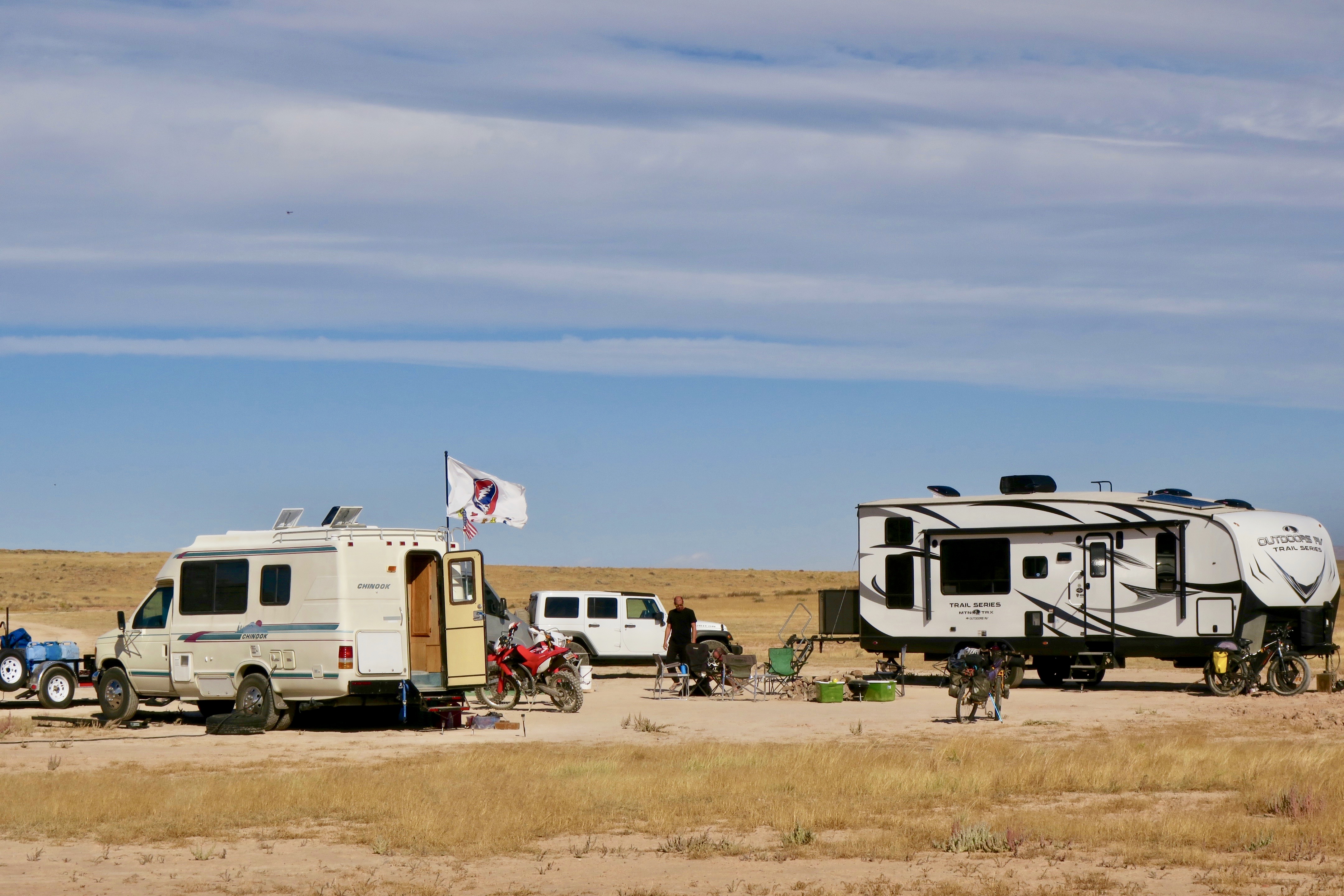
The FOG (“Fucking Old Guys”) camp

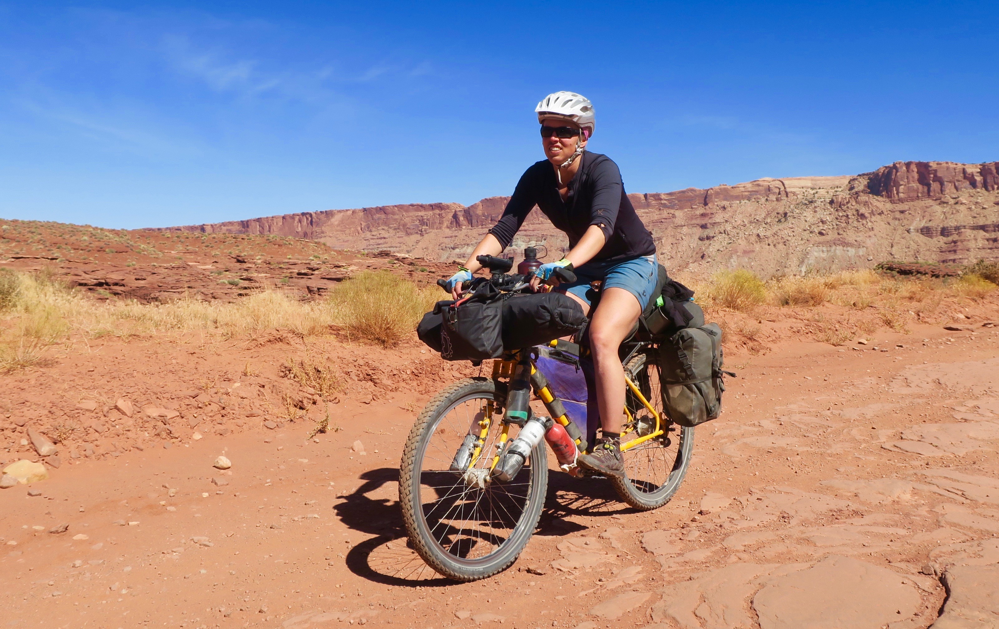
In the morning, The FOG crew fed me an enormous blueberry pancake breakfast and I leisurely made my way into Moab around noon. Getting to Moab felt like a big milestone for me – the very name evoked images of the iconic red rock scenery. Unfortunately, I was under time constraints to get to the Mexican border and I didn’t take the time to ride any of the Slickrock MTB trails that the town is famous for. I went to a bike shop and had sealant put into my tubes to safeguard me from the thorns of the Arizona desert in the future. I stayed for a night with a Warm Showers host and headed to Canyonlands National Park the next morning. From there, I started a section of the Plateau Passage Route along Lockhart Basin Road. 

Canyonlands National Park – though it looks quite and peaceful in the photo, there were many ATVs on this section of the road

Thanks to the random driver offering to take this photo…

Wild rock formations, Canyonlands

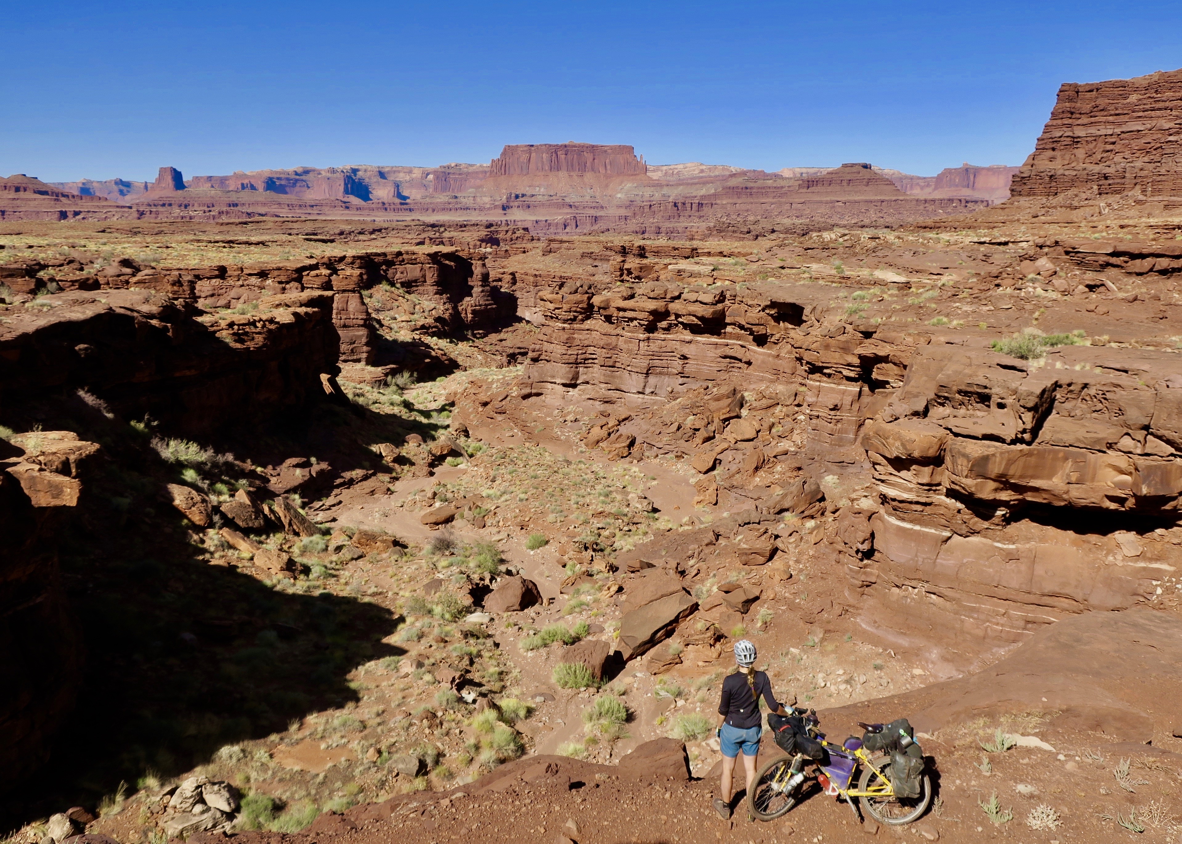
The dirt road leading out of Moab into Canyonlands were spectacular, but full of ripping side-by-sides. I continually had to keep an eye out for the four wheelers whipping past to ensure I wouldn’t be run over. I climbed to a pass and started a rough and rocky descent, which involved a bit of walking. Eventually, the traffic disappeared and I maybe saw one ATV over the next hour.

A faded out sign saying “Lockhart Basin” pointed left towards a sandy river bed. I confirmed with the GPS track that this was indeed my turn off. It took me awhile to figure out exactly which way to go. This was supposed to be an ATV/jeep trail, but all I could see was a corridor of sand. 

Lockhart Basin “Road”

I decided to trust the GPS track and started to push through the deep sand. I followed some motorbike tracks, which continued steeply uphill over a pile of rocks. The route was essentially following some kind of old drainage path cut into the cliff walls. I ended up having to push, drag and carry my bike uphill. It seemed impossible that a jeep could ever have made it through here. 

After a genuinely difficult uphill struggle, I reached the top and finally, a distinct trail. The view across Canyonlands was magnificent and I was completely alone. I didn’t even make it 60km that day, but I was too exhausted to push on. I didn’t care – I ended up at one of the best camp spots of the entire trip.

The red canyons all around burned bright in the fading light. The shadows took on imitations of life in their shifting shapes. 

The rest of the Lockhart Basin ride was challenging and it seemed like i was pushing just as much as I was riding, but the scenery was spectacular. It was absolutely worth it.

Rough going on Lockhart Basin


I questioned, though, if the rest of the Plateau Passage section would be this difficult. I had hoped that I was up to the task. 

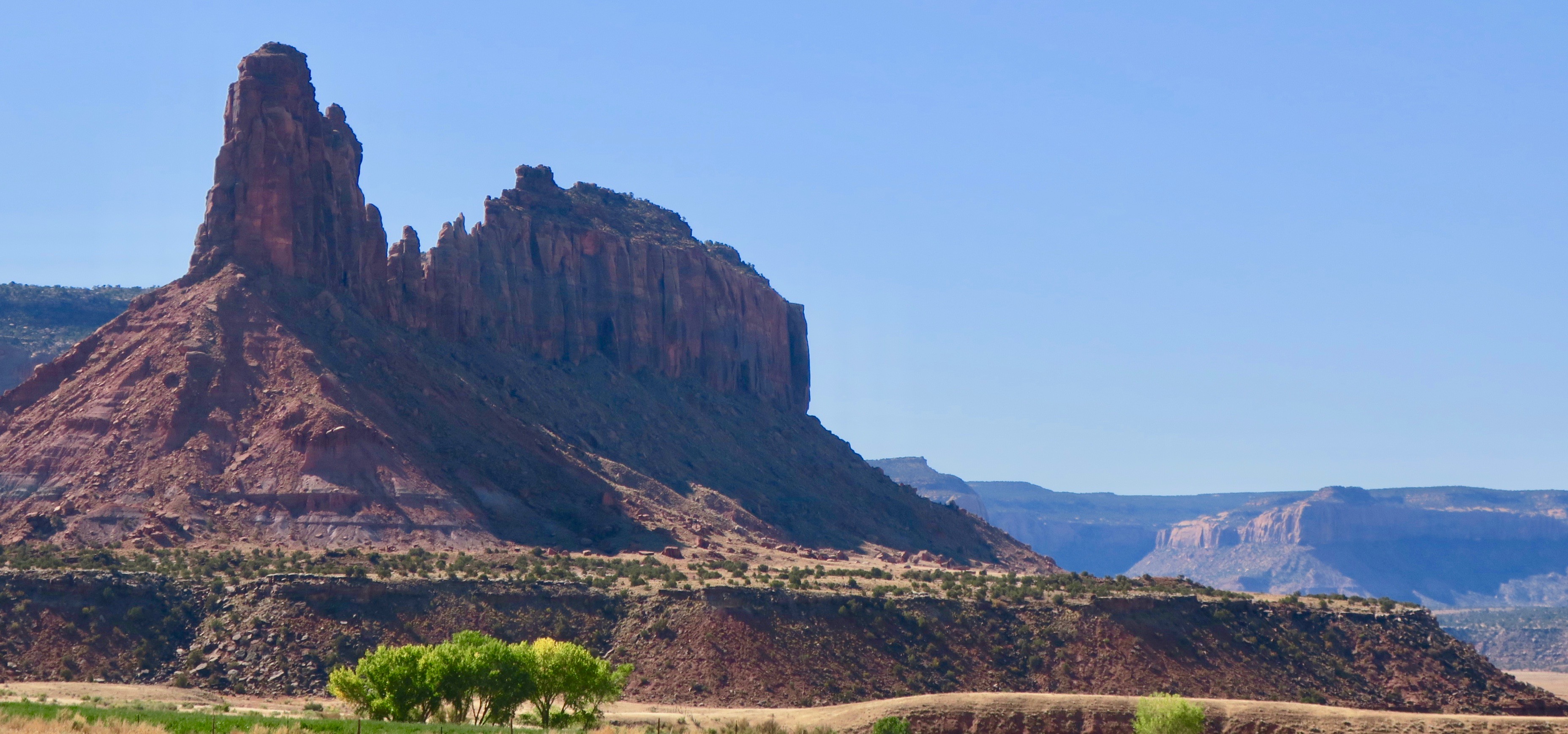
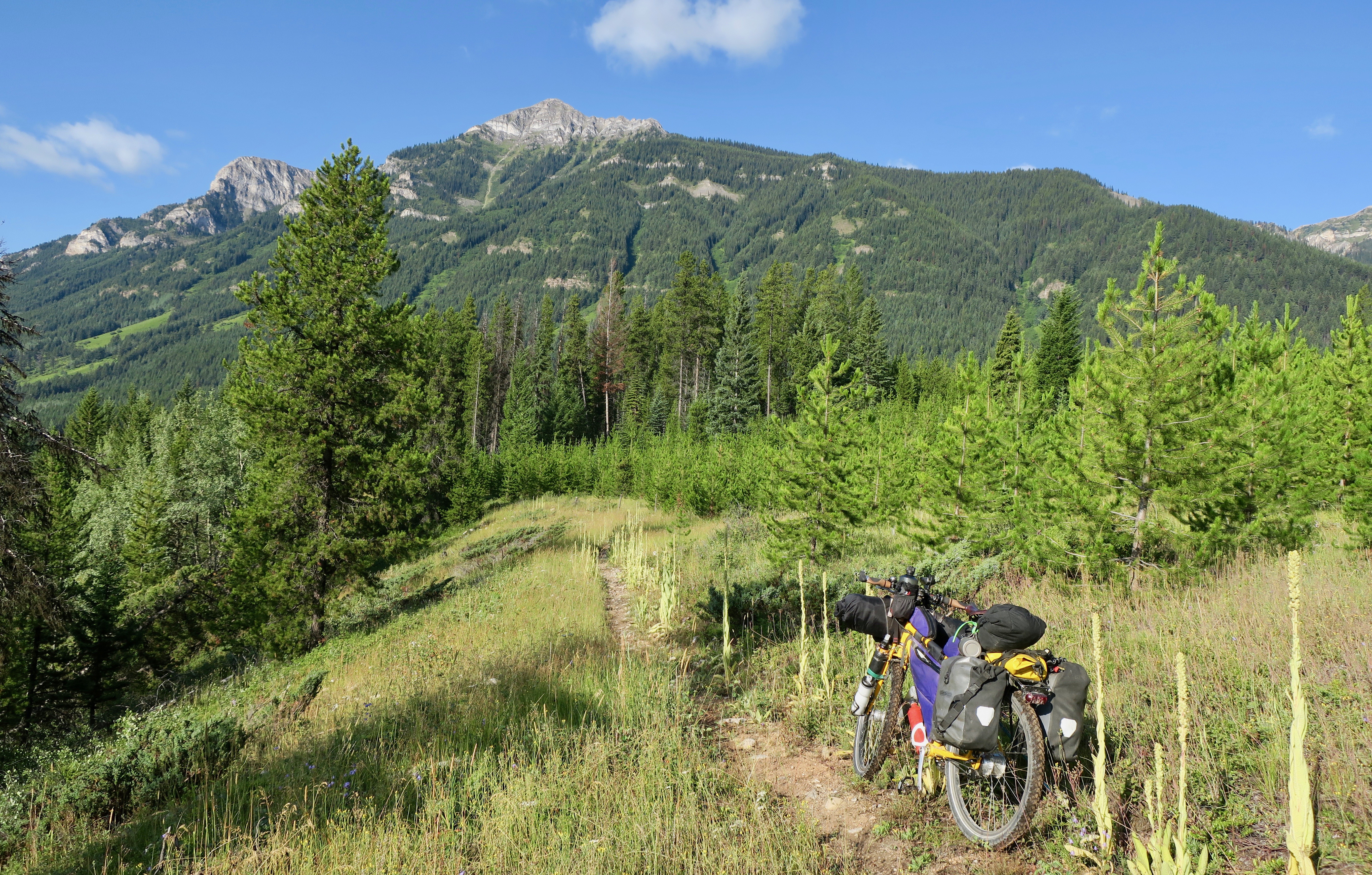
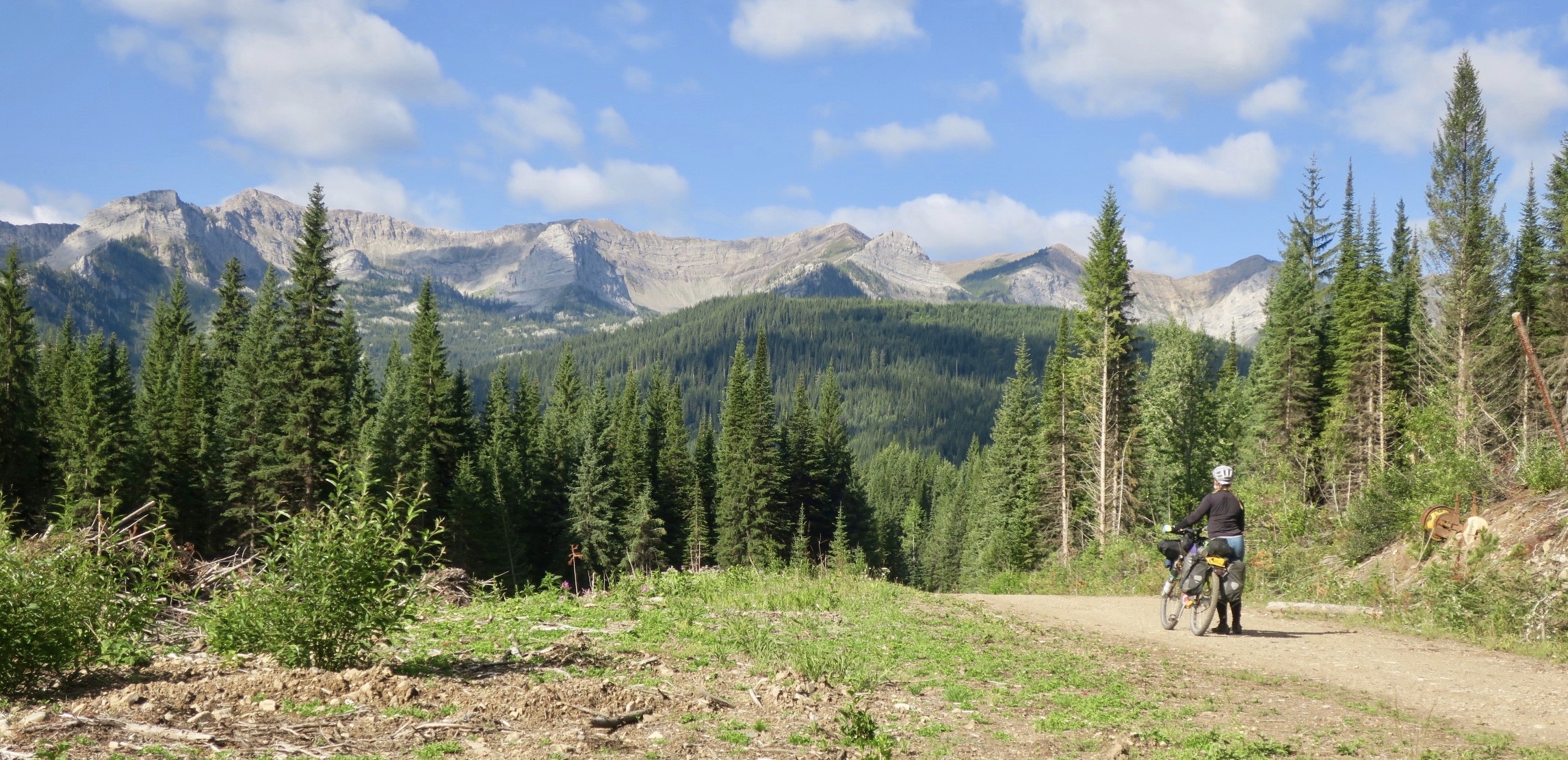
I met a few mountain bikers trail marking along Lockhart Basin for a Moab ultra running race. I met their support truck at the end of the trail and was given cold water and watermelon. The following morning, I detoured to the friendly Needles Outpost store to resupply before reaching Monticello. I climbed 1400m on mostly quiet and beautiful paved roads towards the Abajo Mountains, rich with fall colours. I had now left the heat of the Moab area behind as I headed towards the higher elevations. 

Abajo Mountains near Monticello

A high speed descent brought me into Monticello, where I decided to treat myself to a stay at an RV park with showers and laundry. The next morning, I jumped on the Plateau Passage route again, leaving the town uphill on a snaking dirt road. At one point, the GPS track veered right and appeared to cut straight into bush, with no visible trail of any kind. I walked around for a while, looking for something passable, only coming across a super rough, loose and rocky ATV trail that didn’t appear to be rideable. Eventually, frustrated, I decided to head back to town to find another way around. 

Disheartened, I decided to splurge on a pricey lunch at a new Thai restaurant in town. There, I met Arlo, a twenty something Pacific Crest Trail through hiker, currently living and working in Monticello. It was great to come across a like minded traveller, something that I don’t always find easy outside of my traveling life. I try to savour these meetings while on the road. He offered me a place to stay with him and his mom, Stacey for the night. He said he wanted to return the favour of being a “trail angel” because so many had done the same for him on his epic hike. His mom, Stacey was a very kind woman who had a very rough go at life. Still, with very little, she was very keen to feed me and make me feel comfortable. Yet again, another mishap led me to a random encounter with wonderful people. This is really what travel is all about. 

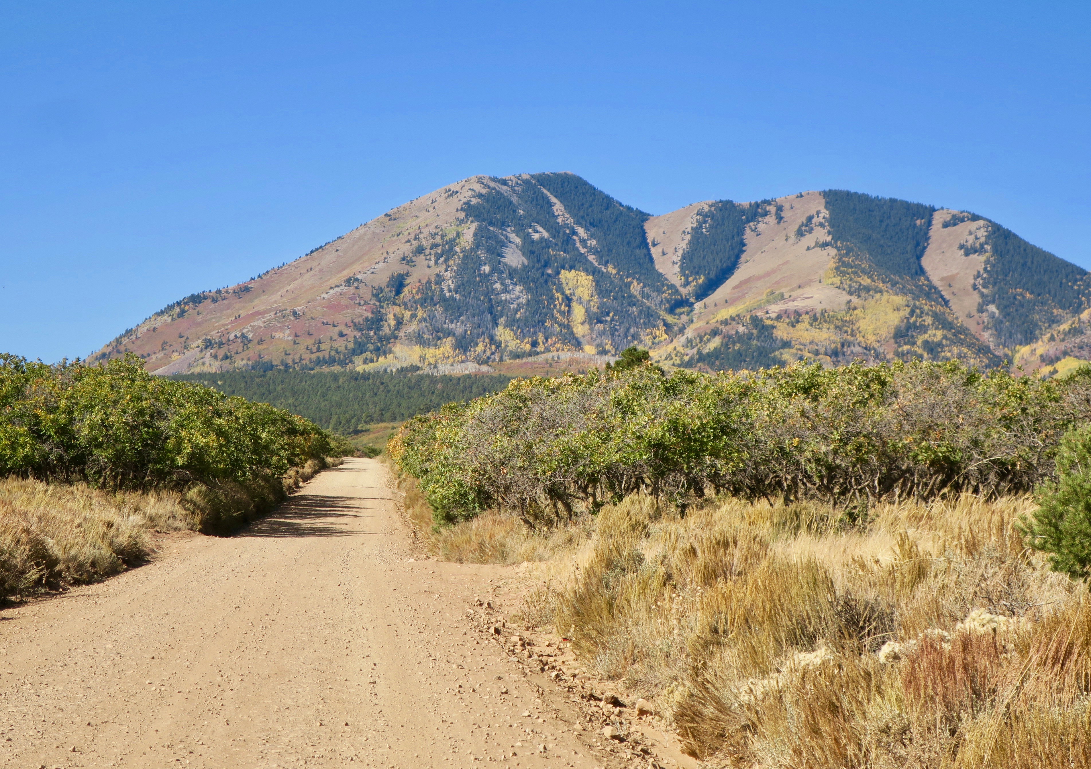
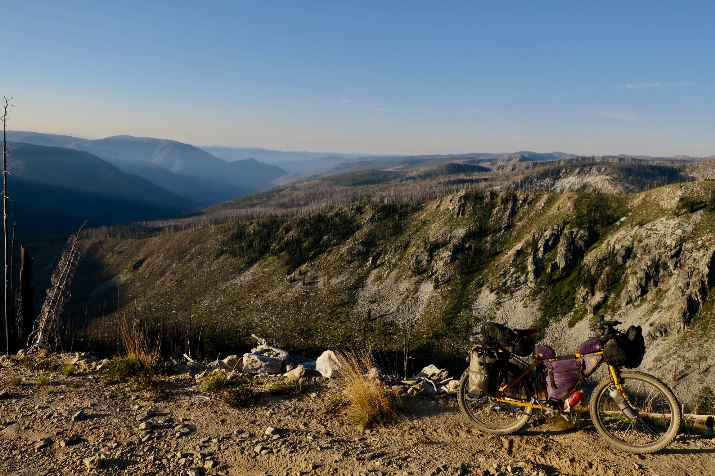
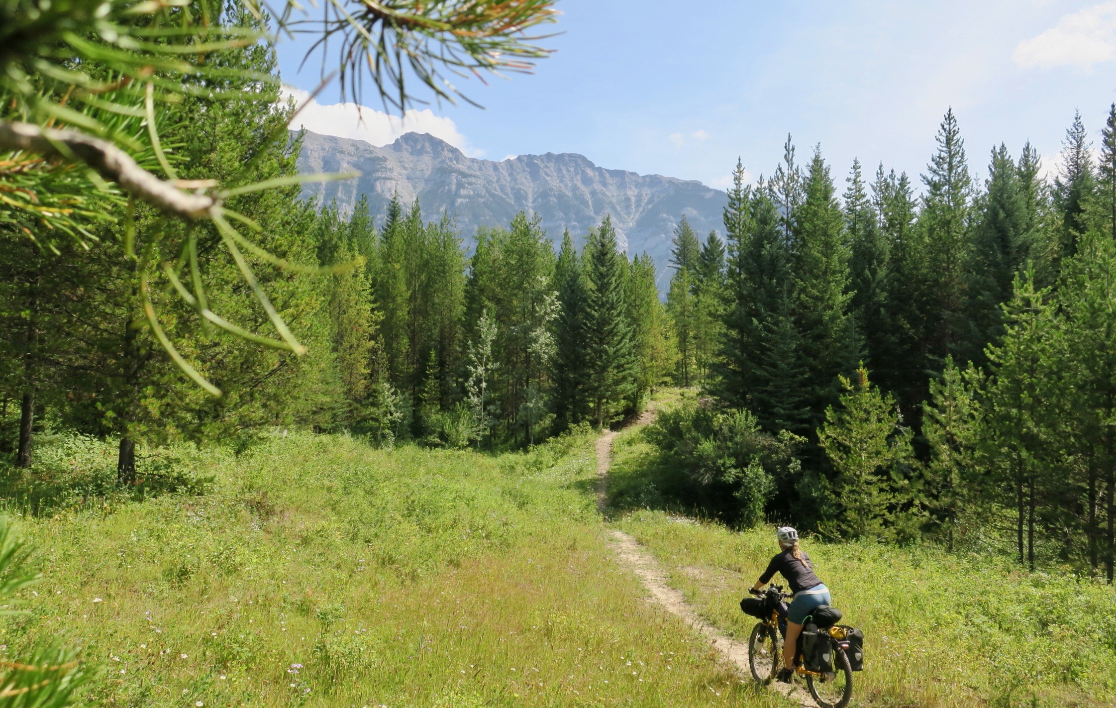
I re-attempted my exit out of Monticello, first riding a short stint of highway before hitting the dirt. Soon,  I was cruising uphill along a smooth unpaved surface, surrounded by Ponderosa pine. The idyll soon came to an end when I followed the GPS track onto the rougher Camp Jackson trail. What followed was a few hours of very tough pushing up steep and loose rock to a 2900m pass. If was without a doubt the toughest section of my trip and and I felt like I was a bit in over my head. Still, I was surrounded by autumn in all its vibrant glory.

I descended along some smoother double track painted gold by the aspen.

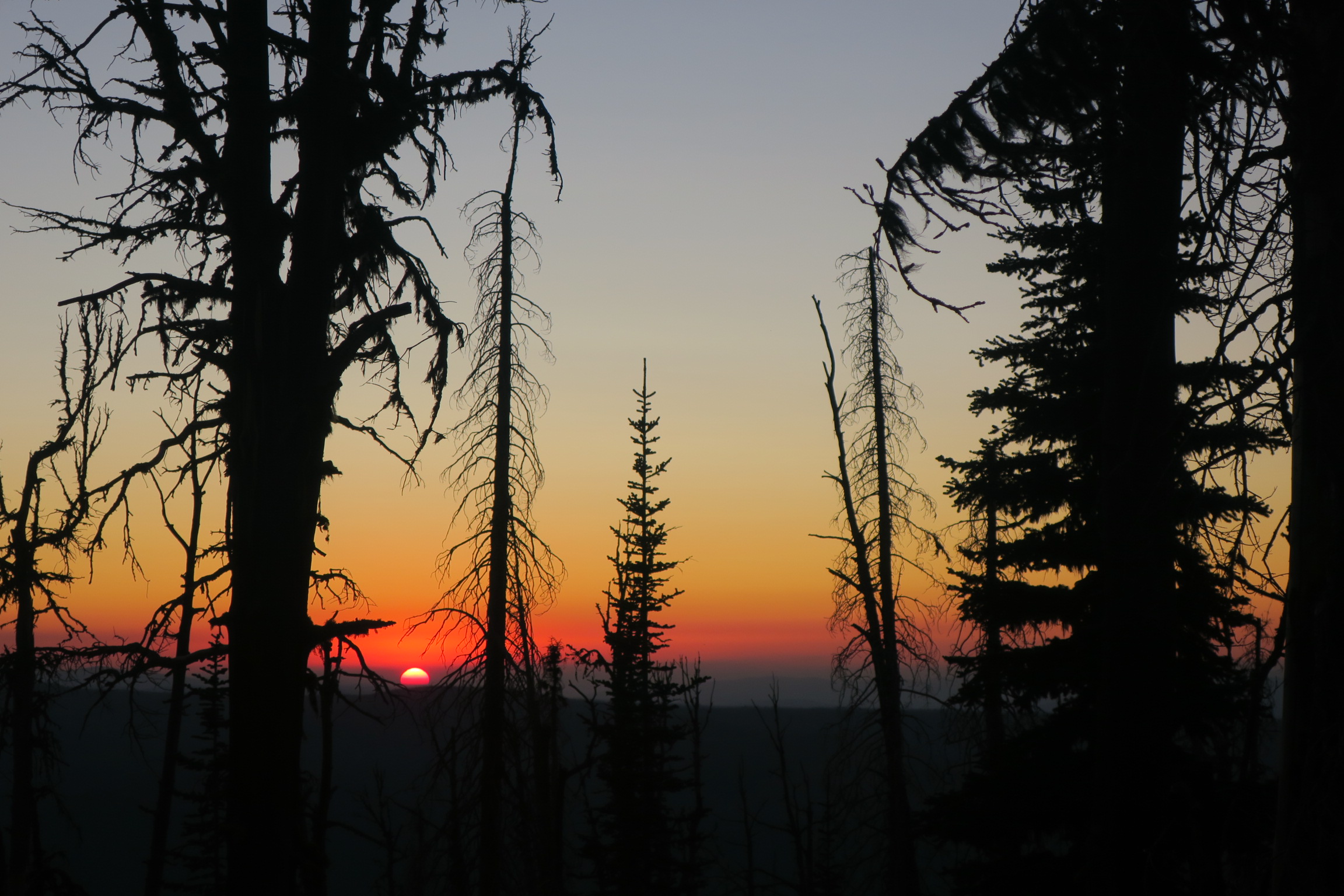
The rest of the day I climbed up and down along sandy roads through the pines, only seeing a few cars. I pulled off the road and into the trees to camp as the temperature began to plunge.

 All night I had dreams of waking up to a tent buried in snow and was relieved when I opened up my tent zipper and only saw the bare forest floor. It was a frigid and windy day, though, not going above 5 degrees Celsius . The route continued along a a dramatic cliff edge, from where I could see rose coloured buttes and mesas swelling above a carpet of vegetation. It was spectacular.

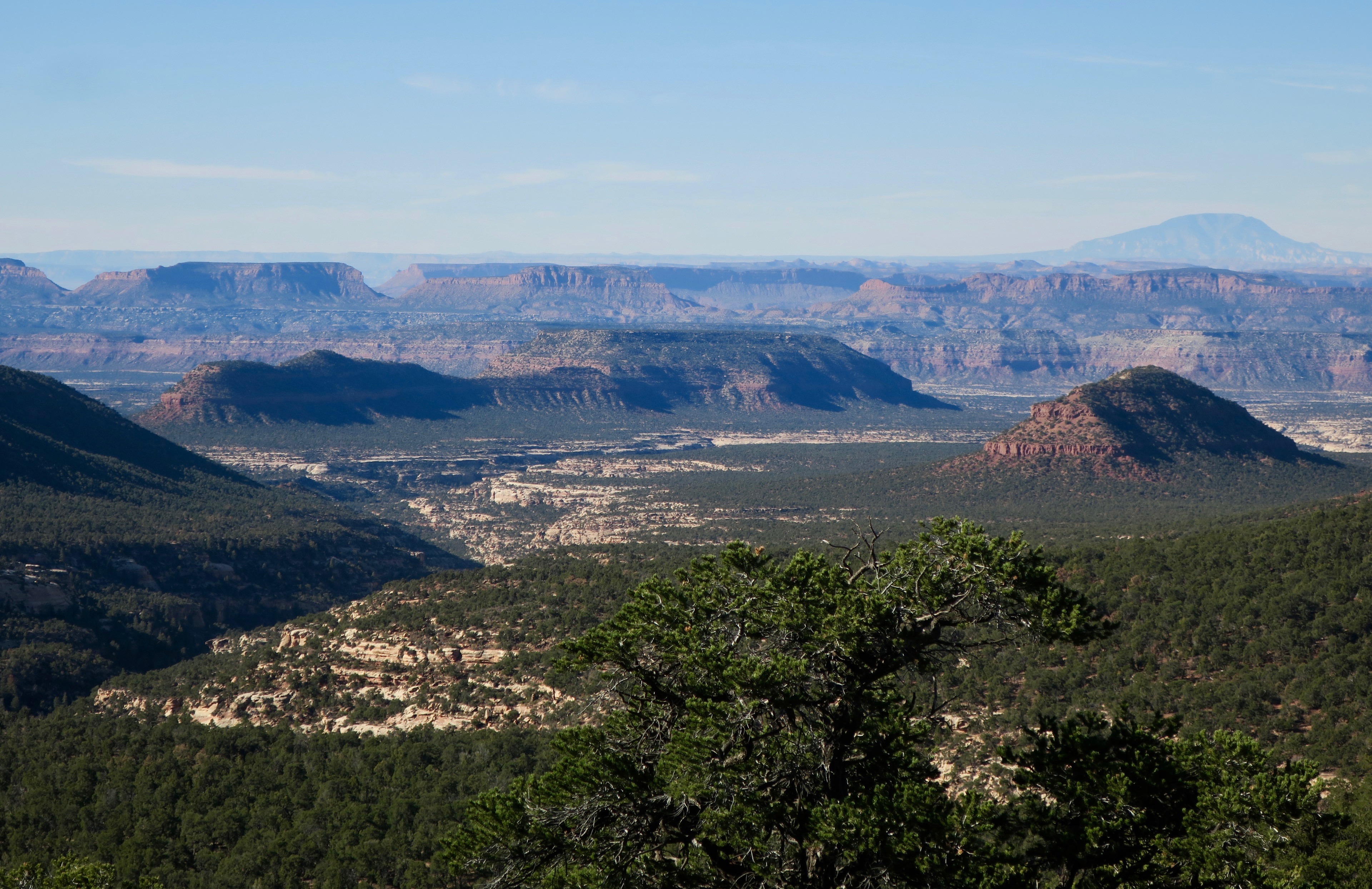
High ridge riding on Plateau Passage Route near Bear’s Ears National Monument

Once again, I only saw a few vehicles, some of them stopping to ask me if I needed anything. I also saw one lone black bear that immediately scrambled up a tree when it saw me.

When I started the long descent towards Hite, the temperature warmed and the pine disappeared, making way for scrub brush and open desert. The road colour changed from beige sand to crimson red. 

Back in the low desert heading towards Hite

The scenery approaching Hite was totally surreal. Wild, bizarre and undulating rock formations set to the backdrop of the silver Henry Mountains. It was all laid out like a calculated art installation by a master sculptor. I almost wanted to cry I thought it was so beautiful. 

From Hite, the plateau passage followed the paved road before making a rough and difficult crossing over the Henry Mountains. With the very cold temperatures and my then current level of fatigue, I decided to take a slightly easier route.

Colorado River bridge near Hite

View of the Henry Mountains

I followed the main road to Ticaboo, which turned out to be a tough day in itself with many short, steep climbs. At this point, I was feeling very, very tired. So tired that I ended up spending $100 USD at the remote Ticaboo Lodge because I didn’t even have the energy to camp. It turned out to worth every penny, because by the next morning, I had recovered and felt like I was soaring.

I joined the relatively famous Burr Trail Road just south of Ticaboo. Another magnificent ride set to a landscape that look like someone’s computer-generated fantasy. It would have been interesting to have a geologist with me, because It was difficult to understand how the shifting Earth could possibly have created such art. It was landscapes like this that especially ignited my wanderlust. When I pass through a place unlike anything I’ve ever seen before, it makes me want to keep exploring, to experience more of the unfamiliar.. 

Scenery along the Burr Trail

After scaling the wild Burr Trail switchbacks, the beige coloured cliffs changed to red again and more scrub lands appeared. 

Burr Trail switchbacks

I stopped in the tiny community of Boulder, home to the famous Hell’s Backbone Grill. Supposedly this was one of the first restaurants in the USA to have all of their menu sourced directly from the farm where it was located. I ended up having an Elk Sandwich for lunch – it was expensive and delicious, but I honestly could have eaten 3 of them. Luckily it was my second lunch. 

I ended up taking Scenic Byway 12 to Escalante, which was apparently voted #2 on the list for the most scenic drives in the world. Spectacular, it was, but I think it would better experienced in a vehicle, with the combination of traffic and knife edge descents. 

Back in Midway, Steve and Noelle told me to contact them when I was heading to Escalante, because they had a daughter living there in a yurt. They said that I could camp with her on Noelle’s mother’s property. Unfortunately, she had already left when I arrived, but my hosts arranged something even better. Noelle’s mother Joett owned a bed and breakfast in town and she set me up with a luxury room (jacuzzi included!) for the night. I couldn’t believe the generosity. 

The next day I cycled to Bryce Canyon, something I had been looking forward to the entire trip. I was now finished my big Moab loop detour and was back on the main Western Wildlands Route, heading South towards Arizona and Mexico. 

I stopped in the tacky Bryce Canyon City to get a few supplies. Outside of a grocery store, a guy got out of his car to talk to me. He said he had just cycled the Pacific Coast route and wanted to help me out, because of how much he appreciated people helping him on the road. He gave me a few bottles of beer and Clif bars – what a treat! Really, the generosity was never-ending in this country.

I picked up a bowl of “Soup-er Meal” ramen, my new favourite, salty post-ride snack. After wolfing it down, I headed to Sunset Point campground by the canyon, literally grabbing the last spot. I met a really nice couple from Tucson who offered me to stay at their site for free, but the ultra strict park warden wouldn’t have it. 

I headed over for sunset. It was another absolutely awe-inspiring sight. I realize this description is probably starting to sound like a cliche – but in this part of the world it was one world class view after another.  So many hoodoos, awash with bright pink. 

Bryce Canyon at sunset

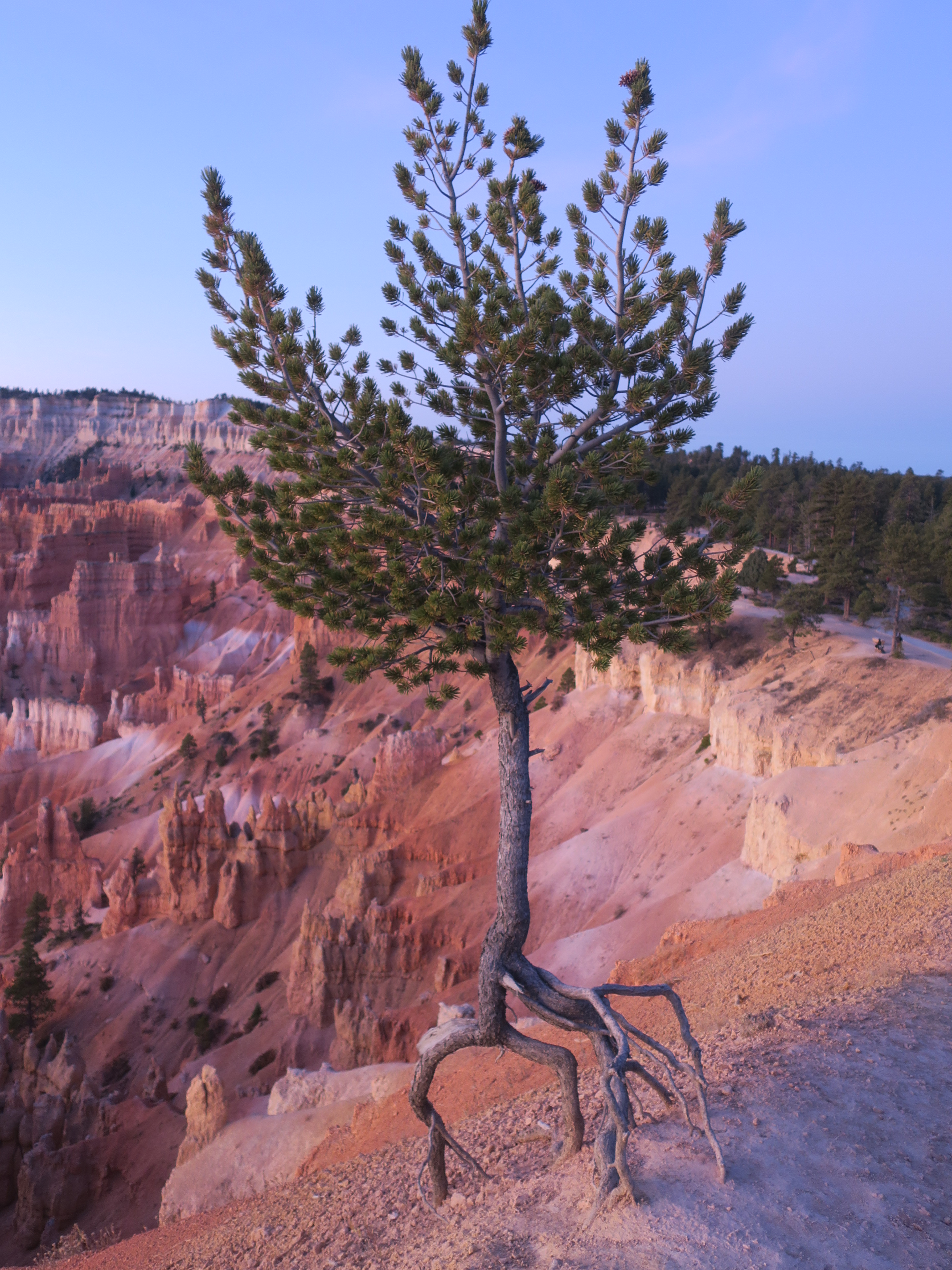
Limber Pine – an ultra resilient tree growing out of the rocks in Bryce Canyon

It dropped to -7C that night. I hadn’t planned to get up for the sunrise view, but then I realized sunrise wasn’t until after 7am, an hour past my usual waking time. So, I experienced yet another incredible view. The dawn light created softer and more understated tones along the rock.

Bryce at sunrise

 Leaving this majestic place behind, the route followed a backroad out of the park, only opened to administrative personnel and cyclists. What followed was more pine, some scrub brush and rolling hills with no traffic. Above the treed canopy, the odd red rock formation poked out. In the Western Wildlands Route guide, there is a note saying that the final 40 miles were the “fastest of the segment.” Hitting some nasty, mushy gravel and wash board, I wondered what kind of shitty roads I must have avoided further north. 

Eventually, I hit pavement and descended through many miles of private land. I ended up camping about 10km from Kanab just off of the main highway. I took a side road and pushed my bike behind some houses far enough until I hit a sliver of public land beside on ATV trail. I could hear families playing with their children into the night –  If they saw me, I wonder what they thought of this stranger camping in somewhat close proximity. 

“Wild” Camping a few hundred metres from the highway near Kanab, UT

I took my time in Kanab, the last town before Arizona. I enjoyed a breakfast bagel and coffee at a local cafe, sending email updates to family and friends. When I headed back to my bike, a woman greeted me with a $10 bill. 

“I saw you in Boulder, but I was too shy then to talk to you. I think what you are doing is amazing. Could I please buy you breakfast?” 

I said thank you, giving her a big hug, trying to hold back tears. 

Western Wildlands Route: Montana and Idaho


Shortly after leaving Eureka, I had yet another mechanical issue. After hearing a cracking noise coming from my bottom bracket, I noticed that I had lost one of the two bolts holding the eccentric shell in place. I had foolishly forgotten to bring a spare, so I needed to order some from England.  This was an exotic, finely threaded bolt I wouldn’t be able to find anyone in the USA, apparently. I had them sent to a Warm Showers host in Challis, about 10 days ride away. I would just have to deal with the annoying sound for a while. 

Crossing Lake Koocanusa, MT

Quiet 2-track through the Purcell Mountains, Montana

After some fast pavement following Lake Koocanusa, I climbed into the Purcell Mountains on quiet and forested double track. Eventually I ended up in a small town called Troy, MT, which I wouldn’t say was particularly memorable if not for the very friendly residents. Stopping at a grocery store, I had several people approach me to tell me that they loved what I was doing and offered any help that I may need. This would become a trend on my travels throughout Montana and Idaho. 

Leaving Troy, I passed through an area with scattered clearcuts by a river. The landscape was unique with a sparse scattering of spindly conifers that had been left behind. 

Now on the official Western Wildlands Route, I had luxury of using an app that would provide me with all sorts of useful information such as water sources, towns with resupply, sights of interest and spots to camp. Usually, I would avoid official campgrounds to in order to save money. I was pleasantly surprised, however, by the number of high quality and free campsites both in Montana and Idaho. 

Marten Creek Campground, Montana, one of the many free sites

Towards Porcupine Pass into Idaho

The smoother tracks deteriorated as I climbed Porcupine Pass into Idaho. On the rough descent, I encountered my first bikepacker on the WWR – Geert, a Dutchman living in Adelaide, Australia. He was in his late sixties. I later found out through social media that he was the first to ride the entire Wild West Route Northbound. He was also an extraordinary artist, using watercolour to paint the landscapes he passed through on his bike tours. 

One of Geert’s paintings. Photo from Bikepacking Roots Facebook page

We chatted for about 45 minutes in the middle of the dirt road, without having to move for a single vehicle. He gave me some information about the long ride ahead of me, including a stiff warning about using tubes in Arizona – he told me he had 20 flats and switched to tubeless! This worried me a bit as I was planning to use tubes the whole way!

Saying goodbye to Geert, I pushed on to Wallace, Idaho. Camping in City Limits RV park, I was spoiled by RV campers who gave me beer, a bag of fruit and energy bars for the road. The local generosity was really never-ending.

Wallace, ID

Leaving charming and historic Wallace, I climbed steadily onto the Route of the Hiawatha, a bicycle trail built from old rail grades. For me, normally a “rail trail” isn’t the most exciting for cycling, but this was definitely an exception. I pedalled high along old trestles that disappeared in and out of densely forested mountains. I got to experience pedalling a 3km long tunnel, which fun, if a bit claustrophobic. I was surging forward through a long, black cylinder that trapped echoing voices, chasing the beam from my headlamp. Real “tunnel vision.”

One of several tunnels (this one was short, the longest was 3km) on the Route of the Hiawatha, ID

Route of the Hiawatha, ID

Route of the Hiawatha, ID

Back into the light, I started to make my way to the town of St. Regis, Montana The landscape was becoming more arid, Ponderosa pines still a steady companion. Now, the sound from my bottom bracket had worsened and I knew that I had many rugged and remote miles left before I would reach Challis where the replacement bolts would end up.  If I didn’t find a solution, I would probably damage the bike.  In St. Regis, I searched online for a bolt similar to the one I needed. It was a very unusual size and I was basically told that no hardware store (or likely bike shop) would stock it in this part of the USA. I ended up finding only one online supplier in Massachusetts that had something similar that would temporarily work.  The fastest it could be shipped to me was three business days, meaning I would have to hang out in St. Regis. At the local post office, I inquired about a general delivery option and then placed the order. 

Not long after, I was approached by an older man, asking me about my trip. He said that he had done some biking in the past.  I said that I was riding to the Mexican border, but I needed to stay in St. Regis to wait for the replacement bolt. 

“Well..” he paused “We could put you up. Let me just phone my wife.” 

And that’s how I got to know Billy and Jennifer, two retired Californians living in St. Regis. I had a wonderful three days staying with them in a peaceful and beautiful little spot by the river. Once again, a mechanical breakdown resulting in amazing encounters. Jennifer couldn’t believe how “serendipitous” the whole thing was. I was so humbled by their kindness and once the bolt arrived, I was a bit sad to leave. 

St. Regis, MT

The River

On a bicycle riding through Montana and Idaho, my life revolved around the rivers. The route often followed them closely, the cool water providing refuge in the humid summer temperatures. 

I drank out of them and I washed away the day’s dirt and sweat. Climbing the Hoodoo Pass and descending to the Clearwater River was a highlight of the trip. The narrow road meandered through the woods and then rambled along the river, rock cliffs towering on either side. It was also labour day weekend, so I met plenty of ATVs. It seemed like no matter how remote the area was, I would always meet someone on a side-by-side. The majority of the riders were very courteous, often stopping to ask if I was OK. 

Following the Clearwater River, Idaho

This area of Idaho was becoming increasingly remote, preparing me for the crossing of the Magruder Corridor, supposedly the most rugged and remote section of the entire Wild West Route. 

I passed through small towns like Pierce, with only a few hundred residents.

Most of the locals I chatted to knew all about the Magruder as it was also a popular ATV outing. Of course, everyone thought I was nuts to be doing it on a bike. 

“They (the government) let the wildfires burn, so it’s not as beautiful as it used to be,” one man said. 

On the hottest day of the trip, I descended to the Selway River, which I soaked in for a about half an hour to regain my energy so I could start the 40km climb towards Elk City near the beginning of the Magruder Corridor. Big elevation gains and losses were the facts of life crossing Montana and Idaho. Climbing for 30+ km up and down a mountain pass was basically a daily standard. I made it about 10km up the climb and ended the day camping at a large landing on the side of a quiet dirt road. 

_ _ _ _ _ _

Tiny community of Elk City, ID

The climb to the summit was relentless and I hit the descent towards the tiny outpost of Elk City with barely any reserves left. While speeding down a paved road into town, I saw a man in full camo with one arm outstretched holding a can of beer, the other waving to me.  As I slowed down, he beamed “Hi! Do you want a cold beer?!” 

“Why, yes I do!!” 

I gratefully accepted the ice cold Bud Light. John was a road cyclist himself and really, really into hunting…like, lived and breathed it. Inside his home he had many mounted heads of large ungulates and impressive rugs. He had a thick Idahoan accent, as dense as his moustache. He pronounced creek like “crick” and him like “eem.” He was a joy to talk to and one of the friendliest people I’ve ever met.  After a couple of beer, I really started to feeling the fatigue of the climb and gratefully accepted his offer to stay the night. He made me his favourite meal, chili dogs, which are basically amped up hot dogs smothered in chilli sauce, cheese and onion. It really hit the spot. I will always fondly remember John the Elk Hunter from Elk City. 

The Magruder Corridor

In the WWR guide, The Magruder Corridor crossing is described as “90 miles of rough and taking dirt and 4X4 roads sandwiched between two of the largest wilderness areas in the lower 48. So, obviously, it wouldn’t be cake walk. Several large wildfires over the last several decades had ripped through the area. They left behind large swathes of eerie skeletal trees climbing up and down the hillsides. It was a stark and surreal looking scene – blackened spears challenging a piercing blue sky. 

Fire damage in the Magruder Corridor


I came across a black bear with two cubs in the middle of the road in a more forested area.

I stopped and waited for them to move away from the road before I continued. Throughout the day, the views became larger and more dramatic. The road went from bad to worse – from rough dirt to large rocks.  I wasn’t alone in this wilderness as there were quite a few people on side by sides and a select few willing to beat the shit out of their trucks. I also met two other bikepackers doing a section of the WWR – only my second and third at that point. I left the most brutal climb for the end of the day after an equally tough descent to Poet Creek.

Rough road, Magruder Corridor

 Within the last 800m of the summit I had absolutely nothing left in my legs and opted to push the rest of the way, which wasn’t much easier that riding. I had really hoped that I could camp somewhere once I got to the top, because there was no level ground anywhere, it seemed. Huffing and puffing, pushing and dragging, I finally made it to the top of the climb. I was in luck – a pullout! Large enough for me to camp. It was next to the road but there was very little traffic and I was too tired to care. I was so tired that it was almost a bit discouraging – I was suddenly having doubts about my ability to physically cope on this trip. These negative thoughts were temporarily cast aside when the sun began to set. The silhouettes of a broken woodland stood strong against an extraordinary palette of colours. 

I slept hard that night. 

Sunset, Magruder Corridor

Magruder Corridor

Magruder Corridor

The following morning, all doubts from the previous day seemed to disappear. The toughest part of the Magruder crossing was over, but there was still some climbing to do and a very rough descent. My goal was to reach a campground called Deep Creek. In my tired state, I thought of the movie “Get Him to the Greek” and came up with “Get Me to the Creek” to try and give myself some motivation. Definitely more amusing to me at the time…

The cheesy title didn’t motivate me enough, but I did end up camping by a creek, grateful to have a wash at the end of the day.

_ _ _ _

After resupplying in the touristy town of Darby, Montana I headed off to climb the Horse Creek pass back into Idaho. Like the Magruder Corridor, the area had extensive amounts of fire damage. It was a lonely and eerie climb. The sky was heavy with greyness, with the odd sliver strand of sunlight fighting its way through. I slept beside the road at the top of the pass. It was one of the quietest nights of trip – no wind, no stars. I was only surrounded by lifeless limbs burnt to the bone. These trees offered no shelter, no protection and held no secrets. 

Camping at Horse Creek Pass, Montana

The Climb to Horse Creek Pass, MT

The next morning, the climbing continued, leading to a massive and hairy descent down to the Salmon River Canyon through dramatic, rocky hillsides dotted with ponderosa pine. 

I continued along the Salmon River, when the weather began to turn. It rained steadily the rest of the day and I arrived at McDonald Flat campground soaked and cold. I didn’t waste any time and set up my tent as quickly as I could. While I was doing so in the persistent drizzle, a pickup pulled up beside me. An older man and woman were in front.

“We saw you riding further up the road. You were moving fast, but you looked cold. It didn’t look like you were having a lot of fun!” the man said. 

“Yeah,” I laughed, “Heavy rain isn’t my favourite!”

“Do you drink beer?” he asked. 

They invited me to come and hang out at their campsite after if I wanted. I said that I would come over. Freezing cold and starving, I first ran to the public bathroom and cooked pasta inside. When I finished doing that, I changed into dry clothes and crawled into my sleeping bag, where I laid for about 30 minutes before I felt warm enough to go anywhere. 

Later, I went over to the campsite where Kevin and Pat where staying, whom I had met earlier. They were a local retired couple camping out in their RV for a week.  I was greeted by a raging fire and offered beer and food. These wonderful people completely turned my day around. I stayed with them until darkness fell. We exchanged stories by the flickering light, while my cycling clothes dried out over a camp chair. They told me to come back the next morning for coffee. 

Trail angels, Pat and Kevin

I savoured the following morning with them, sipping slowly at my coffee with honey. Once again I was so grateful to have encountered such wonderful human beings. Departure is a thrilling part of nomadism, but the “goodbye” isn’t always easy. 

Unfortunately, the rest of the day didn’t turn out so well. There was now a more distinct chill in the air and the aspens fluttered in gold. Fall was here. I was shivering most of the day and it seemed like I couldn’t shake the chill no matter how many layers I put on. I soon hit a big descent towards Challis – the coniferous forests changed into sage-covered hills once again. 

Scenery approaching Challis, ID

I had absolutely no energy when I arrived in town and I even considered walking the last flat and paved mile, because I wasn’t sure I could make it. 

At my Warm Showers host’s place, I felt completely out of it, thinking it was just fatigue and I struggled to keep it together. When I left the next morning, I suddenly decided that I felt too ill to ride and went straight to a hotel. I didn’t leave the room for two days – I believe I had food poisoning of some kind, but even now I am not exactly sure. 

When I managed to ride away from the hotel in Challis, I was far from 100%, but I had to keep going. Another big climb followed over the old Custer Motorway and past several small ghost towns. On the way to Stanley on a chilly morning, I passed some hot springs right on the side of the road. I almost choked on the steam, lushly hanging in the cold air. I took off my gloves and shoes, dipping my cold hands and feet in the hot water. It was heaven.

Hot springs on the side of the road near Stanley, ID

The tiny town of Stanley, with the dramatic Sawtooth mountains as backdrop, seemed to attract outdoor hipster types.  After a latte at a hip food truck, I headed off to explore the valley. 

Stanley, ID

On some double track near town, three bikepackers raced downhill at full speed, hollering as they ripped past me. I assumed that they were on a day trip because of how light their rigs looked. Throughout the day I started to see more and more riders  pass me. Eventually one guy stopped and asked if I was on the “Smoke and Fire.” 

“The what?” I asked. 

Russ, Idaho Smoke and Fire 400 racer

The Idaho Smoke and Fire 400 is a self supported bikepacking race that takes place every September. I ended up seeing about 25 riders that day. It was sort of exciting, because I had only met about three other bikepackers since beginning the Western Wildlands Route. I chatted with quite a few of them – some looking disoriented and sleep deprived, but still having a great time.  It made me happy to be in such a large community of cyclists, which is something I am definitely missing in my home life. I really got to experience the depth of the field – from the leaders at the front, to those chilling at the back. I met two guys who said they started each morning of the ride with a bloody mary and were in no rush. Apparently the winner of the race completed the 640km-ish  course in an astounding 48 hours! 

Sawtooth Valley, ID

That same night I met two guys doing a section of the WWR on a fat bike and a plus bike. They both joined me at camp. Around 10pm, a woman from Boise, Idaho racing the Smoke and Fire also joined us. All three were traveling ultralight and sleep in bivy sacs. It was great to have the company.

After the beautiful ride through the Sawtooth Valley, I passed by the mountain bike hub of Galena Lodge on my way to Ketchum and Hailey, ID.

Mountain biker on the route near Galena Lodge, ID

near Galena Lodge, ID

Beyond Hailey, the stands of trees started to disappear and the landscape became even drier and more wide open. Golden coloured grasslands and sagebrush dominated. These were the vast “wild west” type vistas I had envisioned.

Craters of the Moon National Monument presented a very unique volcanic and blackened landscape. I was unfortunately unable to appreciate it as I was still recovering from my sickness from less than a week ago. I could barely stay awake at the visitor’s centre and decided to keep moving on. I had to take a nap in a ditch on a quiet dirt road just so I could keep going. Luckily, it helped. 

Snake River Plain

Snake River Plain, ID

Pedalling across the vast intermountain Snake River Plan brought back the feeling of crossing the Australian outback or Mongolia. It was a huge sky tucked into a sea of sage brush from where the odd lone peak emerged. I loved the solitude. In the distance, I could see a storm cloud growing. I decided to stop early to set up my tent, knowing I would be fully exposed. I ended up stopping just in time. With no real wind shelter, the storm hit hard. The blasts of wind were intense and I attempted to brace my tent poles with my hands, fearing they would snap. After about 15 minutes, the winds began to calm. I watched as the navy clouds pulled the storm away across the treeless plain. The sun battled through the dark skies and glazed the scrublands in gold. It was a surreal sight. 

Storm, Snake River Plain, ID

After the storm, Snake River Plain, ID

Wildflowers on the Snake River Plain

The wind stayed strong the following morning, delivering me a good combination and headwind and crosswind. Crossing the Snake River plain was a highlight of the journey for me, because of how remote it felt. Unlike the Magruder Corridor, I was completely alone. I was a mere speck in the vast kingdom of sage brush. 

   Characters of Soda Springs

The very south of Idaho was quite different because I was now surrounded by more farmland. Wild camping became a bit trickier. Just outside of Blackfoot, a generic town full of chain restaurants, I had a dog follow me for about 10km. I was passing through some farming areas and while many dogs barked threateningly, I had one that hollered with excitement and began to follow me. He ran beside me, occasionally fighting with other dogs and chasing away cats. When I hit the busier road to Blackfoot, he finally stayed put, standing in the middle of the road watching me pedal away. I hope he made it home, wherever that was!

Wild camping near Soda Springs, ID

I navigated some more hilly country and private land before reaching Soda Springs, following a brutal day of headwind. I enquired at an RV park about somewhere to camp for the night and the owner was generous enough to let me stay for free. I was warned about some rain coming in the next day. From this point until pretty much the very end of the Wild West route, most of the roads would become impassible when wet, due to the clay-rich soil. 

The following morning, I packed up and went for breakfast at the Main St. Diner. This seemed to be the meeting point for all of the retirees in town. It was a no frills, friendly, small town kind of place. I talked to a guy smoking outside, who told me he had met a French Canadian girl a week previous doing that same route I was.  I had already known about Rose, a friend of a friend on the route who I communicated with throughout the ride. He advised me against heading into the hills, because in the rain it would turn “into concrete.” Over a massive breakfast skillet loaded with bacon and sausage, I made the call to wait out the rain and leave the following day. 

I ended up in a basement room in a cheap motel to hide out from the weather. A few doors down, a long haul trucker and his apprentice were stuck, waiting to get their rig fixed after a breakdown. In their tiny room, he was making beef stew in a slow cooker, the savoury smell wafting down the hallway.  He said they were likely leaving in a few hours and I could have as much as I wanted. The trucker was like a character out of a pickup commercial with a full, deep voice and a pronounced drawl. We exchanged stories about life “on the road,” even though my version of life on the road couldn’t be more different. He talked about endless miles across the prairies, sleepless nights, dreams of hauling up to Alaska.

“…and then,” he said, “there were the truck stop girls…”

 It was a good way to spend a rainy day and to gain insight into what was for me, such a foreign way of life. 

I ended up at the Main St. Diner again the next morning and met the same man smoking outside in the same spot at probably around the same time. After another massive breakfast, it was time to leave the characters and stories behind to hit road. 

Weather turns cold in Southern Idaho

In the rugged Preuss Range, I started to feel like I had a narrow window of good weather left. It was late September and the days were cold now, but luckily I had no snow. I did manage to get caught in a hail storm on a climb not too far from Soda Springs. The roads turned to mud, but luckily the weather improved throughout the day and I was able to avoid camping in the rain. 

I woke up the next morning to a frozen bike. Yes, winter was just around the corner. 

I climbed up through more rolling and sage covered hills. The roads were ribbons of crimson coloured dirt slicing through. In the distance, I saw the bright blue waters of Bear Lake, which straddled the border between Utah and Idaho. It was a fast descent on dirt, which eventually led to smooth paved road following the lake. I was now in Utah, beginning the next chapter of the ride. Utah is a place I had dreamed about cycling for years and I had finally made it. 

Descending to Bear Lake, Utah/Idaho

I loved the Idaho and Montana sections of the route – both people and scenery. 

But what called me the most was the desert. 

Next post…Utah!

Great Divide Mountain Bike Route: Canmore, AB to Eureka, MT

Day one and I am buzzing from head to toe. I pedalled out of the same driveway in Canmore where an injury forced me to end my trip a year ago. I was filled with excitement and anxiety. Although I was coming to the start fit and healthy, I was anxious that my knee issue might resurface. I wanted to continue doing what I loved most. Leaving the town behind, I started to slowly climb to new heights. The mountains beckoned, surrounded, cradled me like a new life.

I had a wonderful few days with my Warm Showers hosts Toivo and Suzanne in Canmore. These two had taken me in the previous year when I had decided that I was unable continue my planned route on the Great Divide. It was also great for my dad to join us – a lifelong cyclist was a new interest in touring.

This year, I had a new plan. In May 2019, I came across a Facebook post about a new long distance bikepacking route through the USA called the Western Wildlands Route (then named the ‘Wild West Route’ but changed in 2020 out of respect for First Nations as it passes through traditional territories). The route claimed to be “more remote and rugged” than the Great Divide.” The 2700 mile route passed through Montana, Idaho, Utah and Arizona. The crossing of Utah and Arizona is what hooked me in. I had planned to deviate from the Great Divide anyway to go to those states. It seemed too perfect and I was beyond excited.

Goat and her kids near Canmore, AB

Goat Creek Trail near Canmore, AB

Back to the beginning – after a decent climb out of Canmore, I turned off onto the Goat Creek trail, following blissful double track through the woods.

I was alone, fiercely in tune to my surroundings. The sun appeared every now and then, illuminating a corridor of green.

I passed by several small lakes and travelled along power line tracks.

Eventually, I left the tracks behind and entered the Spray Lakes Road. Kananaskis area is a very popular area to visit in the summer, so I saw a little bit of traffic on this road.

The views continued to amaze.

Spray Lakes Road

Spray Lakes Road

Wanting to avoid the busier and pricey campgrounds in the provincial park, I opted to wild camp. I ended up camping near a MTB trail by a river, pushing a bit into some tangly undergrowth in attempt to conceal my tent. Being in grizzly country, I made sure to clear all food and smelly objects out of the tent and hang them in a tree. Although I have wild camped many times solo around the world, overnighting in bear country always made me feel slightly uneasy.

Leaving camp the next morning, I began the climb up a remote power line trail towards Elk Pass. Travelling through bear country, I like to make some noise, so as to avoid a surprise encounter. This would usually involve some singing or occasionally yelling out “whoa, bear! Hey bear!” or something of the sort. I guess I was too focused or winded from the climbing that this time it escaped my mind. Cresting a smaller hill, I suddenly laid eyes upon a grizzly with two cubs, maybe 50m away.

As one would expect, my adrenaline shot up to the max. Luckily, years of experience working in the bush helped me to stay calm and react rationally.

I got off my bike and began to walk backwards very slowly. She stayed put and merely gazed at me, sniffing the air. The cubs were large enough to be small black bears. A trio I wanted nothing to do with.

When I was a ways away, I slowly turned around and started to descend slowly, making sure I wasn’t being followed. I ended up finding another MTB trail that would take me around to Elk Pass, avoiding that section of the power line and the grizzly hangout.

I was still experiencing the rush, afraid that she could reappear at any moment. The alternate trail followed a narrow, scenic corridor carved out around a stream. Eventually, the trail left the waterway and climbed steeply to Elk Pass, back on the original power line trail. I scanned my surroundings and to my relief saw no grizzlies.

The descent from Elk Pass, power line trail where I encountered a grizzly and two cubs!

The descent that followed was spectacular. I ripped down the flowing power line trail towards a sky dominated by the giants of rock and ice.

Eventually the trail led to the Elk Lakes Forest Service Road, one of the most spectacular I have ever travelled on.

Elk Lakes Forest Service Road

After a while, the big mountain scenery disappeared slightly behind denser forest and hilly clearcuts.

A man in a pickup soon pulled up beside me. He had a long scraggly white beard and a gruff voice, likely formed by years of bush work, booze and cigarettes. He was falling danger trees and asked me if I was going to New Mexico, because he had met an Irish cyclist earlier.

I always enjoyed these brief encounters in the middle of nowhere. A human voice to ground my drifting thoughts from being lost to the land.

A few hours later, I ended up seeing another grizzly cub on the side of the road! I was relieved when the bearded man drove by in his pickup again moments later – perfect timing.

Coming out of Round Prairie (merely an area, not a town of any kind) the Divide route turned onto some singletrack. I was uncertain about this section because I felt like my moderately heavy load and lack of mountain biking experience might make it a bit of a struggle. I ended up having a lot of fun with it. If I had to push a little bit, who cares, thought.  I wasn’t in a rush.

I loved the windy bits through the woods, the foliage filtering the sun’s rays, dispersing them in golden strands.

In Elkford I stopped at the gas station for some late morning instant noodles, eating them at a picnic bench outside. I joined a crew of colourful local characters – some retired, some just bored. I told them my grizzly story and they followed with some bear stories of their own. Apparently there were a few “locals” around town that were spotted often. They even had names for some of the bears and complained about them like a surly neighbour. “Last time, I got ‘im, Billy, with birdshot, told ‘im to fuck off.”  An entertaining stop it was.

The single track continued for a while until I hit the paved road to Sparwood, where I would take a day off to meet my friends Lucas and Starr, whom I met working in natural resources years ago.

Riding singletrack near Sparwood, BC

Of course I had to take a photo of me and my bike with “Titan” the gigantic mining truck.

Titan truck: Two pickups and two Greyhound buses can fit into the box of this thing!

Lucas came to pick me up to take me and my bike to their beautiful little town of Bellevue in the Crowsnest Pass. One planned night off turned into a full day off as I couldn’t resist their amazing company and a chance to go canoeing on Beaver Mines lake. Heavy rain was also in the forecast for the late afternoon and early morning, which I certainly didn’t mind hiding out from.

They spoiled me to the max with good food and company.I felt so lucky to have friends like them!

Beaver Mines Lake, Alberta

The next day, they drove me to the start of the Flathead Valley at Corbin Rd. so I could avoid backtracking to Sparwood and riding the highway. After the pavement, I turned onto the muddy Flathead FSR. On the Great Divide routes there are two options from Sparwood to the USA border. The first is to head south towards Fernie on a mellower route with slightly more pavement. The second is to head southeast into the remote, rougher and untouched Flathead Valley, nicknamed “Grizzly Highway” and the “Serengeti of North America” for its high concentration of wildlife. I opted for the more adventurous route.

The start of the Flathead was very slick and I was glad I had waited out the rain the day previous. I met more than a few side-by-sides on the road, which became a common sight on many parts of the ride. It was also the weekend and people were out to play. I stopped a few times to scrape the slimy mud off of my tires. Eventually the surface solidified a bit, only to morph into a bumpy and rocky mess and then to a full on riverbed.

Start of the Flathead Forest Service Rd.

The road and the river become one.

I spotted one jeep crazy enough to attempt the journey. They barely made it across some sections and were moving about as slow as I was. One motorcyclist I met said that he saw someone trying to make it through with a camper. Only parts of it survived the haul apparently.

Apart from the odd ATV parade about once an hour, I had this wonderful place to myself. The dense forests of the valley crawled up the mountainsides. A wild landscape free from the scars of clearcuts and seismic lines.

The rough and remote Flathead Valley, BC

I had planned to get to Butt’s Patrol Cabin that night as it was not recommended to wild camp in an area with such a high grizzly population. I was worried that I wouldn’t make the 80km distance because of the super rough road conditions. Luckily, they improved and I eventually hit smooth dirt.

I had the tiny, spartan cabin to myself. I slept with the bike inside, cozy yet unable to shake off that “Cabin in the Woods” kind of creepy feeling in the dark and total silence. 

Butts Patrol Cabin for the night

The next day, I can say, was one of the best I have ever had on a bike.

Perfect track on a perfect day to Cabin Pass, BC

Hello, little friend.

I had already been lucky with such amazing weather on this stretch of my trip and that day it continued. The climb up to Cabin Pass along smooth double track track was like slowly moving through a pleasant, familiar dream. Purple, white and yellow wildflowers lined the path, softly illuminated by the sunlight.  Drifting clouds created shadows that shifted on the high peaks, defining its contours.  There was a light breeze – just enough just to tickle my face and not hinder my forward progression. Bliss on a bicycle, this was it.

I only saw two parked vehicles that day and a few other bikepackers. After the magnificent climb, the track became much rougher on the descent. I met up with the Wigwam River Rd. a double track trail that was closed to motorized vehicles. I met a pair of French cyclists along the way who were doing a small section of the Great Divide. I meant to ask them about the infamous “Wall” that lay ahead on the route, but it slipped my mind. I was on such a high from the day that i sort of brushed off the thought of any potential difficulty that might lay ahead.

More singletrack, the easier section before I had to walk it…

Eventually I left the relatively easy 2-track in exchange for rougher overgrown single track that eventually followed a river. I was unable to ride most of it and resorted to walking. Then, the beast revealed itself. “The Wall” was an accurate description: a pretty well vertical rocky and rooty hiking trail of about 60m+ (that is just a guess!). It took everything I had to push/pull/carry my bike and load up that hill. I had to unload my rear panniers and do it in two trips. I was completely wiped out.

When I finally returned to a rideable road, the climbing continued to Trapper’s Cabin where I had planned to spend the night. Completely out of energy and with my brain functioning at about 50% capacity, I saw a big pile of wood planks and briefly though that the cabin was no more. I almost cycled away, before I decided to check the map and noticed that the cabin was slightly off trail. Sure enough, it was a few hundred metres away up hill and across a stream.

I mustered just enough energy to cook my cycling special of pasta and tuna before passing out blissfully in that tiny cabin in the woods.

Inside Trapper’s Cabin where I spent the night

Lonely cabin in the woods

The next day I went over the steep and rough Dalton Pass. The descent was almost as tiring as the climb and I had to stop often to rest my hands from all the braking. The landscape changed to dry, open grasslands dotted with Ponderosa Pines. It very reminiscent of a corner of British Columbia near Kamloops that I have spent a lot of time in. The border crossing at Roosville was very laid back, the border guard wishing me well on my journey. I was now in Montana, where I would turn away from the Great Divide and begin the Wild West route.

Still exhausted from the previous day, I decided to call it quits after about 60km at a free campground called “Camp 32” close to the quaint town of Eureka. I set up my tent and went to seek out some water, asking an older couple RV camping where I could find some. They directed me to a stream in the woods. On my return they asked what I was up to. When I mentioned that I was heading to the Mexican border on my bike, they insisted on feeding me. I went back to continue setting up camp and then returned to meet my new, interesting neighbours.The guy had been drinking a little bit when I first met them, but now he was completely hammered. He praised me over and over saying how “awesome” and “crazy” I was. The conversation topics ranged from tales of my cycling life, to anti-Trump rants to their working life in the wilds of Alaska. Then, things got extra interesting.

“Do you have a gun?” he asked, “what do you do for protection?”

“I have bear spray, which I would hope to not have to use on a person.”

Then, he paused for a minute and reached into a case under the picnic table.

“You are from Canada, so you might find this a little strange…”

He slapped two handguns on the table and said I could have one if I wanted.

“I think I’m OK, thanks!” I said, a bit surprised.

Then, the conversation took a wild turn.

“Would you kill someone if you had to?” he said, in a drunken slur.

That was a bit jarring. “Ummmm….if I had to in self defence, I guess?”

“What if acted like I was going to get you with one of these guns?”

“I’d shoot ya!” his partner glared at him.

“Ah cummon, honey, calm down, I’m not serious obviously!”

Then he proceeded to tell me that he had been in jail a few years from acting in self defence and was still healing from his time there.

After a while it seemed that these two were harmless, if a bit wacky. Amongst the wild stories and gun offerings they fed me heaps of food, offered me drink and continued to praise me. I excused myself around 11pm and they said to come back for coffee in the morning. What an entertaining night!

The next morning I went to oil my chain and noticed that I had a broken link. I took out my chain tool, only to realize that it was damaged to the point where it was useless. The lady I had met the previous night was heading into town with her pickup and offered to take me and my bike in.

My amazing hosts Jim and Sue in Eureka, Montana

In Eureka, I asked at the local hardware store if there was some way I could repair my tool. “Nope, nothing like that here,” the guy at the counter said. Then, right behind me in line, a man said, “Go to the high school and ask for Jim, he rides bikes a lot.” I went straight to the school and it turns out that Jim, the superintendent of the school was already waiting for me. He said that he would help get me back on the road. He didn’t have a chain tool, but he was headed to Kalispell, Montana for the day and could drop me in Whitefish at a bike shop along the way. I gave my older friend a big hug and thanked her for everything she and her entertaining husband did for me.

After a great afternoon in Whitefish, I met up with Jim and his wife Sue again to take my fixed bike and new chain tool back to Eureka. Jim and Sue said I could spend the night at their place and I gratefully accepted. They took me to an absolutely beautiful outdoor restaurant that was an old barn house converted into a restaurant and micro brewery. I enjoyed their company so much. Jim’s own story is highly inspirational.  He used to be dangerously overweight and is now an Ironman triathlete and ultra runner at 59 years old. He told me that he had an interest in bikepacking and was intrigued by my own experiences on the road. Sue was also a gem of a human – easy going and kind. I felt so privileged to have met these two. When I left, I joked that I was glad to have broken my chain, because it brought me to them.

While nature will thrill and amaze on a cycling tour, I feel that it is those human encounters that truly define the experience. And here I was, living these encounters, on the road again.