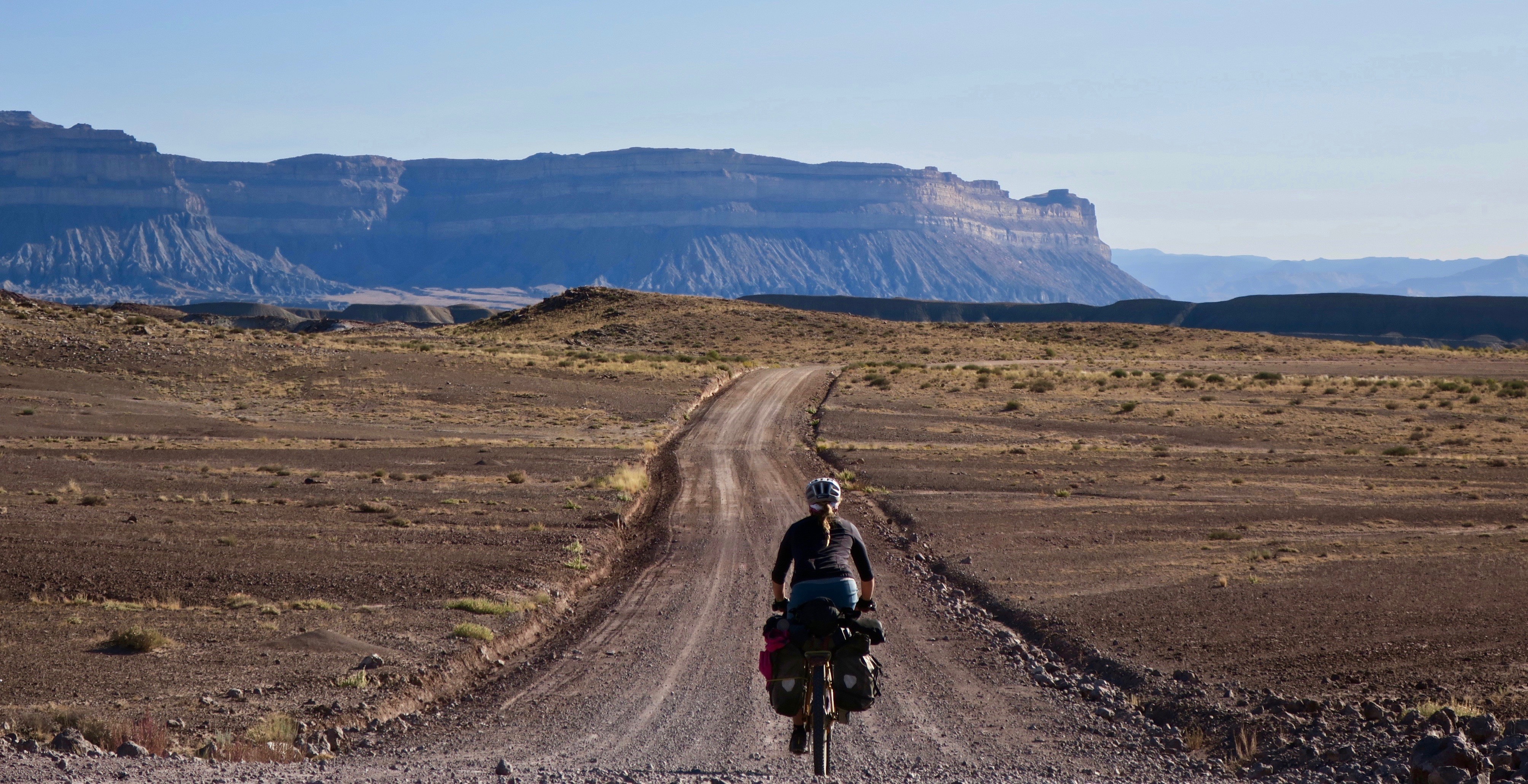

The kingdom of the sagebrush extended its reach as I entered Arizona, final state of the trip. Some miles after leaving Kabab, Utah I turned my tires back onto a new strip of dirt carving its way into another vast and empty landscape. Dry hills sparsely dotted with vegetation drew me into the distance. I came across a lone pickup truck, the only vehicle I saw the rest of day. The nice couple inside offered me water, saying that they came from “over the mountain,” pointing to the hills in the distance where I was headed. The gravel track lead to some steep climbing through Juniper woodlands to the northern end of the Kaibab Plateau.
Descending into the House Rock Valley, I passed by a California Condor release site. There was a retired couple there, both avid birders. They had a telescopic type lens set up and invited me to take a glimpse of a condor perched high on a cliff. I have seen Andean Condors in the past and it was exciting to have another siting of this absolutely massive bird.
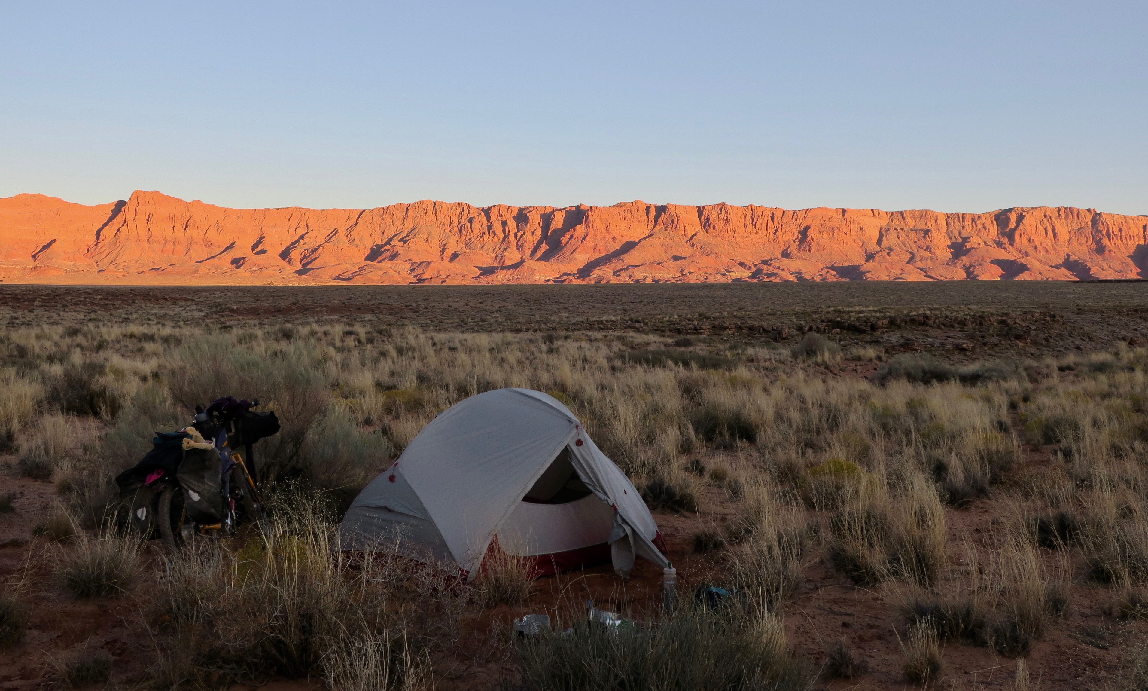
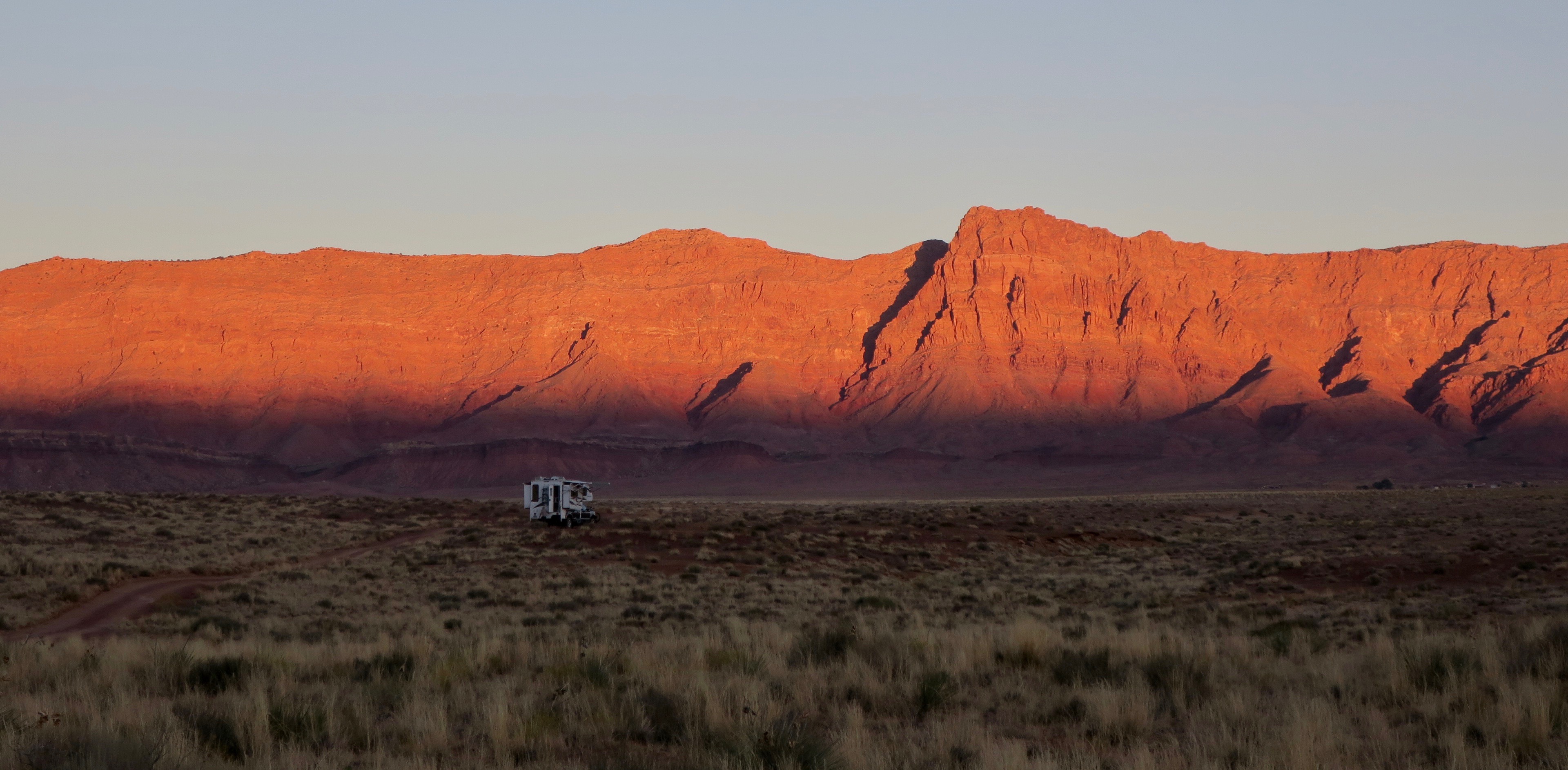
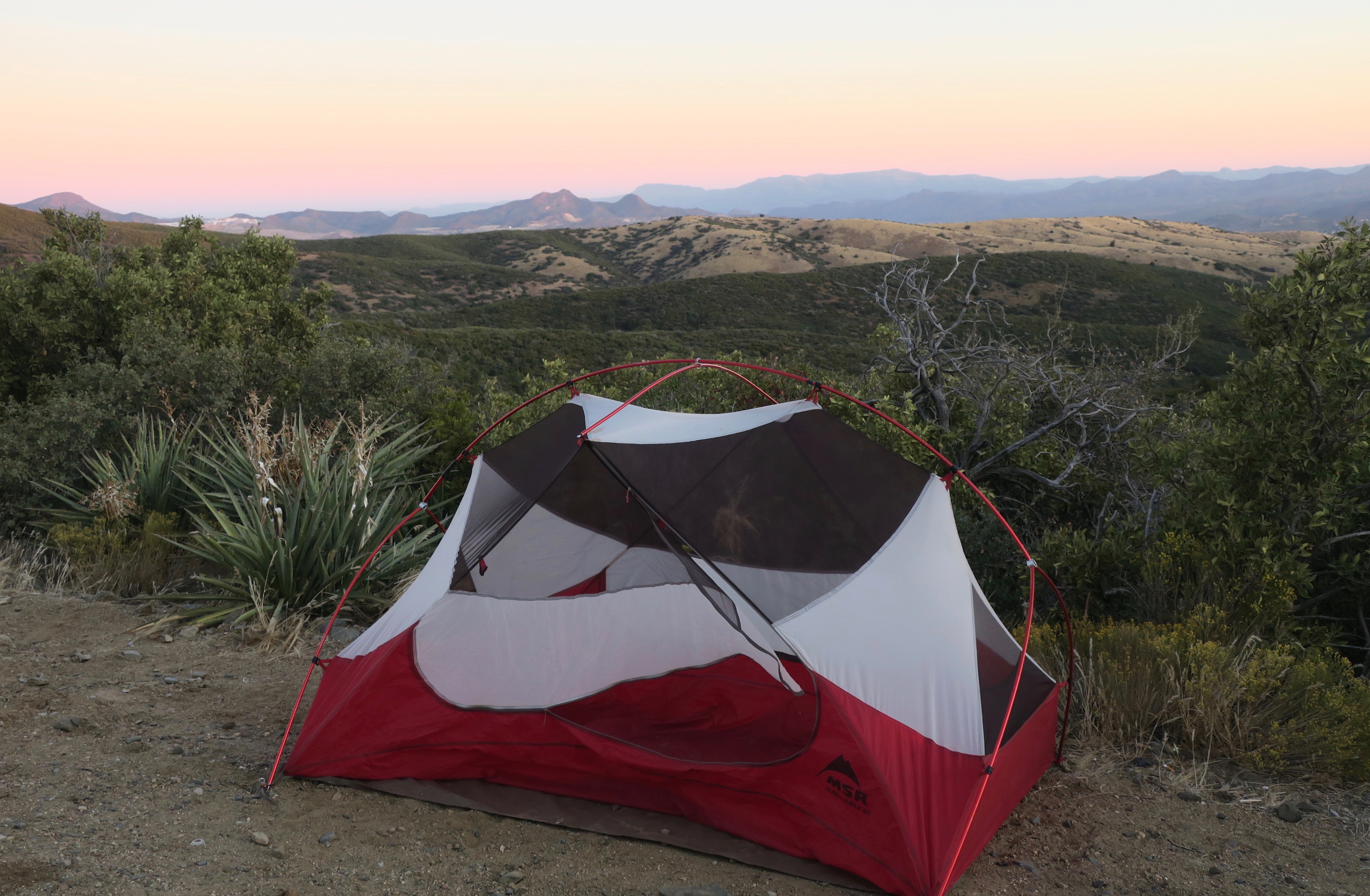
I continued cycling into the shadow of the Vermillion Cliffs – powerful and imposing. I stared at the rocky giants in all of their glory at sunrise the following morning. I emerged from my tent into the cold morning air to see a spectacular projection of colour onto the faces of rock.

Vermillon Cliffs, Arizona at sunrise

Only a few days in and I was already in awe of the landscapes of this state. I was now on a tighter time frame as I had spent more time exploring Utah than planned. I had already cycled for two weeks non-stop and in order to make it to the Mexican border and in time for my November flight home, I basically had to continue almost non-stop for another three weeks. My body was tired, lips sore and blistering from the powerful UV rays. But my enthusiasm to explore was stronger than ever. I would push as hard as my body would allow me to.
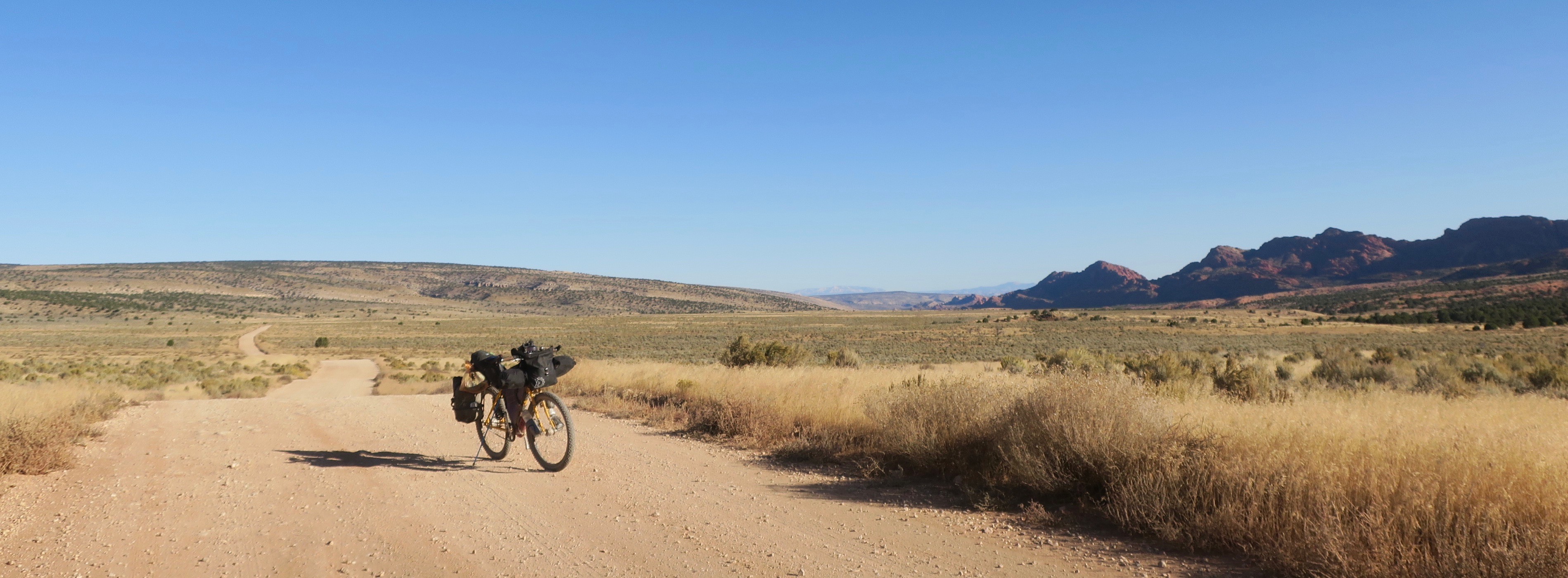
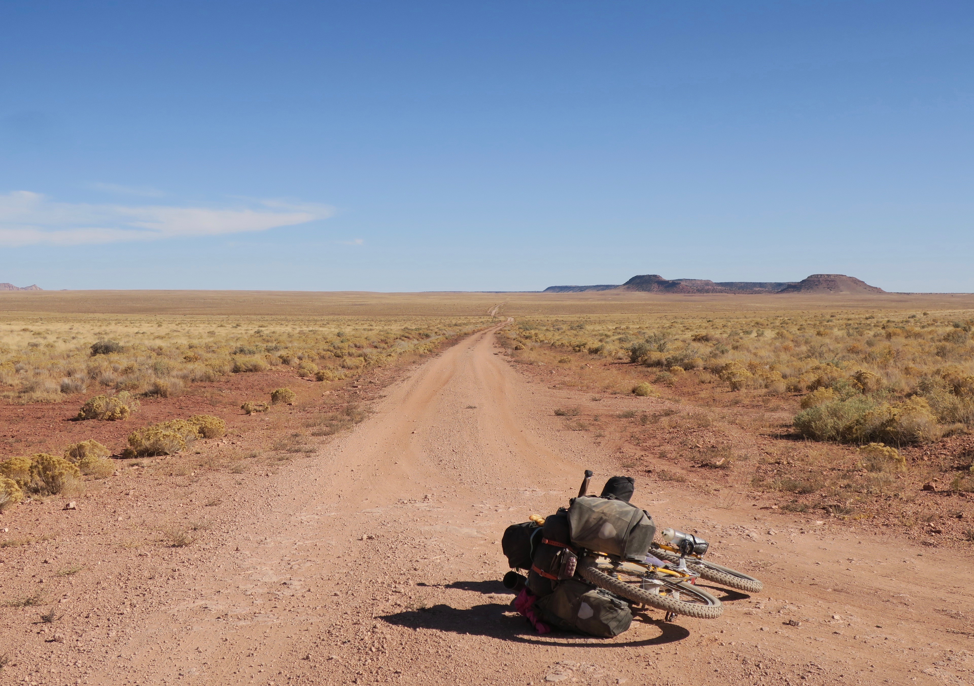
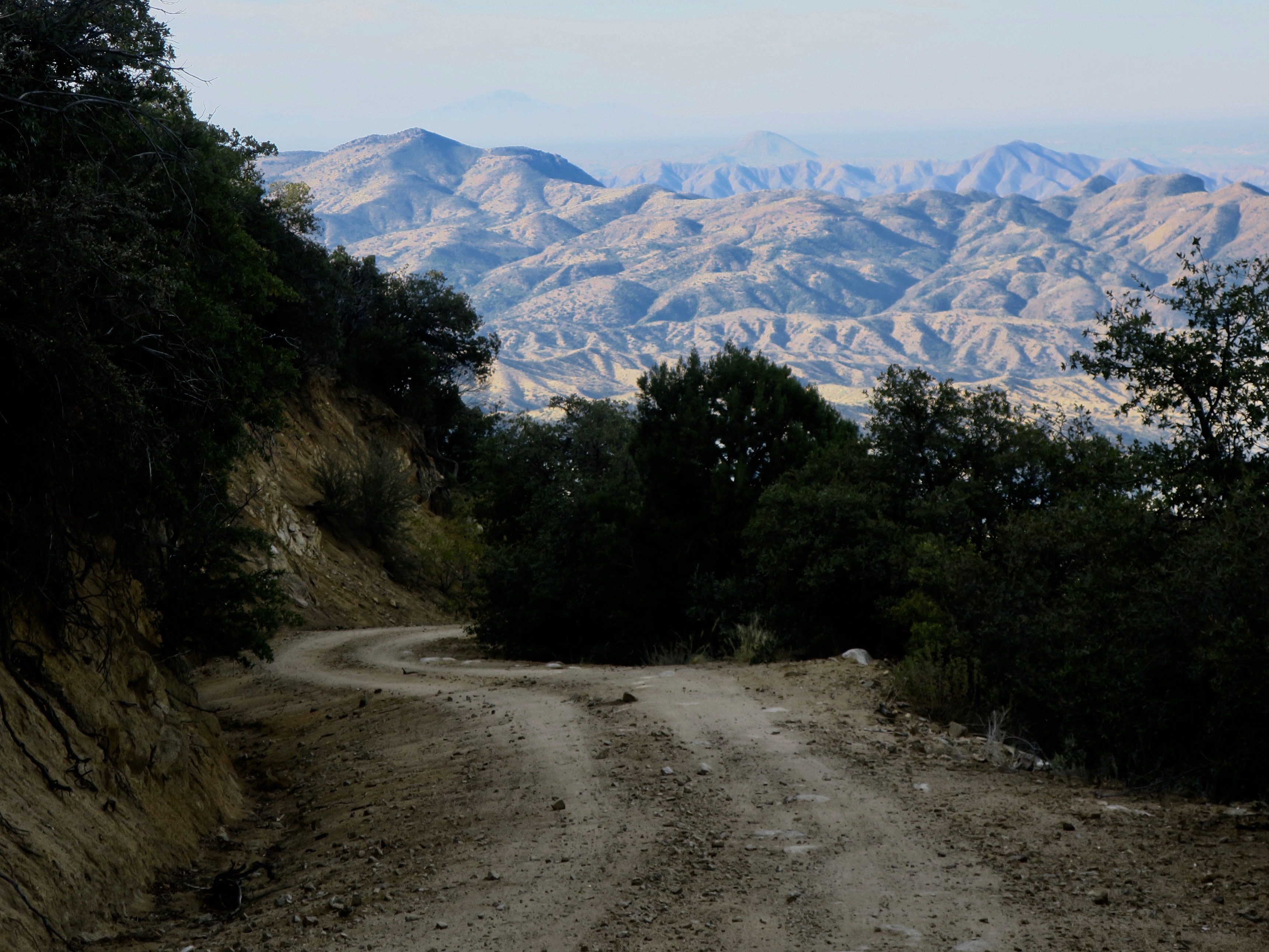
I was now approaching Navajo Nation, one section of the Western Wildlands Route I was really looking forward to. This area is all private land, but Western Wildlands Route riders were granted special access to the land with the purchase of a mandatory backcountry permit. Its conditions involved only cycling the designated GPS route and only camping in certain spots, marked by GPS waypoints. Not long after I left the highway to turn onto the reservation, I was stopped by a woman in a pickup truck, who told me to turn around, insisting that I was trespassing. I politely argued, saying that I had been granted special permission and possessed a permit. It took a while to convince her, but after allowing her to take a photo of my permit, she eventually left. Even though I knew I was 100% allowed to be there, I still felt pretty uncomfortable after the encounter. These thoughts eventually drifted away as I pedalled further away from the highway onto another vast and empty landscape.
Big skies, big landscape on the Navajo Nation, Arizona
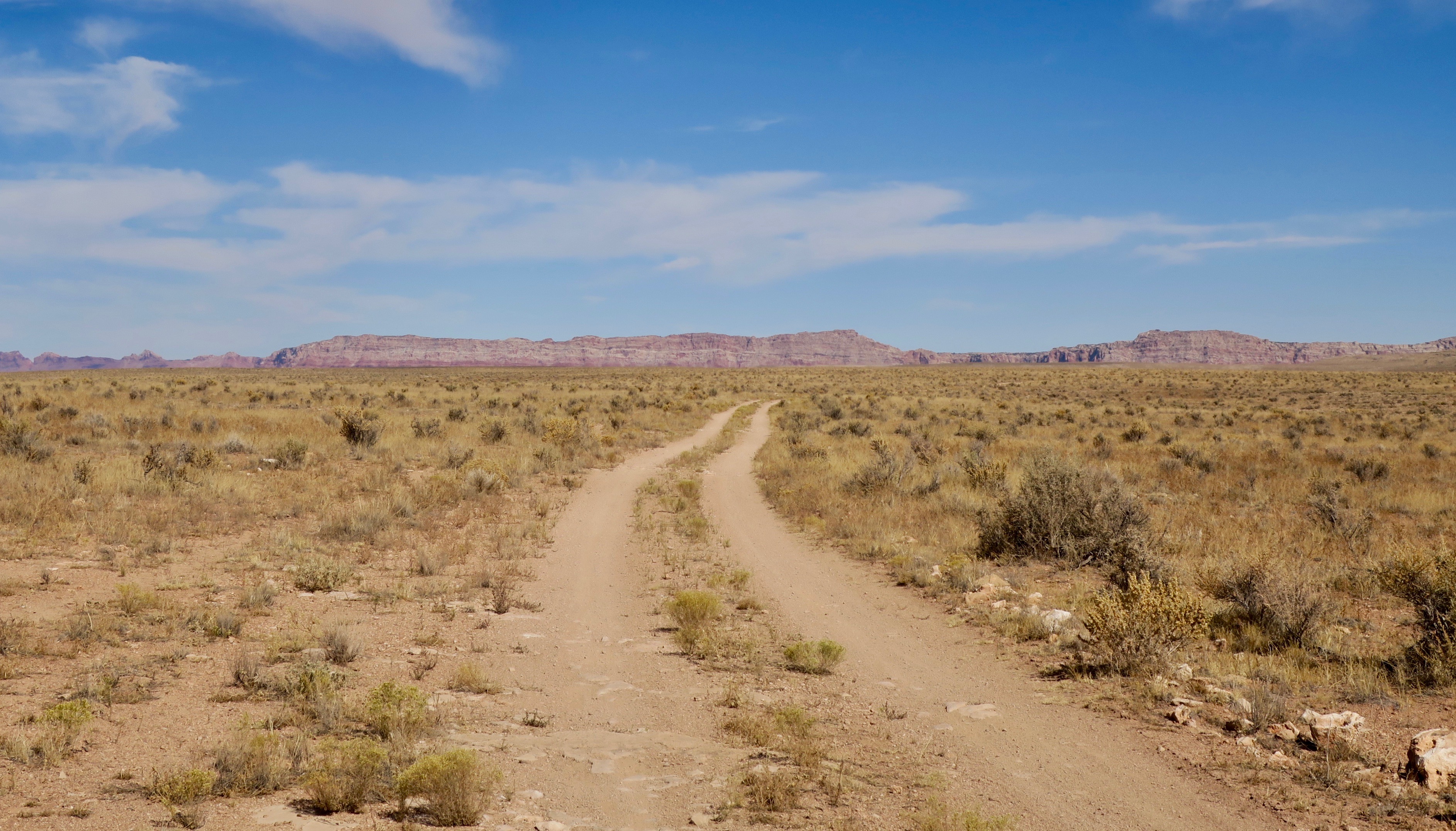
Along meandering dirt tracks and trails, I traversed high rolling grasslands and desert. The odd singular formation of crimson-coloured rock swelled to the surface. While some of the dirt roads were rough and washboarded, others were among the smoothest of the trip. Out in the distance I could see the odd Hogan, the traditional Navajo dwelling. Later, I came across my second vehicle of the day. It was a beater of a pickup truck hauling a large water tank. There were four or more children crammed into the front. I didn’t even see the driver. A young girl closest to the passenger window asked me where I was going. “We’re bringing water to our house!” she said. Then, the truck starting moved again, leaving a horizontal dust tornado behind. I would imagine life out there to be harsh – being in a desert, all water would have to be brought in. I myself was carrying a three day supply on my bike (12.5 litres).
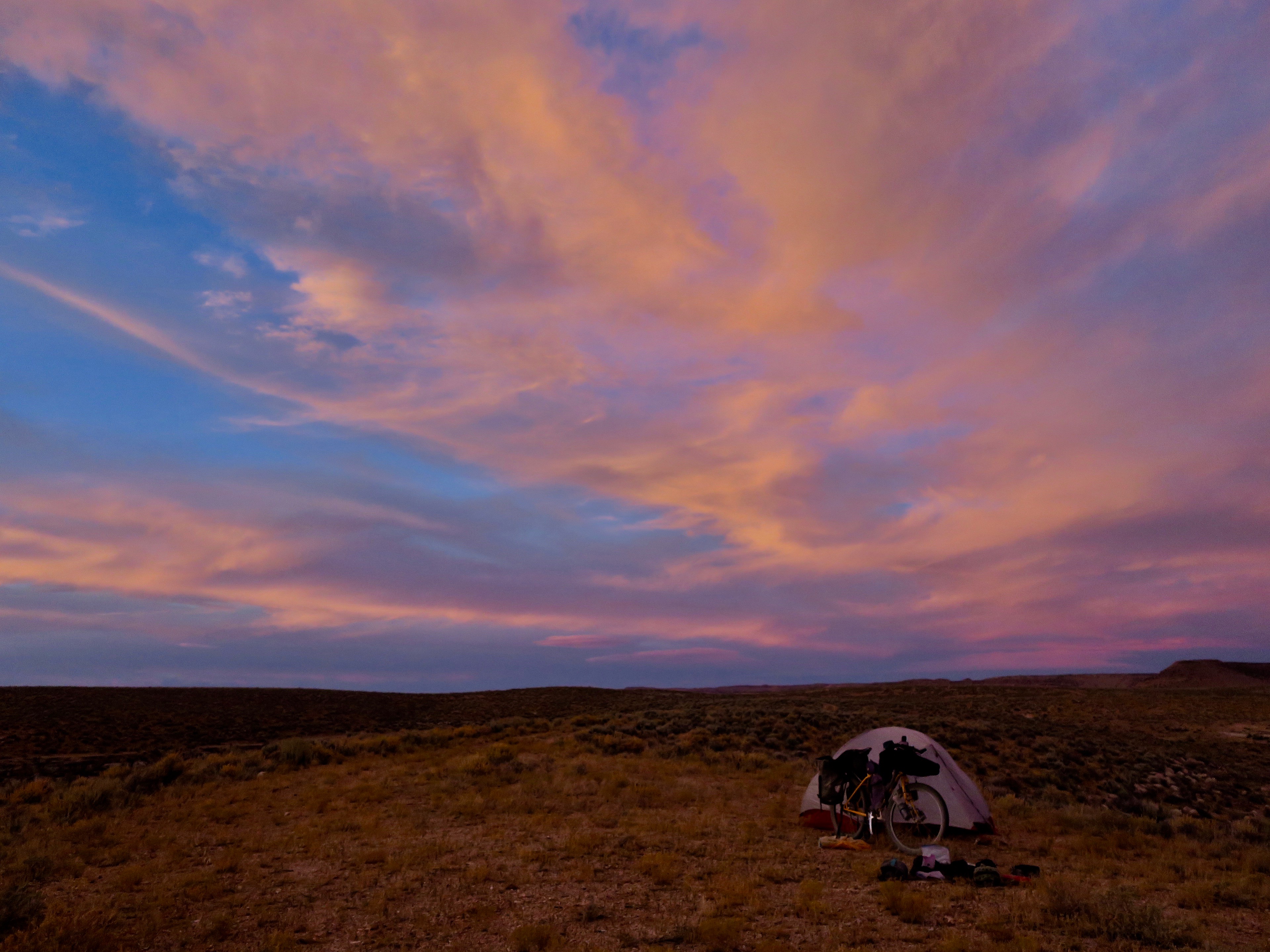
I arrived at one of the designated campsites. It wasn’t developed or signed in any way. It was merely a section of flat ground high up on a rocky, exposed area. The wind was strong and whipped up sparse clouds of dust and tiny rocks. The land empty, largely void of civilization with only one lone hogan to be seen far in the distance.
After I finished setting up my tent, an extraordinary thing happened. The wind died instantly. The sun was beginning to set, casting out streaks of oranges, pinks and purples across a still piercing blue sky. High on that ledge, the fierce colours surrounded me 360 degrees. If I were a religious person, I might say that at that moment, God revealed itself. I felt so incredibly small and all I could see and feel was sky. I also suddenly felt intense loneliness. I wanted someone to be there with me to be able to grasp the power and magnitude of what I was experiencing. Eventually, the blue deepened to navy, then to black and the brilliant colours faded into darkness. It turned into a silent, starless night.

Amazing skies camping. Navajo Nation
The next day, I passed through more parched and desolate landscapes, only coming across one other person on the reservation in a truck. I pedalled past groups of wild horses, who were often spooked by the sight of me. “Quit scaring the horses! “ the friendly man in the pickup laughed. “I’ve seen it happen lots – they don’t seem to like bicycles or motorbikes.” He lived on the reserve and was just returning from a run into town. At the this point I was pretty close to the highway again. The Navajo Nation crossing had been a true highlight of the journey.
The route did its best to avoid busy Highway 89, taking small dirt detours where it could. I got to touristy Cameron and its trading post, where throngs of people flocked en route to the Grand Canyon. It is always a bit of shock to arrive in places like this, especially after the mostly uninhabited Navajo Nation section I had crossed. The only official camping on offer was an RV park across the highway for $15/night with no bathroom or facilities. The desk clerk at the hotel said that I could camp behind the gas station for free, which was the overflow area for RVs. I set up my tent on a small dirt patch in the parking lot. I pulled out my earplugs I had purchased for my first gas station camp out at Soldier Summit, Utah. I eventually fell asleep; the nocturnal diesel hymns of the highway fading away into dreams.
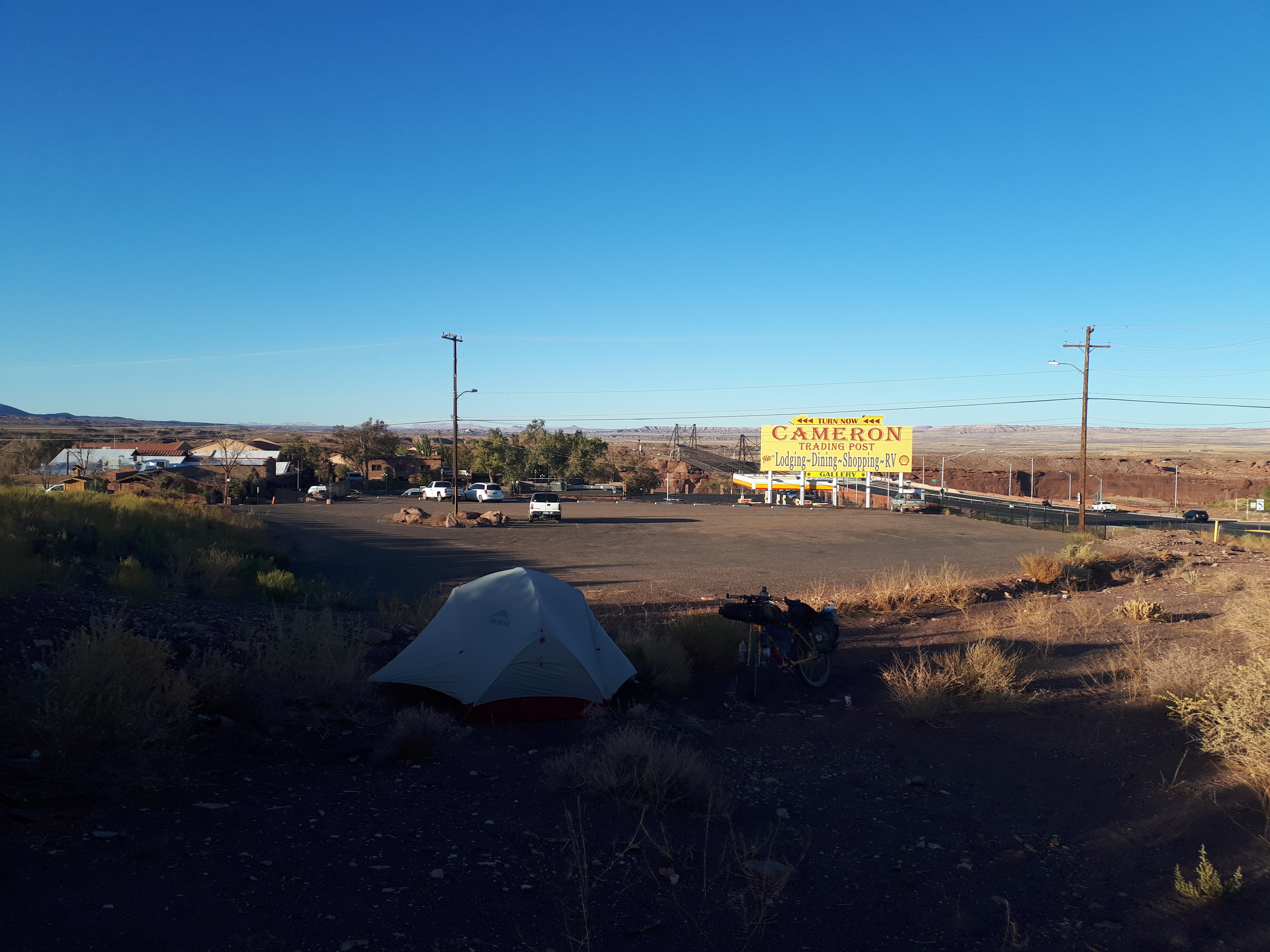
Gas station campout #2 – Cameron, Arizona
After a breakfast of instant noodles, I headed towards the Grand Canyon. The route passed through Little Colorado River Tribal Park, amongst smaller canyons and gorges. I followed old rail grades, eventually getting to a gate across the highway with the sign: ROAD CLOSED. There was a gap just large enough to squeeze a bicycle through. This led to an old tarmac road with faded yellow lines and large cracks through its surface. Nature had begun to reclaim it, with greenery forcing its way through the openings and into the light. It felt eerie and post-apocalyptic.

Abandoned old highway en route to the Grand Canyon
I climbed most of the day, eventually reaching the Grand Canyon. It was certainly an impressive sight, but I will admit that I wasn’t overwhelmed the way I was with Bryce Canyon. Perhaps this was because of how intangible the size of it was from my viewpoint. At 277 miles/446km in length and a average of 1 miles/1.6km in depth, I almost think the best way to experience it would be a flight or a hike down into the canyon. The view was still fantastic. I enjoyed watching a few crows using the drafts to coast back and forth effortlessly along the edges.
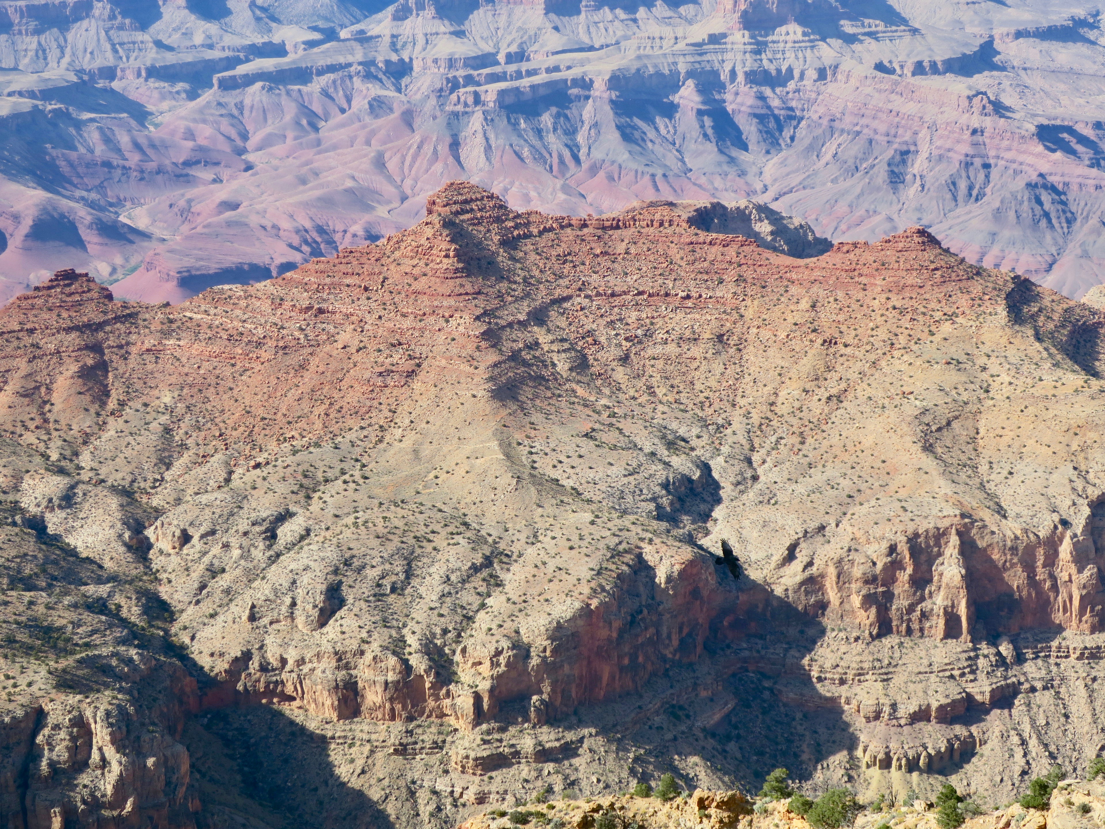
Crow coasting in the Grand Canyon

Grand Canyon at Desert View Overlook
It was starting to get late and I needed to be clear of the park boundary in order to be able to wild camp. It was another chilly evening. I eventually turned off the main paved road onto a pretty gravel road through Ponderosa pines. Like the sagebrush, this tree had become a familiar companion all the way from Montana.

Yikes! Leaving the Grand Canyon..
Wild camping in these parts was very easy, like the rest of the route. Basically, I could just pull off of the dirt road whenever I felt like it. I passed the odd RV’er doing the same, but for the most part I was alone with the pines.
I woke up the following morning feeling very tired. I had been riding for weeks straight and I was starting to feel it. I was ambitious, however and wanted to get to the border in time before my flight. For me, the A to B mode of travelling isn’t usually a motivator, it is about the places I pass through. But, for some reason, I just really wanted to get to the end – to finish the Wild West Route. I had been so focused on being present during the trip – not using social media and only updating friends and family. I wasn’t even listening to music. On that morning I decided to listed to a song by Fleet Foxes, “Mykonos.” I was so moved by his voice that I started to cry. It was a brief moment of reconnection to the power of music. I was ready to keep going.


The mellow riding through the pines stretched on a bit longer – a tunnel of green illuminated by the sun’s rays that brought little warmth, only enhancing the colour. The road turned into rocky double track on the Arizona trail that was probably more suited to a mountain bike. Eventually, it smoothed out into pleasant single track.

The nicer section of the Arizona Trail on the WWR

Leaving the Arizona Trail, I pedalled Lockett Meadow road, golden aspen lining the hillsides. At the entrance to the road was a map outlining the areas for fall colour spotting. It was obviously the thing to do around here, because it immediately went from zero traffic to car after car on a steep climb. I had an amazing view of the green San Francisco peaks. One doesn’t often think of Arizona as being “mountainous”. I was already very impressed by the diversity of the landscape in this state alone.

San Francisco Peaks near Flagstaff, AZ
After pushing my bike uphill along a rough and rocky trail, I came across a guy and girl hiking at the summit. They were mellow in nature and never stopped smiling. The two were from Flagstaff. They gifted me some sun block with zinc in it for my lips when I talked about my ongoing issue with sun exposure. I joked that I must look “road weary.” The guy said, “yes, you look feral, but in the best way.”
It was an amazing descent on the Schultz Pass/Waterline Road and into Flagstaff. Beautiful, but cold. There were green mountains in the distance fringed by acres of charred forest. I decided that I would take a half day off Flagstaff, with a Warm Showers host. I really liked the feel of the little college town and wish I had more time to hang out there in its cosy coffee shops.
It was late October and winter was fast approaching in the area, which meant a possibility of snow in the near future. I had a particularly cold and windy night camping in more pine forest at a higher elevation about the town. Luckily, no snow.
The next day I biked some ridiculously rough roads. The first was a series of rocky ATV trails, where I spent a good amount of time walking, even downhill. I played hopscotch with a couple of hunters in a side-by-side who would stop every now and then. Eventually we met up and they stopped to chat.
“Don’t you ever take a break?” they said.
They two men were out elk hunting and they told me that they were impressed by my bravery. They were also surprised that I wasn’t carrying a gun myself. In general, people in Arizona seemed a little more paranoid about personal safety. The guys were very friendly as I had experienced with most ATV riders on the trip. They just wanted to make sure the crazy cyclist on her own was surviving out in the wild.
After leaving the densely forested ATV trails, I followed the signs to Schnebly Hill Road. It was here that I got my first glimpse of the spectacular pink cliffs of Sedona.
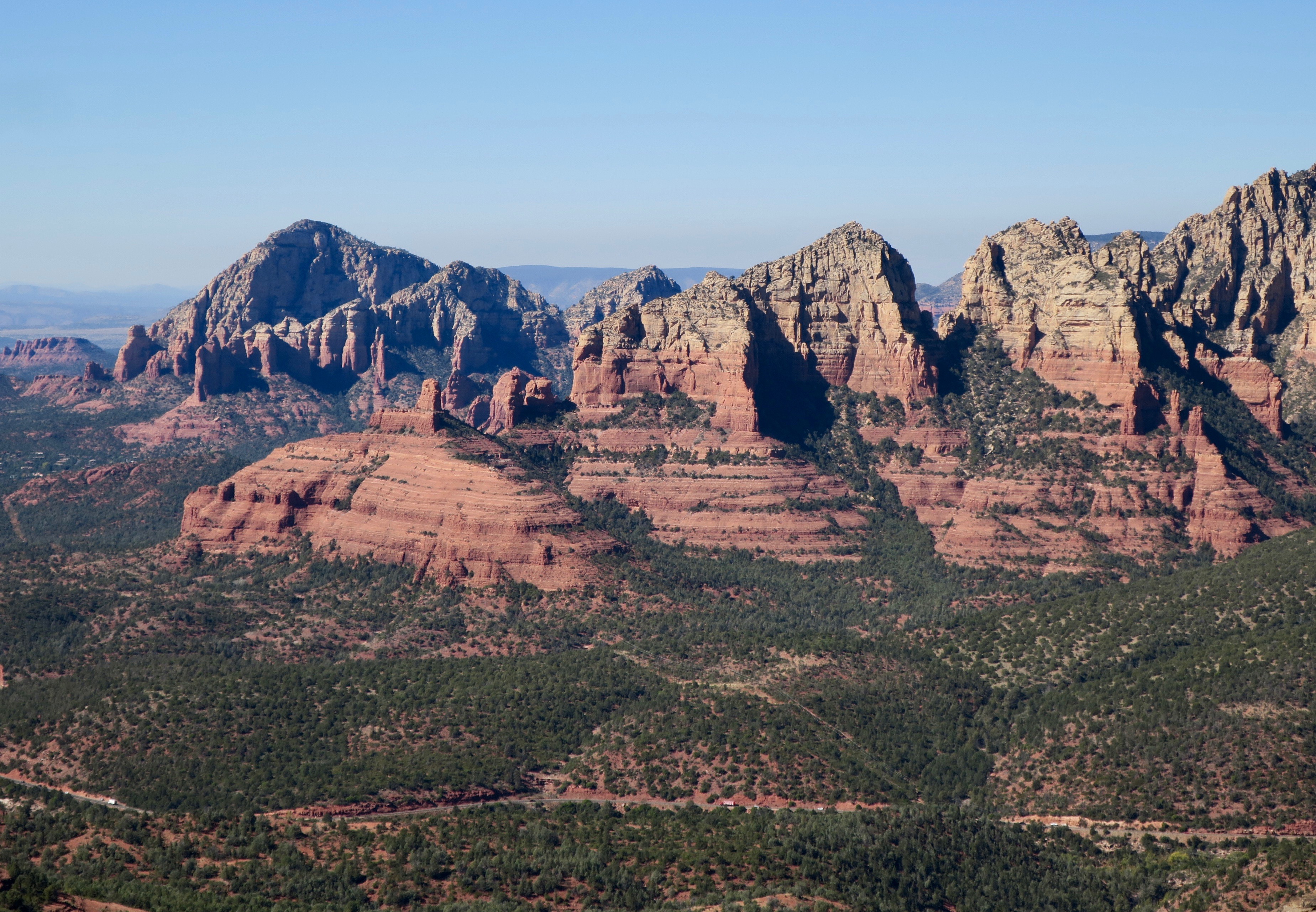
Pink cliffs of Sedona, Arizona

At the summit, the view was incredible. This was the only thing that made the hilariously bad 8km decent on Schnebly Hill somewhat bearable. Without exaggerating, it was probably one of the roughest, rockiest descents I’ve ever done. I think I averaged about 5-6km per hour going downhill. My hands hurt from braking so much and I had to stop often to rest them. Tourists on excursions in pink mini jeeps laughed as they bounced around on the ridiculous surface. If the view wasn’t so spectacular I probably would have complained to the Wild West Route creators!
The town of Sedona itself seemed overly glossy, full of souvenir shops and jewelry stores. I bought an overpriced coffee and pumpkin bread, filled up on water and left. I followed some scenic mountain bike trails that paralleled the highway. From here the landscape began to change again as I dropped lower in elevation. The gangly ocotillo desert plant became a more common sight.

After the ridiculously rough Schnebly Hill Road, I wasn’t too keen when I saw the marked waypoint “very rough road” ahead on my GPS. It must really be rough, I thought if nothing was mentioned about Schnebly hill. Not keen, I turned left instead of right following a dirt road in good condition uphill to the quiet HWY 3. This led to a bit more pavement riding, but I think it was the better option. Not just dirt for the sake of dirt.

Rim Road, Arizona
After a brief stint on paved road, I climbed up to the Rim Road, almost like a mellower version of the Magruder Corridor in Idaho. It was there I met Belgian cyclist couple Daan and Griet. They were on a honeymoon multi month bike trip. They had started riding the Great Divide route, but switched to the Wild West Route in Utah due to late season foul weather. It was great to ride with them. We all complained about Sedona’s rough Schnebly Hill Rd. and talked almost non-stop throughout the day. We enjoyed some beers together, camping in the bush at night. Unfortunately, Griet woke up at around 3am in severe pain. We were in the middle of nowhere, about 40km from the tiny community of Young, with barely any cell service. We managed to flag down a passing truck in the dark. It took some convincing, but the man agreed to take them to find help. They ended up leaving their bikes and camp behind. I heard weeks later from Daan via email. It turns out Griet had an ovarian cyst that ruptured. Luckily, she was treated in hospital and they were covered by insurance.
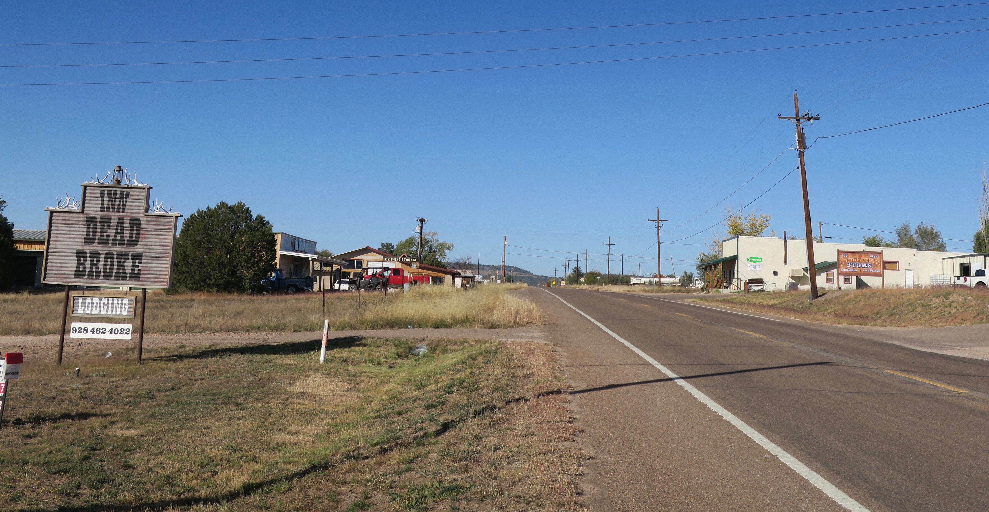
The very rural community of Young, AZ
Young was probably the most rural community on the route. It had two small hotels, a small shop, gas station and a few other closed businesses. This would be the definition of a “one horse” town. The shop was run by a pretty blonde woman. The older, weathered-looking local residents buzzed around her like flies. I guess this was the place pass the time – people seemed to have plenty of it in this town.
I chatted with the friendly lady for a bit. She had heard about the Wild West Route because she had met a few of the cyclists who were scouting it the previous year. She said I was probably the third or fourth cyclist to have come through this year.
Into the hills about Young, Arizona
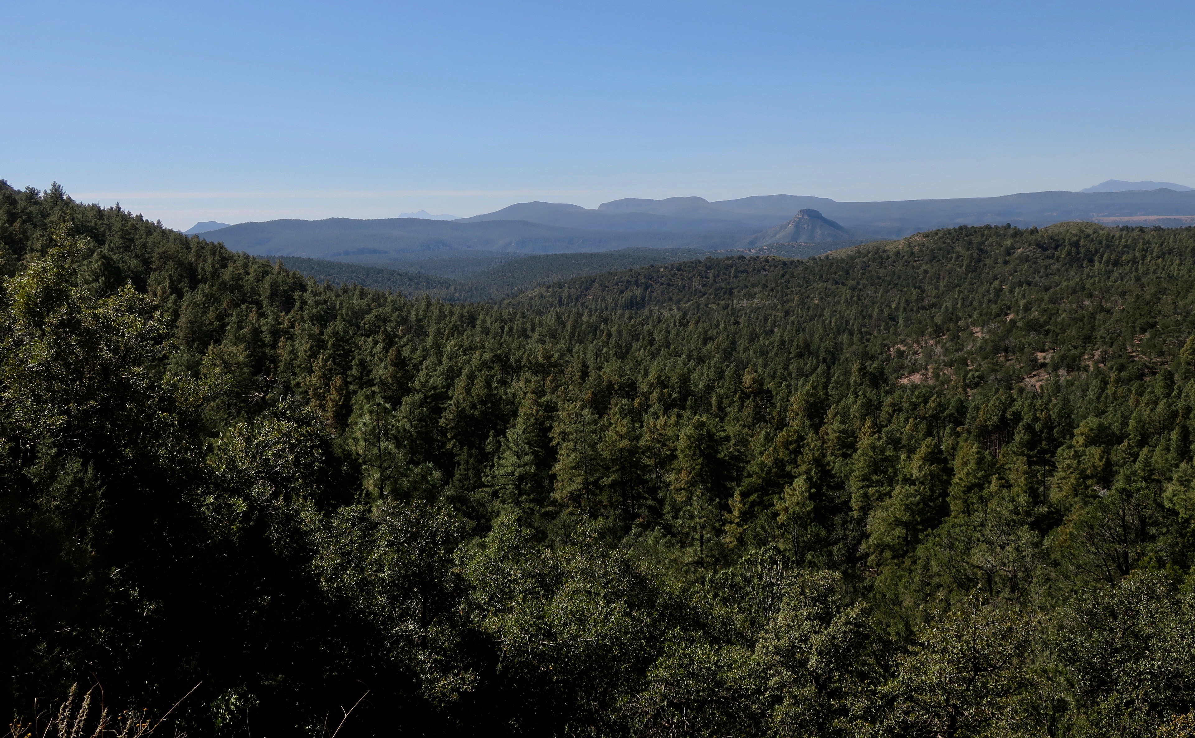
Leaving Young, I climbed again high above large swaths of confers and rolling hills. This section to Globe was another great highlight of the journey. The WWR route memo describes a decent to the Salt River and “into the realm of the Sagauro cactus.” That was enough to get me excited. I absolutely love cacti. After a seemingly endless climbing through more pine forests, the road started to descend into a desert wonderland. I marvelled at all the strange and wonderful plants of the Sonoran desert.
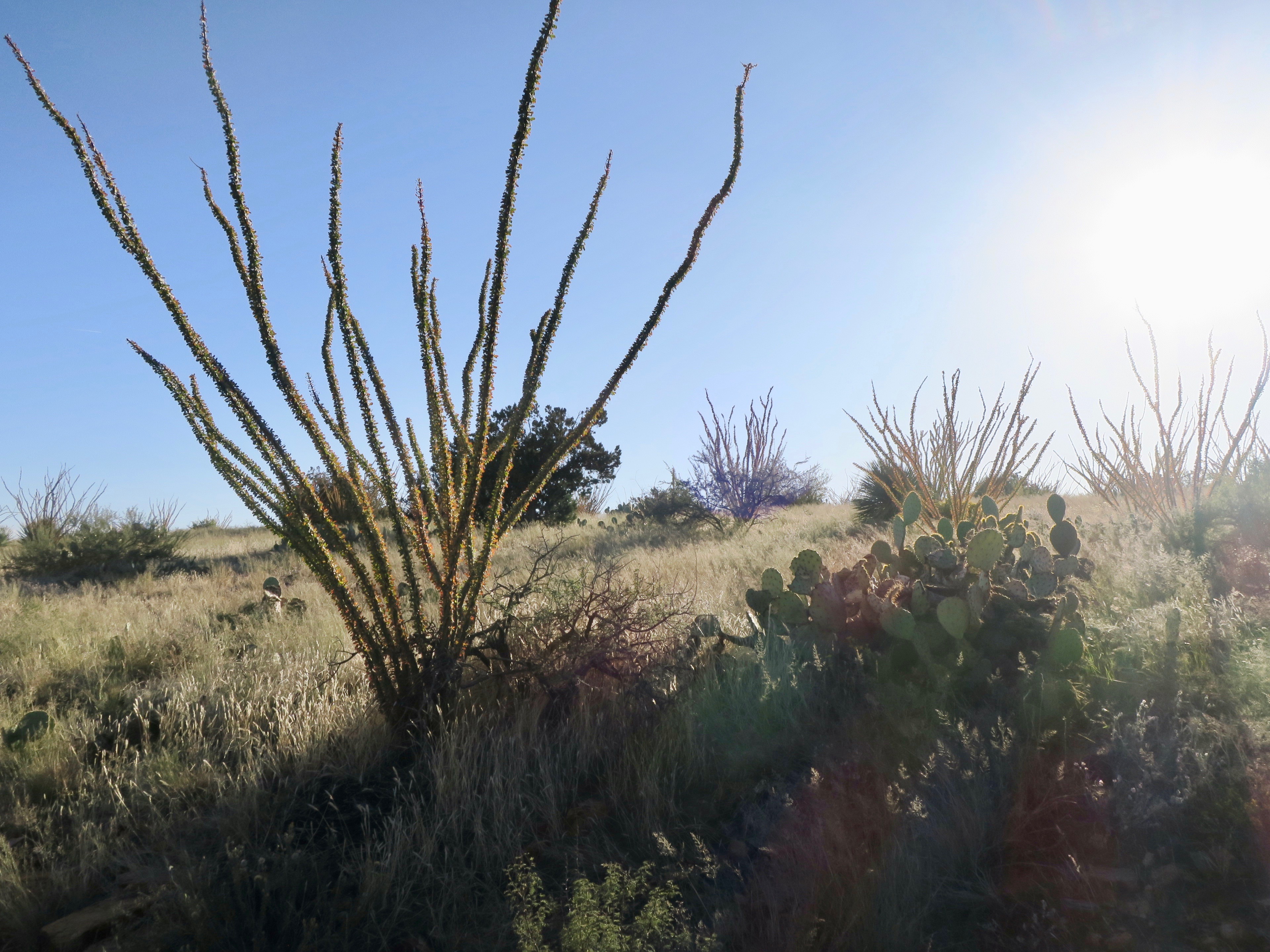
Octotillo plant
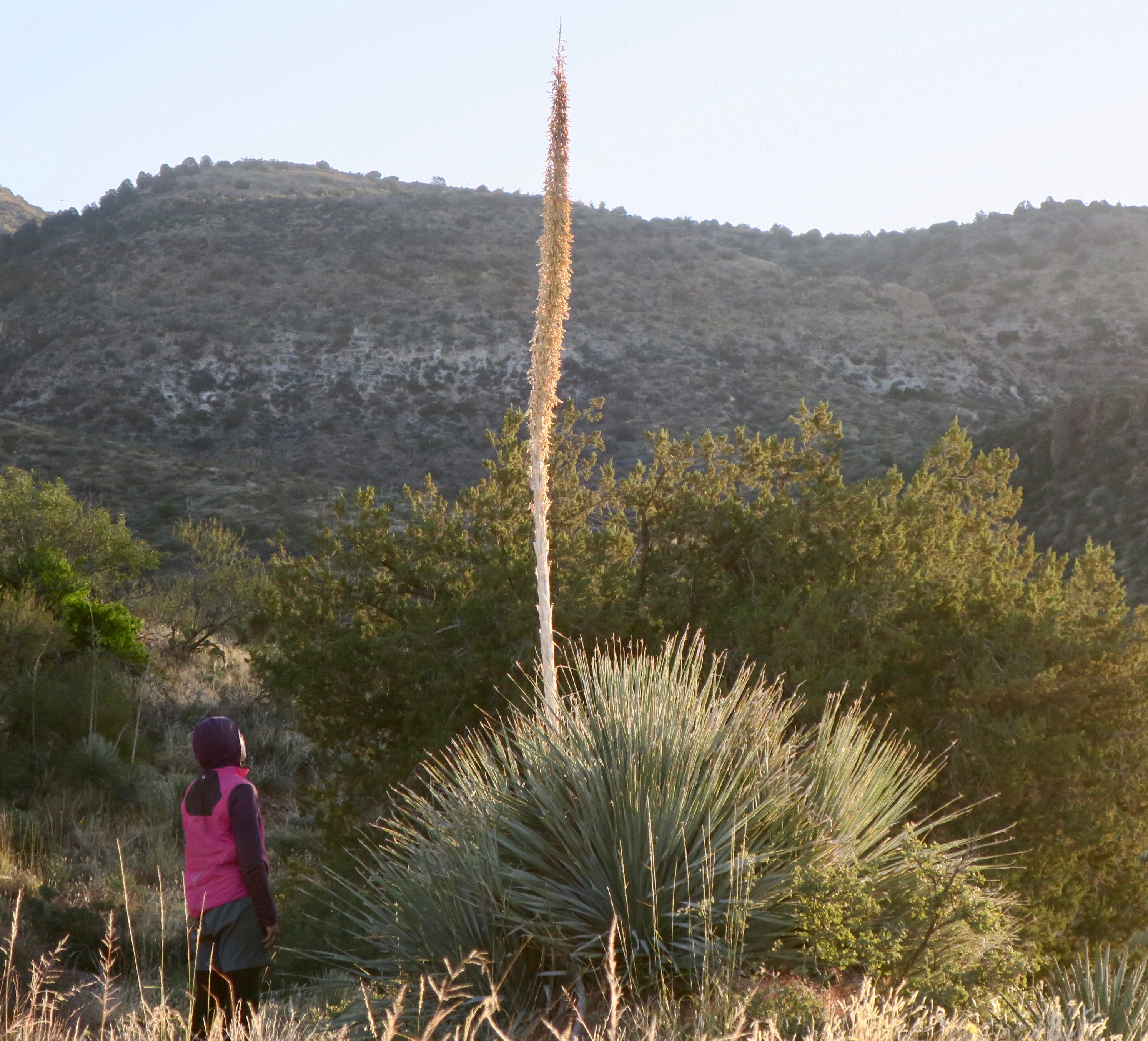
Agave plant, I believe
 Then, the cacti started to appear – first as a sprinkle on the landscape, then an entire valley full of it. Against the sharp blue of the Salt River, it was an unforgettable sight. I couldn’t stop taking photos and make very slow progress downhill. I couldn’t believe how massive the Saguaros were!
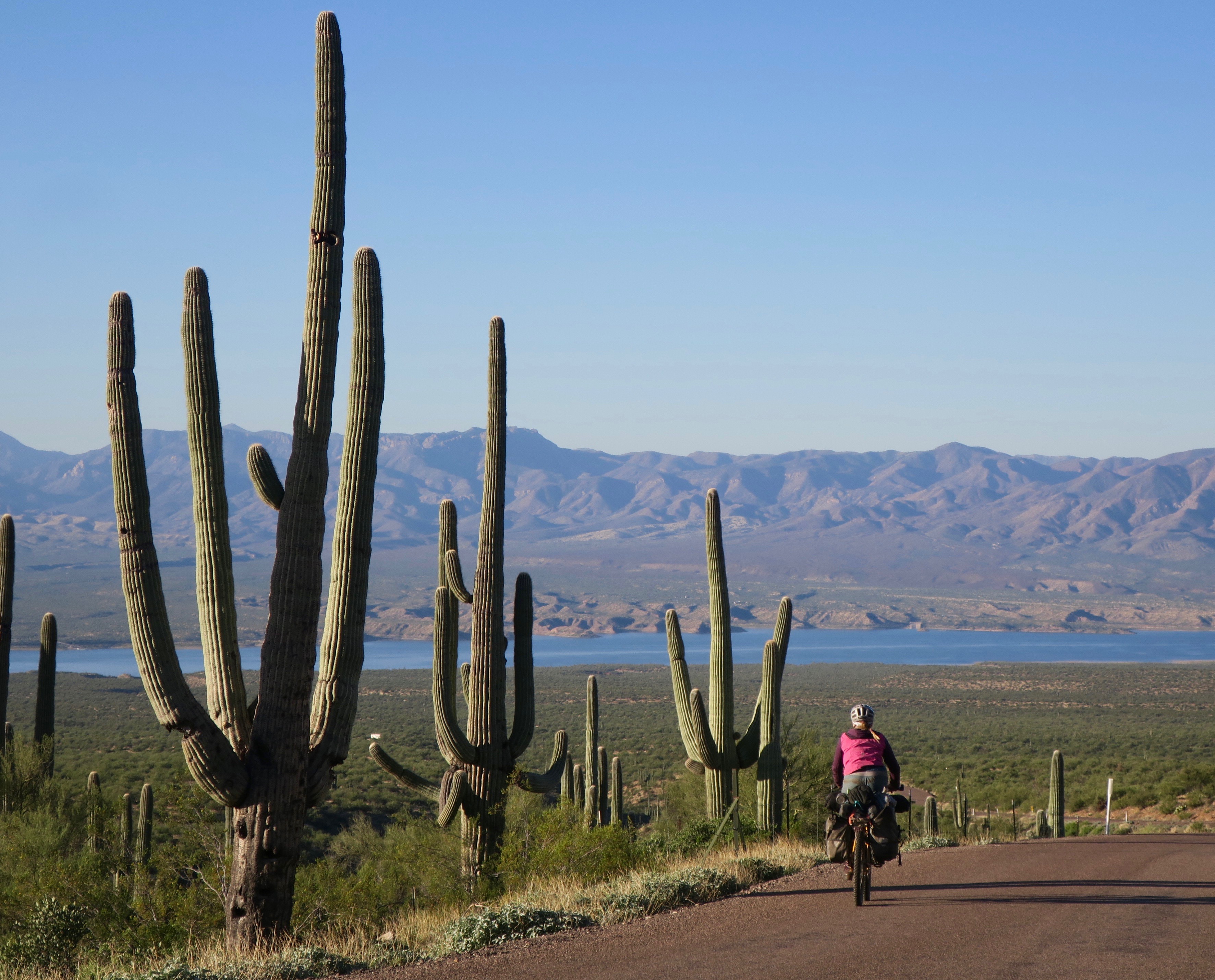
Riding amongst giant saguaros. Globe-Young “highway”
On the descent to the Salt River (not actually salty)

View to the Salt River near Globe, Arizona

In Globe, I made my customary gas station stop for a drink and snack and washed my second pair of shorts in the bathroom sink. I was adamant about wearing clean shorts – not as much about everything else. I sat outside on the curb, messing around on the internet. As usual, friendly Americans came to talk to me, to ask about my journey and to give me praise.
I climbed out of Globe and into the Pinal mountains a little too late in the day. About half way up to the summit, I completely burned out and had to desire to continue climbing. Unfortunately, there was little in the way of good camping spots. It was steep everywhere. I came across a decently wide pullout on the side of the dirt road. It was less than ideal with no cover whatsoever and I was only about 50m from the actual road. Too tired to care, I decided to set up. My lazy decision making didn’t work in my favour and I was in for a sleepless night.
Worst night camping ever, but a nice view…
Only a few cars had passed in the time since I had set up camp. I stiffened each time I heard wheels crunching on gravel, my tent illuminating as they approached. I breathed a sign of relief each time they passed without stopping.
It was around 9pm and on the other side of my paper thin tent wall, I heard a terrifying sound.
It was a hoarse, low-pitched growling sound. It almost sounded like a human imitating a wild cat – like a devious child trying to scare a friend. I froze in fear and a wave of heat rushed over me. I used my instincts as Canadian bush worker and immediately yelled out “hey-oh! Hey oh!” to try and scare off whatever seemed to be only a few feet away from my tent. I threw a rock outside that I had used to hold town my tent. I heard nothing. I didn’t moved for about an hour, senses heightened. Eventually I had to pee so badly that I made myself go outside, large rock in hand. I slowed rotated 360 degrees, leading with the light of my headlamp. Nothing. I did what I had to do and quickly zipped myself back inside. I am assuming I had heard a puma, but I really wasn’t sure. Around 11pm, the 4th vehicle of the night drove by, but this time it slowed to a stop. I heard a guy’s voice say “hey!” before they sped off. This only added to my anxiety. It was one of the most nerve-racking nights of wild camping I can remember.
Sleep deprived, I got up before sunrise the next morning to pack up and continue the climb. I couldn’t get away from that spot fast enough.

Pinal Mountains, Arizona
 It was a cold and beautiful climb. I loved the dramatic wrinkles and folds of the Pinal range that spread out like waves in all directions. After a rough descent, I pushed my bike through an old creek bed, eventually coming to a fenced area. It was some sort of government facility, according to the sign and there were (wild?) boars running around. I wasn’t aware that they existed in this part of the world.
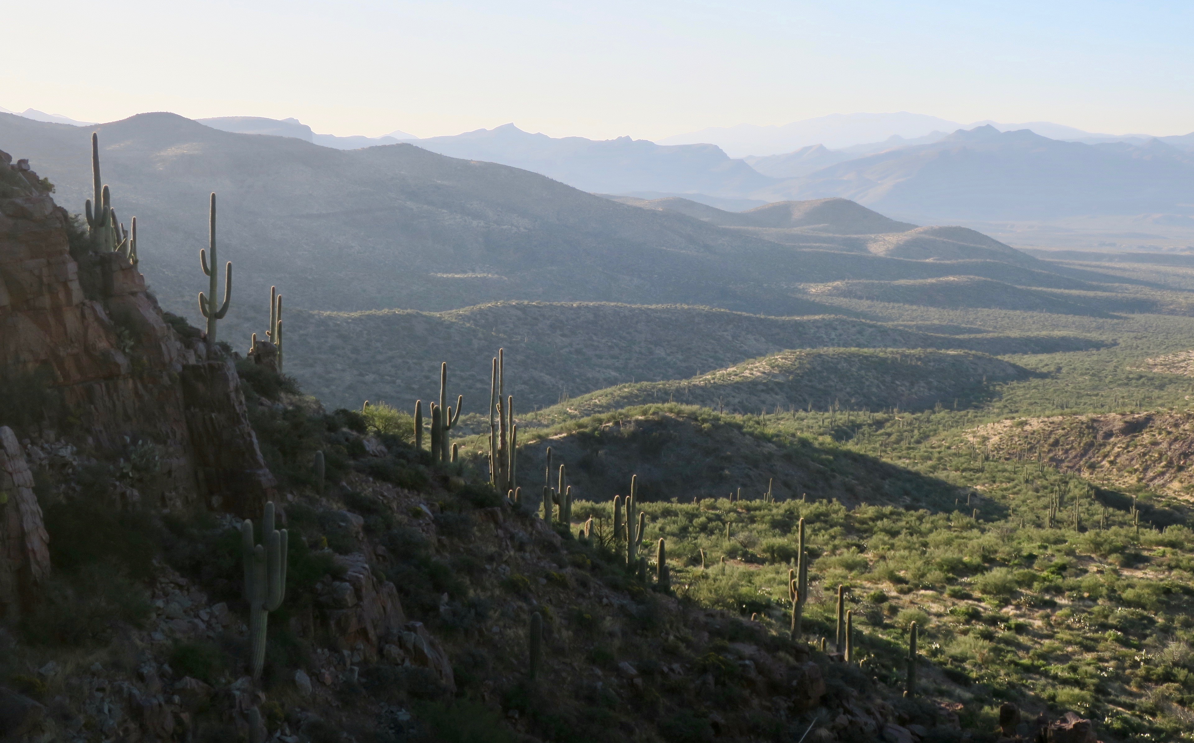
The dirt roads continued through more awesome desert landscape, covered in Saguaro cacti, the gangly ocotillo and Dr. Seuss-like agave plants. I think I already loved Arizona almost as much as I loved Utah.

 I stopped in the unexciting town of Winkleman for a gas station feast, where I often spent too much money. Constantly hungry, it was hard to resist pizza, burritoes and ice cream – all at once! After Winkleman I passed Oracle, home of Biosphere 2. If I had time, I would have paid a visit. Unfortunately, I also had to take the shortcut to San Manuel, cutting out the climb to Mt. Lemmon.
I continued downhill through a wonderland of Saguaro cacti on a paved road before re-connecting with sand and washboard to Benson, another uninspiring town of chain stores and restaurants. I stayed at the Red Barn campground just off of the highway. Its facilities were in a great state of disrepair, much like its aging owner. The man seemed overly paranoid in general and only reacted to my exploits with overt concern “there’s a lot of weirdos out there, can’t trust no one these days.” I seemed to encounter this attitude much more often in Arizona compared to the other states I had passed through.
I set up my tent on the gravel platform under a wooden shelter. I would say that the campsite at $26/USD was overpriced if it weren’t for the entertainment I would receive that evening.
I was cooking my usual pasta and tuna concoction on a park bench, when a pick up pull in front of the campsite. An older man stepped out. He said that he was the owner’s assistant and had heard about a woman travelling alone on a bicycle. “I thought,” he said “I just have to go and talk to her! Do mind? Am I interrupting your dinner?”
“Not not at all!” I said. He also brought over a six pack of beer to share with me.
I talked a bit about my trip and the places I had passed through. We also got into a conversation about a life outdoors in general – him working on a ranch with horses and me in the forests of Canada. It was pleasant and interesting, until it suddenly took a bizarre turn. “Yes, I love being out in the land, because here, in America, we are the country under God.”
Oh boy, I thought.

Sadly, there were a few of these around in Arizona
Then, he went off on a tangent about the evil democrats and how Christianity saved the Native Americans (saved??). I have never been a good debater by nature and just awkwardly listened to him rant. Eventually, the religious propaganda died down and the topic switched to my personal safety. Suddenly he was like a concerned father. He said that he worried about me being out on my own. I had told him my wildcat camping story and he worried about illegal immigrants. He reached into his pocket and pulled out his wallet, taking out a $20 bill.
“Here,” he said, “I just got paid today. Now go and pull yourself some protection – pepper spray or something, I am not sure exactly what it costs.”
I insisted that I would be fine and initially politely rejected his offer, but I eventually gave in.
I will selfishly admit that I never bought that pepper spray.
Next stop on the road was the touristy Tombstone. It was set up like a wild west movie set for tourists, complete with horse drawn carriages and Wyatt Erp type duels scheduled on chalkboards outside of “saloons”. I randomly found an Italian cafe, more interested in the meatball parmesan and gigantic cinnamon buns. I only had one night left of camping on the route. It was crazy to think that it would all soon be over, but I was tired, sunburnt and sore. I was ready.

San Pedro Riparian Conservation Area
The road from Tombstone led to San Pedro Riparian Conservation area. It was a completely different landscape – grass, scrub and the odd deciduous tree. Maybe it was the nonsense rambling of the man from Benson that made me feel a bit uneasy so close to the Mexican border. I was also slightly less comfortable wild camping after that experience in the Pinal mountains.

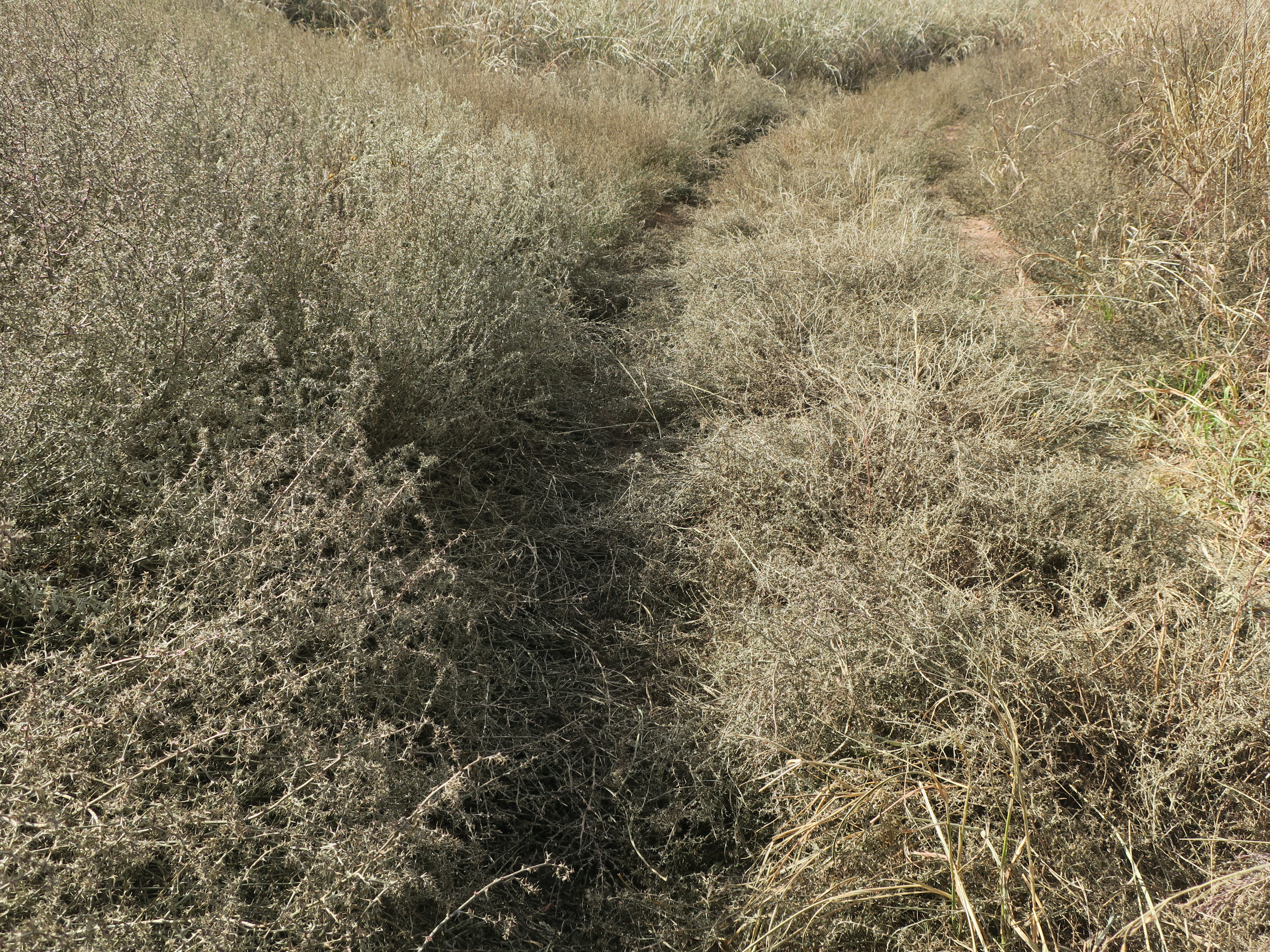
Thorns galore in this part of the world
Much of the San Pedro trail was overgrown with thick grass and thorn bush. I felt very lucky to have gotten this far without a puncture and I was almost sure I would get one on this stretch.

The overgrown San Pedro Trail
The last 800m of the route, overgrown with thorns..
The last half mile/800m or so to the Mexican border wall and the Southern terminus of the Wild West route was just silly. The trail was completely overgrown with thorns. I almost didn’t go, because I could see the end, the fence just fine from where I was. But, I guess the Instagram type mentality took over.
No, I need a photo of the finish at the fence.
Really, who gives a shit, I thought. It’s close enough, it’s just a damn fence.
I ended up scratching my legs up and I got that stupid photo.

The end!

Mexican border fence, Wild West Route Southern Terminus
Of course, ending at a border fence does seem anti-climatic. But that was it, it was done. I made it and with zero flat tires! Now it was time to backtrack 45km to the town of Sierra Vista, where I would be picked up by a friend and taken to Phoenix and then fly home.
Thoughts on the Western Wildlands Route (for interested cyclists)
There is a ton of information in the PDF download available from the Bikepacking Roots website for the route (I may be repeating some of it here). I highly recommend it and also the app for navigation and many useful points of interest. I used my Garmin GPS as a principle source of navigation and my phone as back-up. This is the first tour where I have hardly had to do any planning. Everything was mapped out ahead of me and indicated also where to get food, water, potentially camp and places of interest. Loved it!
Overall route/scenery
I really, really enjoyed this ride. With the combination of people and scenery, it was one of the best trips I’ve ever done. For me, some of the scenic highlights were:
-all of the Great Divide, Canada section (not the WWR, but I have to mention it because it was that great!)
-quiet doubletrack in Purcell Mountains, Montana
-Hiawatha Rail Trail, Idaho
-Hoodoo Pass and into Clearwater country, Idaho
-Sawtooth Valley, Idaho and meeting the Smoke and Fire 400 riders
-Climb to Elk City and the Magruder Corridor crossing, Idaho
-Snake River Plain, Idaho
-Navajo Nation
-the pink cliffs of Sedona
-the many peaceful dirt roads through pine forests throughout
-Young to Globe, Arizona and the descent to the Salt River
-Saguaro cacti and desert flora in southern Arizona
-unique towns like Eureka, MT, Wallace ID, very rural Young AZ, and Flagstaff AZ
-I will mention Utah separately because the majority of my ride through the state was a detour from the Wild West Route using sections of the Plateau Passage Bikepacking route. South Eastern Utah – Canyonlands, Bears Ears, Burr Trail Rd, Bryce Canyon was THE highlight of the whole trip. It in is my top three destinations I have visited in the world.
On the Western Wildlands Route, There was the odd short section I didn’t follow exactly because sometimes it seemed unnecessarily hard and was just following dirt for the sake of it, so I would detour. An example of this would be climbing an extra 8km after already having climbed 15km to a summit. This was just to avoid a (quiet) paved descent and not adding much scenery wise. Or, following a ridiculously rough and rocky road to avoid an extra 10km of (quiet) paved road. These were very small sections and it wasn’t a common occurrence.
There was very little traffic on the route, but I often came across people on ATVs. Besides the 25+ cyclists I met in one day doing the Idaho Smoke and Fire 400 race, I only met 8 other bikepackers.
There are not many bike shops along the route, so it is important to be fairly self sufficient. Some of these towns are very rural and probably not used to bike packers like many town on the Great Divide would be. Very friendly people everywhere.
Terrain/difficulty
There is A LOT of climbing on this route, but from what I have read it is similar to the Great Divide. In Montana, daily climbs of 20miles/30ish km seemed common. The road surface varied from smooth dirt, doubletrack to very rough 4X4 tracks with a tiny bit of single track. I rode a fully rigid bike with 2.25” tires and had no issues. I occasionally had to push because of the surface or steepness, because it was never for that long. Front suspension would definitely have been nice for some of the downhills, but I don’t think it is absolutely necessary. I had a mix between a bikepacking and touring set-up.
Thorns are an issue in Arizona. I didn’t have a tubeless system, but used Schwalbe Marathon Extreme tires (unfortunately discontinued) and had sealant put in my tubes in Moab, Utah. I didn’t have a single flat. I consider myself lucky! I think most would prefer to go tubeless if their setup allowed for it.
Overall I think I averaged about 70km/day.
Weather
I left Canmore to start the Great Divide section mid August, which put me at the start of the WWR in late August. For me, the timing worked out quite well. I arrived at the Southern Terminus on November 3rd. I had some pretty chilly nights in Southern Idaho and Utah, the coldest being around -10C in Soldier Summit, Utah. I arrived in the southern Idaho section in late September and I wouldn’t want to be there much later than that. I had some frost and one hail storm but managed to avoid snow the whole trip. The high plateaus of Utah were chilly in October but never below 5C during the day. Snow in October is possible, but I avoided it, luckily. Northern Arizona until Flagstaff was chilly in mid-late October. Pleasantly warm after that.
I think I had about 7 days of rain over 85 days. Lucky!
Camping, food, water
I never had to carry more than three days food at once. The resupply options were often in small towns with a very basic shop, so not always a ton of variety. The groceries were usually a bit expensive because of this.
The most water I had to carry on the Wild West Route was a two day supply to cross Navajo Nation. I carried three days worth in sections of Utah, but that was off road. Depending on the time of year, I think it is a good idea to have a capacity of at least 10L on the bike. The most I carried was 12.5L
There is plenty of surface water in sections of Montana and Idaho. I carried a UV purifier to treat these sources. Camelback AllClear is the one that use (discontinued).
I found the wild camping to be very easy as a lot of the route is on public lands. I was also pleasantly surprised at the number of free campsites in Montana and Idaho. Most of them had washrooms and picnic tables. I got the information for these campgrounds from the PDF, but it didn’t always indicate which ones were free and which ones weren’t. RV parks were often good places to stay in towns if you wanted to get a shower/treat yourself.
Here is a tally of where I slept each of the 85 nights (whole trip):
Airbnb – 1
Campground/RV park (paid)- 10
Campground (free) – 16
Gas station (free) – 2
Hotel – 4
Friend’s house – 2
Warm Showers host – 8
Random invites (homes) – 7
Bed and Breakfast (free) – 1
Wild camping – 32
Total distance: 5300km.